
Browse "Places"
-
Article
Elgin Settlement
The Elgin Settlement, also known as Buxton, was one of four organized Black settlements developed in Southwestern Ontario in the mid-1800s. Established in 1849 by Reverend William King, the Elgin Settlement was one of the last stops on the Underground Railroad. Today, the settlement is a national historic site within the Municipality of Chatham-Kent. It was named in honour of Lord Elgin, governor general of Upper Canada. The name “Buxton” paid tribute to Sir Thomas Fowell Buxton, a slave trade abolitionist. While the community was officially known as the Elgin Settlement, at its heart was the Buxton Mission. The Elgin Settlement was the largest of the four Black settlements and considered the most successful.
"https://d3d0lqu00lnqvz.cloudfront.net/media/new_article_images/ElginSettlement/BuxtonMainStreet.jpg" // resources/views/front/categories/view.blade.php
https://d3d0lqu00lnqvz.cloudfront.net/media/new_article_images/ElginSettlement/BuxtonMainStreet.jpg
-
Article
Elk Island National Park
Elk Island National Park (established 1913, 194 km2) is a sanctuary of rolling woodlands and meadows dotted with lakes, bogs and ponds, 48 km east of Edmonton. Public interest in the conservation of rapidly dwindling wildlife led to the establishment of a reserve of elk in 1906, which later became Elk Island National Park.
"https://d3d0lqu00lnqvz.cloudfront.net/media/media/f0d626c8-e7ab-4061-951e-3097fe21e3ad.jpg" // resources/views/front/categories/view.blade.php
https://d3d0lqu00lnqvz.cloudfront.net/media/media/f0d626c8-e7ab-4061-951e-3097fe21e3ad.jpg
-
Article
Elkford
Elkford, British Columbia, incorporated as a district municipality in 1981, population 2,499 (2016 census), 2,523 (2011 census). The District of Elkford is situated on the west side of the Elk River. The Elk River is a tributary to the Kootenay River, in the East Kootenay district of southeastern British Columbia. The district is 35 km north of Sparwood. It’s located among the Rocky Mountains, near the old coal-mining communities of Crowsnest Pass, and on the traditional territory of the Ktunaxa people. At 1,300 m elevation, Elkford is the highest community in British Columbia.
"https://thecanadianencyclopedia.ca/images/tce_placeholder.jpg?v=e9dca980c9bdb3aa11e832e7ea94f5d9" // resources/views/front/categories/view.blade.php
https://thecanadianencyclopedia.ca/images/tce_placeholder.jpg?v=e9dca980c9bdb3aa11e832e7ea94f5d9
-
Article
Ellef Ringnes Island
Ellef Ringnes Island, 11 295 km2, is part of the SVERDRUP group that borders the Arctic Ocean. Most of the island consists of great thicknesses of sedimentary rock, except for an occurrence of the arctic coastal plain in the northwest corner.
"https://thecanadianencyclopedia.ca/images/tce_placeholder.jpg?v=e9dca980c9bdb3aa11e832e7ea94f5d9" // resources/views/front/categories/view.blade.php
https://thecanadianencyclopedia.ca/images/tce_placeholder.jpg?v=e9dca980c9bdb3aa11e832e7ea94f5d9
-
Article
Ellesmere Island
Ellesmere Island, at 196,236 km2, is the third-largest island in Canada, the 10th-largest island in the world and the most northerly island in the Arctic Archipelago. It is located in Nunavut and is separated from Greenland by Kane Basin and Kennedy Channel, and from Devon Island to the south by Jones Sound. Cape Columbia (83°06´ 41" N lat) is Canada's most northerly point of land.
"https://d3d0lqu00lnqvz.cloudfront.net/14318050095_179aa25e79_o.jpg" // resources/views/front/categories/view.blade.php
https://d3d0lqu00lnqvz.cloudfront.net/14318050095_179aa25e79_o.jpg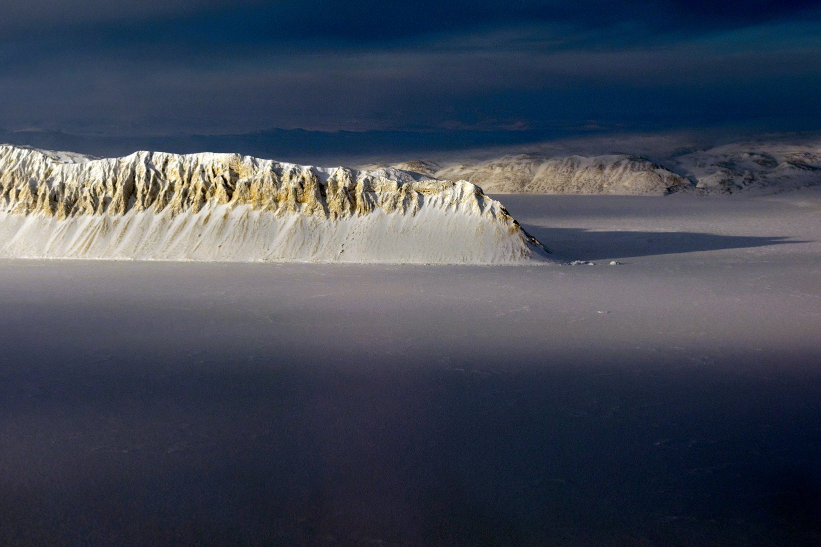
-
Article
Elliot Lake
Elliot Lake, Ont, incorporated as a city in 1991, population 11 348 (2011c), 11 549 (2006c).
"https://thecanadianencyclopedia.ca/images/tce_placeholder.jpg?v=e9dca980c9bdb3aa11e832e7ea94f5d9" // resources/views/front/categories/view.blade.php
https://thecanadianencyclopedia.ca/images/tce_placeholder.jpg?v=e9dca980c9bdb3aa11e832e7ea94f5d9
-
Article
Elmira
Elmira, Ontario, urban area, population 9931 (2011c), 8872 (2006c). Elmira is located about 17 km northwest of KITCHENER-WATERLOO.
"https://thecanadianencyclopedia.ca/images/tce_placeholder.jpg?v=e9dca980c9bdb3aa11e832e7ea94f5d9" // resources/views/front/categories/view.blade.php
https://thecanadianencyclopedia.ca/images/tce_placeholder.jpg?v=e9dca980c9bdb3aa11e832e7ea94f5d9
-
Article
Elora
Elora, Ont, Unincorporated Place. Elora is a picturesque community located about 25 km northeast of Guelph at the junction of the Grand and Irvine rivers.
"https://thecanadianencyclopedia.ca/images/tce_placeholder.jpg?v=e9dca980c9bdb3aa11e832e7ea94f5d9" // resources/views/front/categories/view.blade.php
https://thecanadianencyclopedia.ca/images/tce_placeholder.jpg?v=e9dca980c9bdb3aa11e832e7ea94f5d9
-
Article
Elsa
In 1946 Keno Mining Co Ltd (later United Keno Hills Mines Ltd) reopened the mine. The community received a post office in 1949 and the 1950s was the starting point for the first oil exploration winter road to drilling sites 500 km to the north.
"https://thecanadianencyclopedia.ca/images/tce_placeholder.jpg?v=e9dca980c9bdb3aa11e832e7ea94f5d9" // resources/views/front/categories/view.blade.php
https://thecanadianencyclopedia.ca/images/tce_placeholder.jpg?v=e9dca980c9bdb3aa11e832e7ea94f5d9
-
Article
Elsipogtog First Nation
Elsipogtog (pronounced El-see-buk-tuk) First Nation is a Mi’kmaq community about 91 km northwest of Moncton, New Brunswick. Known for many years as Big Cove, in 2003 the First Nation officially changed its name to Elsipogtog, meaning “river of fire.” However, they are still commonly referred to as Big Cove. Community members largely speak Mi’kmaw and English. As of November 2025, Elsipogtog had 3,671 registered members, 2,795 of whom live on the First Nation’s reserve. The reserve, also known as Elsipogtog, is still referred to as Richibucto 15 in some official documents. It encompasses 19.56 km2.
"https://d3d0lqu00lnqvz.cloudfront.net/media/new_article_images/ElsipogtogFN/TipiElsipogtogFNresized.jpg" // resources/views/front/categories/view.blade.php
https://d3d0lqu00lnqvz.cloudfront.net/media/new_article_images/ElsipogtogFN/TipiElsipogtogFNresized.jpg
-
Article
Emerson
Emerson, Manitoba, incorporated as a town in 1879, population 671 (2011c), 689 (2006c). The Town of Emerson is Manitoba's main port of entry on the international boundary.
"https://thecanadianencyclopedia.ca/images/tce_placeholder.jpg?v=e9dca980c9bdb3aa11e832e7ea94f5d9" // resources/views/front/categories/view.blade.php
https://thecanadianencyclopedia.ca/images/tce_placeholder.jpg?v=e9dca980c9bdb3aa11e832e7ea94f5d9
-
Article
Empress Hotel
The Empress Hotel is a luxury waterfront hotel and national historic site in Victoria, British Columbia. Designed primarily by architect Francis M. Rattenbury, it is noted for its picturesque Château-style design and decadent interiors. It opened in 1908 and was built by the Canadian Pacific Railway (CPR) as part of its network of hotels, which also includes the Banff Springs Hotel, Chateau Lake Louise and Le Château Frontenac. Now officially known as the Fairmont Empress, the hotel, along with its afternoon tea, is arguably Victoria’s most popular tourist attraction.
"https://d3d0lqu00lnqvz.cloudfront.net/media/media/abc93a47-6ec2-4030-8d75-17b7d6b2f2dc.jpg" // resources/views/front/categories/view.blade.php
https://d3d0lqu00lnqvz.cloudfront.net/media/media/abc93a47-6ec2-4030-8d75-17b7d6b2f2dc.jpg
-
Article
Enderby
Enderby, BC, incorporated as a city in 1905, population 2932 (2011c), 2828 (2006c). The City of Enderby is located on the Shuswap River 13 km north of Armstrong and 19 km south of Salmon Arm.
"https://thecanadianencyclopedia.ca/images/tce_placeholder.jpg?v=e9dca980c9bdb3aa11e832e7ea94f5d9" // resources/views/front/categories/view.blade.php
https://thecanadianencyclopedia.ca/images/tce_placeholder.jpg?v=e9dca980c9bdb3aa11e832e7ea94f5d9
-
Article
Arts Commons
Arts Commons (formerly the EPCOR Centre for the Performing Arts and the Calgary Centre for Performing Arts) is the largest performing arts facility in Western Canada and one of the three largest in the country.
"https://d3d0lqu00lnqvz.cloudfront.net/media/media/49f11ae6-e2be-4d83-8489-c998ea88c98a.jpg" // resources/views/front/categories/view.blade.php
https://d3d0lqu00lnqvz.cloudfront.net/media/media/49f11ae6-e2be-4d83-8489-c998ea88c98a.jpg
-
Article
Erickson
Swedish and Norwegian immigrants were among the first settlers in the region. They took up homesteads in the Otter Lake and Rolling River area on a reserve called Scandinavia or New Sweden, established in 1885 as part of a campaign to attract Scandinavian immigrants to Canada.
"https://thecanadianencyclopedia.ca/images/tce_placeholder.jpg?v=e9dca980c9bdb3aa11e832e7ea94f5d9" // resources/views/front/categories/view.blade.php
https://thecanadianencyclopedia.ca/images/tce_placeholder.jpg?v=e9dca980c9bdb3aa11e832e7ea94f5d9