
Browse "Places"
-
Article
Citadel Theatre
The theatre gets its name from its original home, a former Salvation Army building bought and renovated for a combined cost of $250 000.
"https://d3d0lqu00lnqvz.cloudfront.net/media/media/cb709b5e-dd4d-409b-887e-d4dc54573e3a.jpg" // resources/views/front/categories/view.blade.php
https://d3d0lqu00lnqvz.cloudfront.net/media/media/cb709b5e-dd4d-409b-887e-d4dc54573e3a.jpg
-
Article
City
In Canada, "city" is a broad, generic term usually referring to an urbanized area. The size of this area, its economic base, social character and form of local government may be different in each province or territory because Municipal Government derives its authority from the provincial legislature, and in each province the conditions that must exist before an area may be classified as a city differ. As a result, it is simpler to examine the process of Urbanization itself, defined as the generation and spread of characteristic features of urban life. The demographic trend toward urbanization in Canada began well before Confederation and still continues at a rapid pace. Today, 80 per cent of Canadians live in urban areas, meaning cities, towns, villages or unincorporated settlements with populations greater than 1,000 persons, or in built-up fringes of incorporated areas.
"https://d3d0lqu00lnqvz.cloudfront.net/saskatoon/saskatoon-cityscape-winter.jpg" // resources/views/front/categories/view.blade.php
https://d3d0lqu00lnqvz.cloudfront.net/saskatoon/saskatoon-cityscape-winter.jpg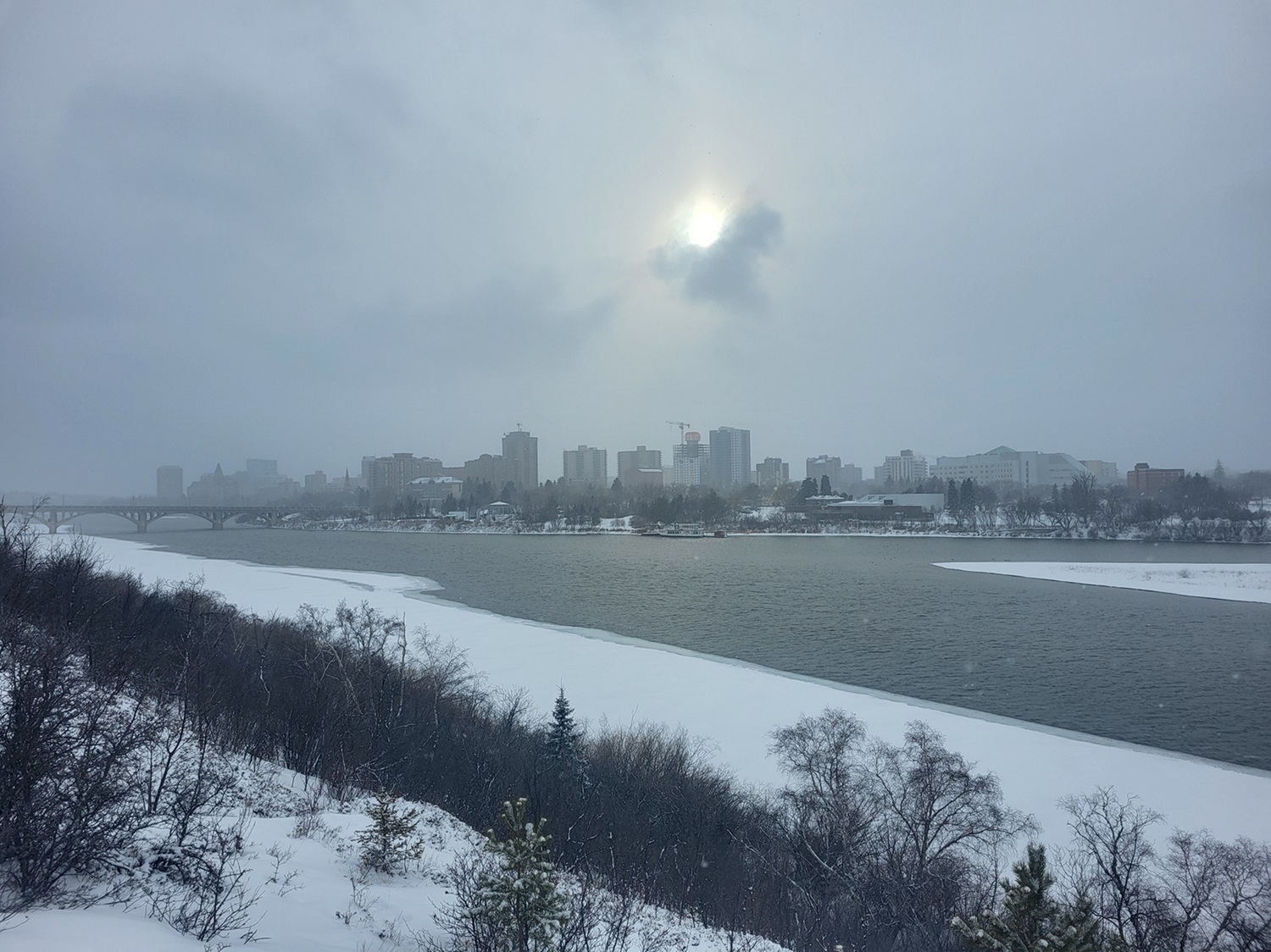
-
Collection
City Neighbourhoods in Canada
Canadian cities are dotted with notable neighbourhoods, which help define their respective city’s history and character. This collection features a snapshot of city neighbourhoods found in Canada.
"https://d3d0lqu00lnqvz.cloudfront.net/Victoria_Chinatown/victoria_chinatown.jpg" // resources/views/front/categories/view.blade.php
https://d3d0lqu00lnqvz.cloudfront.net/Victoria_Chinatown/victoria_chinatown.jpg
-
Article
City Parks
Parks were originally defined (following the British example) as the private grounds of a gentleman's estate. Public parks were not an integral element of the landscapes of the earliest Canadian cities and towns. The city park, as we know it, actually entered North America during the 1830s through the "rural cemetery" movement. These burial grounds were landscaped, and served as quiet places to stroll or to have family picnics. Mount Pleasant Cemetery in Toronto, designed by H.A. Engelhardt in 1874, was one such area.
"https://d3d0lqu00lnqvz.cloudfront.net/media/media/a9ddf5c7-660a-4dd5-9d9c-6387da6a5b36.jpg" // resources/views/front/categories/view.blade.php
https://d3d0lqu00lnqvz.cloudfront.net/media/media/a9ddf5c7-660a-4dd5-9d9c-6387da6a5b36.jpg
-
Article
Clarence-Rockland
Clarence-Rockland, Ont, incorporated as a city in 1998, population 23 185 (2011c), 20 790 (2006c). The City of Clarence-Rockland is located on the OTTAWA RIVER 35 km east of OTTAWA.
"https://d3d0lqu00lnqvz.cloudfront.net/media/media/defe46c4-cbee-4bfe-9a93-0468c4d06603.jpg" // resources/views/front/categories/view.blade.php
https://d3d0lqu00lnqvz.cloudfront.net/media/media/defe46c4-cbee-4bfe-9a93-0468c4d06603.jpg
-
Article
Clarenville
Clarenville, NL, incorporated as a town in 1951, population 6036 (2011c), 5274 (2006c). The Town of Clarenville is situated in a long, picturesque arm facing RANDOM ISLAND on the west side of TRINITY BAY.
"https://thecanadianencyclopedia.ca/images/tce_placeholder.jpg?v=e9dca980c9bdb3aa11e832e7ea94f5d9" // resources/views/front/categories/view.blade.php
https://thecanadianencyclopedia.ca/images/tce_placeholder.jpg?v=e9dca980c9bdb3aa11e832e7ea94f5d9
-
Article
Claresholm
Claresholm, Alberta, incorporated as a town in 1905, population 3,780 (2016 census), 3,758 (2011 census). The town of Claresholm is located approximately 65 km northwest of Lethbridge. The name of the town was chosen by John Niblick, a superintendent of the Canadian Pacific Railway, in honour of his wife.
"https://d3d0lqu00lnqvz.cloudfront.net/media/media/9894a112-1445-494a-867a-8fd029020e2a.jpg" // resources/views/front/categories/view.blade.php
https://d3d0lqu00lnqvz.cloudfront.net/media/media/9894a112-1445-494a-867a-8fd029020e2a.jpg
-
Article
Clarington
Clarington, Ontario, incorporated as a municipality in 1974, population 84 548 (2011c), 77 820 (2006c). The Municipality of Clarington is located on the north shore of Lake Ontario 80 km east of Toronto within the Regional Municipality of Durham.
"https://thecanadianencyclopedia.ca/images/tce_placeholder.jpg?v=e9dca980c9bdb3aa11e832e7ea94f5d9" // resources/views/front/categories/view.blade.php
https://thecanadianencyclopedia.ca/images/tce_placeholder.jpg?v=e9dca980c9bdb3aa11e832e7ea94f5d9
-
Article
Clark's Harbour
Clark's Harbour, NS, incorporated as a town in 1919, population 820 (2011c), 860 (2006c). The Town of Clark's Harbour is situated on Cape Sable Island in Shelburne County, about 95 km southeast of Yarmouth.
"https://thecanadianencyclopedia.ca/images/tce_placeholder.jpg?v=e9dca980c9bdb3aa11e832e7ea94f5d9" // resources/views/front/categories/view.blade.php
https://thecanadianencyclopedia.ca/images/tce_placeholder.jpg?v=e9dca980c9bdb3aa11e832e7ea94f5d9
-
Article
Clayoquot Sound
Clayoquot Sound is a dramatically varied inlet of the Pacific Ocean nearly 100 km wide on the west coast of Vancouver Island (estimated area, water 784.25 km2; land including freshwater 2715.75 km2 ). Clayoquot ("clah quat") Sound takes in the highly scenic islands and mainland drainages from Quisitis Point northwest to Escalante Point. Population is concentrated at Tofino, a fishing, tourism and wilderness recreation centre at the terminus of Highway 4. Most Indigenous communities are accessible only by air or water.
"https://d3d0lqu00lnqvz.cloudfront.net/media/media/90cececc-c640-4ea8-bfdc-87f67c45f230.jpg" // resources/views/front/categories/view.blade.php
https://d3d0lqu00lnqvz.cloudfront.net/media/media/90cececc-c640-4ea8-bfdc-87f67c45f230.jpg
-
Article
Clearwater River
Clearwater River, 280 km long, rises in Patterson, Forest and Lloyd lakes in northwest Saskatchewan, flows southeast to Careen Lake and abruptly turns west to join the ATHABASCA RIVER at Fort McMurray, Alberta.
"https://thecanadianencyclopedia.ca/images/tce_placeholder.jpg?v=e9dca980c9bdb3aa11e832e7ea94f5d9" // resources/views/front/categories/view.blade.php
https://thecanadianencyclopedia.ca/images/tce_placeholder.jpg?v=e9dca980c9bdb3aa11e832e7ea94f5d9
-
Article
Cluny Archaeological Site
The Cluny archaeological site is located along the north bank of the Bow River in south-central Alberta.
"https://d3d0lqu00lnqvz.cloudfront.net/media/media/3e3e67a5-aeaa-4856-ac64-d305e5d4be67.jpg" // resources/views/front/categories/view.blade.php
https://d3d0lqu00lnqvz.cloudfront.net/media/media/3e3e67a5-aeaa-4856-ac64-d305e5d4be67.jpg
-
Article
Clyde River
Clyde River, Nunavut, incorporated as a hamlet in 1978, population 1,181 (2021 census), 1,053 (2016 census). The Hamlet of Clyde River is located on the west shore of Patricia Bay on the east coast of Baffin Island, 750 km north of Iqaluit. The Inuit name for the community, Kangirqtugaapik, means "a beautiful small cove (or bay)."
"https://d3d0lqu00lnqvz.cloudfront.net/media/media/9974cb6b-fdb8-4408-a0cb-ddcadd23aa9d.jpg" // resources/views/front/categories/view.blade.php
https://d3d0lqu00lnqvz.cloudfront.net/media/media/9974cb6b-fdb8-4408-a0cb-ddcadd23aa9d.jpg
-
Article
CN Tower
The CN Tower (Canada’s National Tower) is a communications and observation tower located in Toronto, Ontario (see Telecommunications). Constructed from between 1973 and 1975 at a cost of $63 million, the tower officially opened to the public in 1976. The CN Tower was the world's tallest free-standing structure until 2007, when the Burj Khalifa in Dubai, United Arab Emirates, surpassed it. The tower was also the world's tallest tower, until 2010, when the Canton Tower in Guangzhou, China was completed. Measuring 553.33 metres, the CN Tower remains a unique feature of Toronto’s skyline and a popular tourist destination, welcoming nearly 2 million visitors annually.
"https://d3d0lqu00lnqvz.cloudfront.net/cntower/torontoskylineward-sisland-tweetonly.jpg" // resources/views/front/categories/view.blade.php
https://d3d0lqu00lnqvz.cloudfront.net/cntower/torontoskylineward-sisland-tweetonly.jpg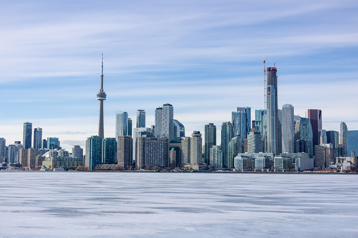
-
Article
Coaldale
Coaldale, Alberta, incorporated as a town in 1952, population 8,215 (2016 census), 7,493 (2011 census). The town of Coaldale is located in southern Alberta, just east of Lethbridge.
"https://thecanadianencyclopedia.ca/images/tce_placeholder.jpg?v=e9dca980c9bdb3aa11e832e7ea94f5d9" // resources/views/front/categories/view.blade.php
https://thecanadianencyclopedia.ca/images/tce_placeholder.jpg?v=e9dca980c9bdb3aa11e832e7ea94f5d9