
Browse "Places"
-
Article
Sainte-Julie
Sainte-Julie is mainly a residential city that prides itself on being "the city in the country.
"https://thecanadianencyclopedia.ca/images/tce_placeholder.jpg?v=e9dca980c9bdb3aa11e832e7ea94f5d9" // resources/views/front/categories/view.blade.php
https://thecanadianencyclopedia.ca/images/tce_placeholder.jpg?v=e9dca980c9bdb3aa11e832e7ea94f5d9
-
Article
Sainte-Thérèse
Sainte-Thérèse, Quebec, incorporated as a city in 1916, population 26,533 (2021 census), 25,989 (2016 census). Sainte-Thérèse is located 20 km north of Montreal along the Rivière aux Chiens.
"https://d3d0lqu00lnqvz.cloudfront.net/media/media/f7a52485-afe1-4d76-b238-1193aa14bdeb.jpg" // resources/views/front/categories/view.blade.php
https://d3d0lqu00lnqvz.cloudfront.net/media/media/f7a52485-afe1-4d76-b238-1193aa14bdeb.jpg
-
Article
Salaberry-de-Valleyfield
Salaberry-de-Valleyfield draws its labour force from the local population and its history is marked by often violent labour disputes (see COMPANY TOWNS). Originally (1874) it was called Salaberry, in honour of Charles d'Irumberry de SALABERRY.
"https://thecanadianencyclopedia.ca/images/tce_placeholder.jpg?v=e9dca980c9bdb3aa11e832e7ea94f5d9" // resources/views/front/categories/view.blade.php
https://thecanadianencyclopedia.ca/images/tce_placeholder.jpg?v=e9dca980c9bdb3aa11e832e7ea94f5d9
-
Article
Salish Sea
The Salish Sea, approximately 18,000 km2, is comprised of the inland marine waters of Juan de Fuca Strait, the Strait of Georgia and Puget Sound, as well as their connecting channels, passes and straits. The name recognizes the use of these waterways for thousands of years by the Indigenous people of the Northwest Coast, and is adopted in Canada and the United States (the international boundary runs the length of Juan de Fuca Strait, and Puget Sound is American territory).
"https://d3d0lqu00lnqvz.cloudfront.net/salishsea/salish-sea-and-strait-of-fuca.jpg" // resources/views/front/categories/view.blade.php
https://d3d0lqu00lnqvz.cloudfront.net/salishsea/salish-sea-and-strait-of-fuca.jpg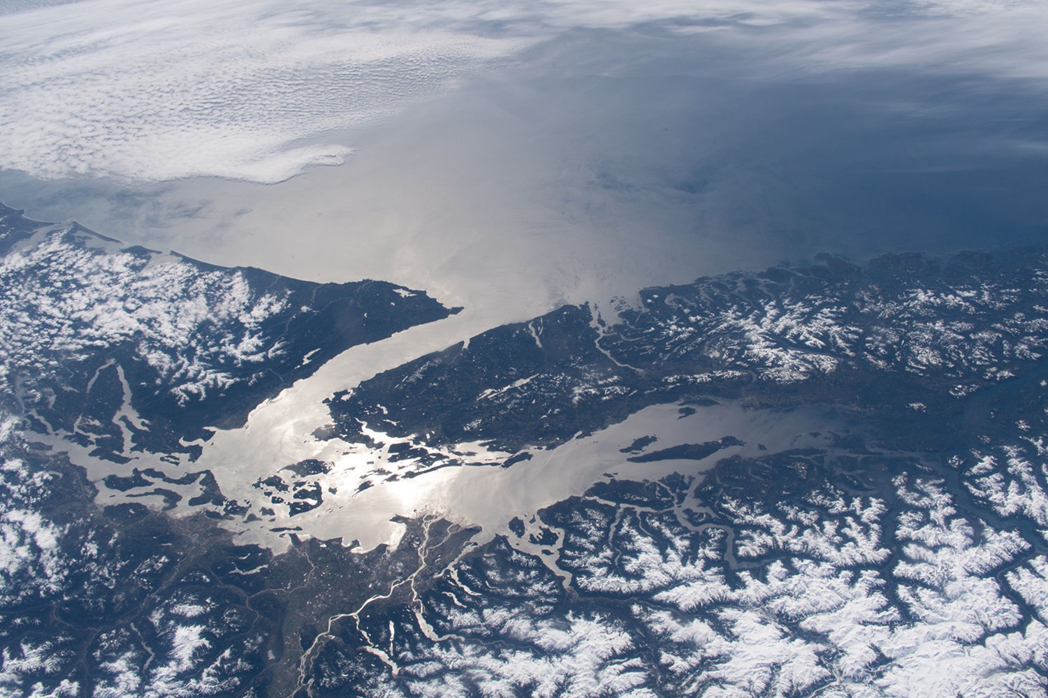
-
Article
Salmo
Salmo, BC, incorporated as a village in 1946, population 1139 (2011c), 1007 (2006c). The Village of Salmo is located in the Selkirk Mountains on the Salmo River at its junction with Erie Creek, 24 km north of the United States border.
"https://thecanadianencyclopedia.ca/images/tce_placeholder.jpg?v=e9dca980c9bdb3aa11e832e7ea94f5d9" // resources/views/front/categories/view.blade.php
https://thecanadianencyclopedia.ca/images/tce_placeholder.jpg?v=e9dca980c9bdb3aa11e832e7ea94f5d9
-
Article
Salmon Arm
Salmon Arm, British Columbia, incorporated as a city in 2005, population 17,706 (2016 census), 17,464 (2011 census). The city of Salmon Arm is located at the head of the southwestern arm of Shuswap Lake, also called Salmon Arm, 110 km east of Kamloops.
"https://d3d0lqu00lnqvz.cloudfront.net/media/media/13d5ba26-c992-4341-99fa-c71c6fe1dc4f.jpg" // resources/views/front/categories/view.blade.php
https://d3d0lqu00lnqvz.cloudfront.net/media/media/13d5ba26-c992-4341-99fa-c71c6fe1dc4f.jpg
-
Article
Saltspring Island
Saltspring Island, BC, 182 km2 is the largest of the Gulf Islands, a group lying in the Strait of Georgia off the southeastern corner of Vancouver Island.
"https://thecanadianencyclopedia.ca/images/tce_placeholder.jpg?v=e9dca980c9bdb3aa11e832e7ea94f5d9" // resources/views/front/categories/view.blade.php
https://thecanadianencyclopedia.ca/images/tce_placeholder.jpg?v=e9dca980c9bdb3aa11e832e7ea94f5d9
-
Article
Samson Cree Nation
Samson Cree Nation (nîpisîhkopâhk or “at willow grove” in Cree) is one of four bands that make up the area of Maskwacis (meaning Bear Hills in Cree), Alberta, along with Louis Bull Tribe, Montana First Nation and the Ermineskin Cree Nation. The nation is located in Treaty 6 territory and is the second largest band in Alberta. As of February 2026, the registered population was 9,596, with 6,521 members living on Samson Cree Nation’s reserve and 2,463 members living off-reserve. The nation is made up of Plains Cree people with Plains Cree being the dominant language.
"https://thecanadianencyclopedia.ca/images/tce_placeholder.jpg?v=e9dca980c9bdb3aa11e832e7ea94f5d9" // resources/views/front/categories/view.blade.php
https://thecanadianencyclopedia.ca/images/tce_placeholder.jpg?v=e9dca980c9bdb3aa11e832e7ea94f5d9
-
Article
Sandon
Silver was found in 1891 and a rush followed, with thousands of prospectors staking the silver-bearing slopes. By 1895 Sandon was a thriving town and the terminus of 2 railways.
"https://thecanadianencyclopedia.ca/images/tce_placeholder.jpg?v=e9dca980c9bdb3aa11e832e7ea94f5d9" // resources/views/front/categories/view.blade.php
https://thecanadianencyclopedia.ca/images/tce_placeholder.jpg?v=e9dca980c9bdb3aa11e832e7ea94f5d9
-
Article
Sanikiluaq
Sanikiluaq, Nunavut, incorporated as a hamlet in 1976, population 812 (2011c), 744 (2006c).
"https://thecanadianencyclopedia.ca/images/tce_placeholder.jpg?v=e9dca980c9bdb3aa11e832e7ea94f5d9" // resources/views/front/categories/view.blade.php
https://thecanadianencyclopedia.ca/images/tce_placeholder.jpg?v=e9dca980c9bdb3aa11e832e7ea94f5d9
-
Article
Sarnia
Sarnia, Ontario, incorporated as a city in 1914, population 71,594 (2016 c), 72,366 (2011 c). The City of Sarnia is located at the convergence of the St. Clair River and Lake Huron, 100 km west of London. A railway tunnel beneath the St. Clair and a highway bridge from nearby Point Edward connect Sarnia with Port Huron, Michigan. Sarnia is a major centre for the petrochemical industry and the southern terminus of an oil pipeline from Alberta. It was also the home of Alexander Mackenzie, first Liberal prime minister of Canada.
"https://d3d0lqu00lnqvz.cloudfront.net/media/media/35d2cb6f-0ea1-4258-9795-68b7ab247e24.jpg" // resources/views/front/categories/view.blade.php
https://d3d0lqu00lnqvz.cloudfront.net/media/media/35d2cb6f-0ea1-4258-9795-68b7ab247e24.jpg
-
Article
Music in Sarnia
Ontario city settled in 1807. It was known first as Fort Rapids, later as Port Sarnia, and in 1856 it was incorporated as the town of Sarnia. It became a city in 1914. Its population was 49,033 in 1986.
"https://thecanadianencyclopedia.ca/images/tce_placeholder.jpg?v=e9dca980c9bdb3aa11e832e7ea94f5d9" // resources/views/front/categories/view.blade.php
https://thecanadianencyclopedia.ca/images/tce_placeholder.jpg?v=e9dca980c9bdb3aa11e832e7ea94f5d9
-
Article
Saskatchewan (Province)
Saskatchewan is part of the Prairie region and is the only province with entirely artificial boundaries. It is bordered by the US to the south, the Northwest Territories to the north, and Manitoba and Alberta to the east and west respectively. It was created from the Northwest Territories in 1905, at the same time as Alberta, and shares with that province the distinction of having no coast on salt water. The name, which was first used officially for a district of the Northwest Territories in 1882, is derived from an anglicized version of a Cree word, kisiskâciwanisîpiy, meaning “swiftly flowing river.”
"https://d3d0lqu00lnqvz.cloudfront.net/media/media/70c52f68-faf0-4d61-b849-c0bf34342d19.jpg" // resources/views/front/categories/view.blade.php
https://d3d0lqu00lnqvz.cloudfront.net/media/media/70c52f68-faf0-4d61-b849-c0bf34342d19.jpg
-
Timelines
Saskatchewan
Saskatchewan is part of the Prairie region and is the only province with entirely artificial boundaries. It is bordered by the US to the south, the Northwest Territories to the north, and Manitoba and Alberta to the east and west respectively.
"https://d3d0lqu00lnqvz.cloudfront.net/media/media/dc2050ae-b79f-4f42-9cb0-d37a157abffa.jpg" // resources/views/front/categories/view.blade.php
https://d3d0lqu00lnqvz.cloudfront.net/media/media/dc2050ae-b79f-4f42-9cb0-d37a157abffa.jpg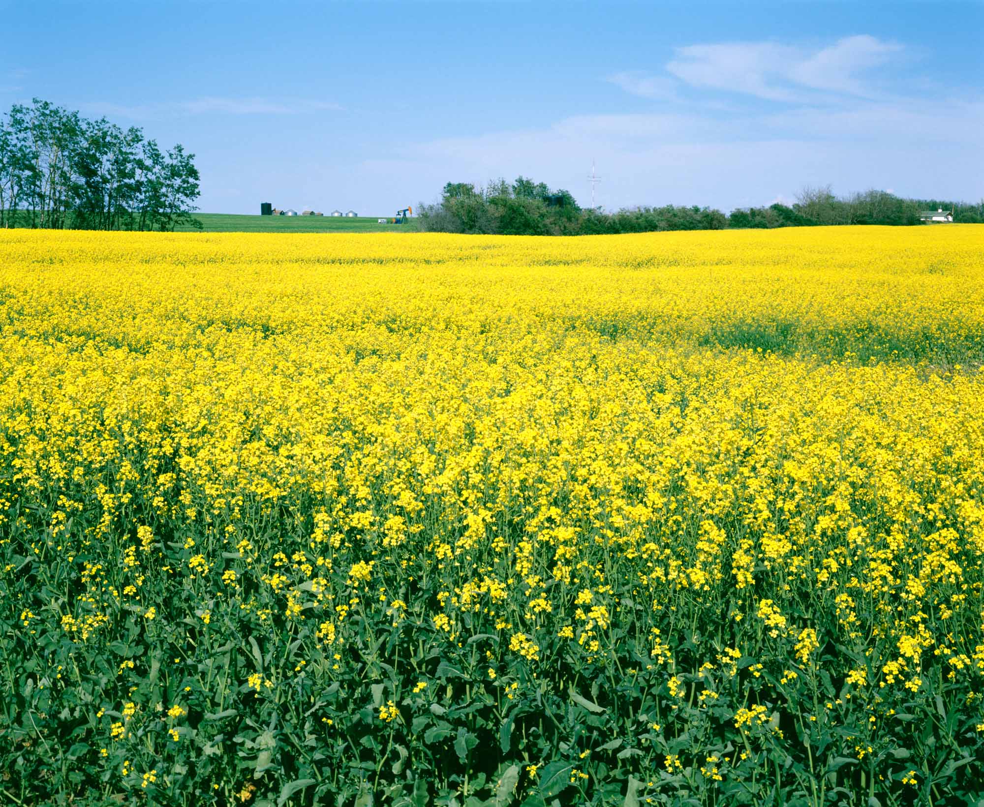
-
Article
Saskatchewan Centre of the Arts
The Saskatchewan Centre of the Arts. A theatre complex at the Wascana Centre in Regina, constructed to commemorate Canada's centenary. It opened 24 Aug 1970 to serve southern Saskatchewan as a centre for performing arts and exhibitions.
"https://thecanadianencyclopedia.ca/images/tce_placeholder.jpg?v=e9dca980c9bdb3aa11e832e7ea94f5d9" // resources/views/front/categories/view.blade.php
https://thecanadianencyclopedia.ca/images/tce_placeholder.jpg?v=e9dca980c9bdb3aa11e832e7ea94f5d9