
Browse "Places"
-
Article
Lake Agassiz
Formed 11,500 years ago, Lake Agassiz was the largest glacial lake in North America, at about 1,500 km long, over 1,100 km wide and 210 m deep. Its location covered parts of what is now Manitoba, Ontario, Saskatchewan, North Dakota and Minnesota.
"https://d3d0lqu00lnqvz.cloudfront.net/2091302531_8e5d16b234_k.jpg" // resources/views/front/categories/view.blade.php
https://d3d0lqu00lnqvz.cloudfront.net/2091302531_8e5d16b234_k.jpg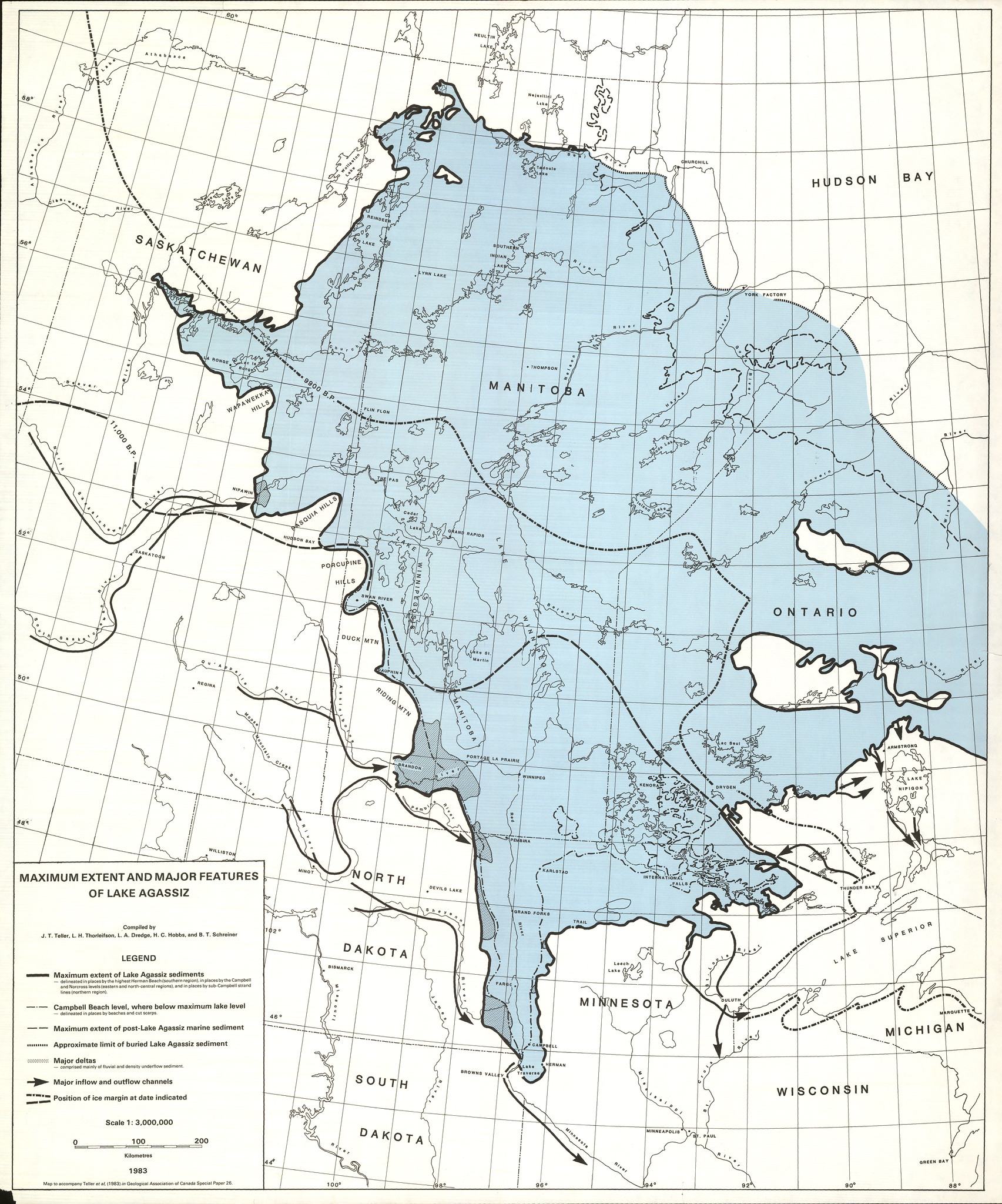
-
Article
Lake Athabasca
Lake Athabasca is located in northeastern Alberta and northwestern Saskatchewan, at the edge of the Precambrian Shield. With an area of 7,935 km2 and a 2,140 km shoreline, it is the eighth-largest lake in Canada.
"https://d3d0lqu00lnqvz.cloudfront.net/media/media/1c6f92bc-560d-45fe-a4b3-ee7504d34131.jpg" // resources/views/front/categories/view.blade.php
https://d3d0lqu00lnqvz.cloudfront.net/media/media/1c6f92bc-560d-45fe-a4b3-ee7504d34131.jpg
-
Article
Lake Champlain
Lake Champlain is a large freshwater lake that borders New York and Vermont, with its northernmost tip in Quebec. It was named by Samuel de Champlain in 1609. Lake Champlain acted as a boundary between Indigenous nations and was used as an invasion route by war parties. During the colonial period, the lake was used by French and British forces, who established fortifications along its shores (see Seven Years’ War). It was also a route for British and American forces during the American Revolution and the War of 1812 and was the site of the Battle of Valcour Island in 1776 and the Battle of Plattsburgh in 1814.
"https://d3d0lqu00lnqvz.cloudfront.net/American-Revolution/North-east-view-Crown-Point.jpg" // resources/views/front/categories/view.blade.php
https://d3d0lqu00lnqvz.cloudfront.net/American-Revolution/North-east-view-Crown-Point.jpg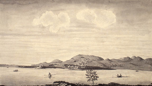
-
Article
Lake Cowichan
Lake Cowichan, BC, incorporated as a town in 1996, population 2974 (2011c), 3012 (2006c). The Town of Lake Cowichan is located adjacent to the Cowichan River and Cowichan Lake on southern VANCOUVER ISLAND, 26 km west of DUNCAN.
"https://d3d0lqu00lnqvz.cloudfront.net/media/media/7c173143-b064-437c-9ca5-29f626b53c24.jpg" // resources/views/front/categories/view.blade.php
https://d3d0lqu00lnqvz.cloudfront.net/media/media/7c173143-b064-437c-9ca5-29f626b53c24.jpg
-
Article
Lake Diefenbaker
Lake Diefenbaker is a reservoir lake south of Saskatoon, Saskatchewan. It was formed by the construction of two dams that widened the South Saskatchewan River as part of the South Saskatchewan River Development Project, inaugurated in 1958.
"https://d3d0lqu00lnqvz.cloudfront.net/media/media/8f6aafbc-a6af-4161-aa3a-a8e615c2209b.jpg" // resources/views/front/categories/view.blade.php
https://d3d0lqu00lnqvz.cloudfront.net/media/media/8f6aafbc-a6af-4161-aa3a-a8e615c2209b.jpg
-
Article
Lake Huron
Lake Huron, 59,600 km2, elevation 176 m, 332 km long, 295 km wide, max depth 229 m; total shoreline length, including islands, 6,159 km. Lake Huron is the second largest of the Great Lakes and fifth-largest lake in the world (see also Largest Lakes in Canada). In Canada, the Lake Huron is part of the traditional territories of the Tionontati (Petun), Neutral, Huron-Wendat and Anishinaabe. Samuel de Champlain visited Georgian Bay and Lake Huron with the French scout Étienne Brûlé in 1615.
"https://d3d0lqu00lnqvz.cloudfront.net/media/media/d843f78b-9289-43dc-8791-10b06a322b23.jpg" // resources/views/front/categories/view.blade.php
https://d3d0lqu00lnqvz.cloudfront.net/media/media/d843f78b-9289-43dc-8791-10b06a322b23.jpg
-
Article
Lake Louise
Lake Louise, 2.4 km long, elevation 1731 m, is located in Banff National Park in southwestern Alberta. Lake Louise's outlet is a creek flowing into the Bow River.
"https://d3d0lqu00lnqvz.cloudfront.net/media/media/572e37ab-e754-4a3b-968d-a9a28711d955.jpg" // resources/views/front/categories/view.blade.php
https://d3d0lqu00lnqvz.cloudfront.net/media/media/572e37ab-e754-4a3b-968d-a9a28711d955.jpg
-
Article
Lake Manitoba
Lake Manitoba, 4624 km2, elev 248 m, is one of 3 large lakes occupying the southern half of Manitoba. A narrow, irregular lake, about 200 km long with marshy shores, it is fed mainly from Lake WINNIPEGOSIS, which lies to the northwest, and drains northeast via the Dauphin River to Lake WINNIPEG.
"https://thecanadianencyclopedia.ca/images/tce_placeholder.jpg?v=e9dca980c9bdb3aa11e832e7ea94f5d9" // resources/views/front/categories/view.blade.php
https://thecanadianencyclopedia.ca/images/tce_placeholder.jpg?v=e9dca980c9bdb3aa11e832e7ea94f5d9
-
Article
Lake Melville
Lake Melville 3069 km2, is a tidal extension of Hamilton Inlet on the rugged east coast of Labrador.
"https://thecanadianencyclopedia.ca/images/tce_placeholder.jpg?v=e9dca980c9bdb3aa11e832e7ea94f5d9" // resources/views/front/categories/view.blade.php
https://thecanadianencyclopedia.ca/images/tce_placeholder.jpg?v=e9dca980c9bdb3aa11e832e7ea94f5d9
-
Article
Lake Nipigon
Later posts were established by the NWC and HBC, but none grew into major settlements. With its limited population, unspoiled environment and abundant fish and wildlife, the area is ideal for outdoor recreation.
"https://thecanadianencyclopedia.ca/images/tce_placeholder.jpg?v=e9dca980c9bdb3aa11e832e7ea94f5d9" // resources/views/front/categories/view.blade.php
https://thecanadianencyclopedia.ca/images/tce_placeholder.jpg?v=e9dca980c9bdb3aa11e832e7ea94f5d9
-
Article
Lake Nipissing
Located in Northern Ontario, between the Ottawa River and Georgian Bay, Lake Nipissing is the third largest lake located entirely within the boundaries of Ontario. The lake spans 65 km in an east–west direction and drains into Georgian Bay via the French River. Its name derives from an Ojibwa word meaning "little water," likely a comparison to the nearby Great Lakes, which were important trade routes for the Nbisiing (Nipissing), the First Nation indigenous to this region. Fishing is a popular activity on the lake both commercially and recreationally. Unfortunately, walleye, the lake’s dominant fish species, has declined drastically since the 1980s as a result of overfishing and ecosystem changes.
"https://d3d0lqu00lnqvz.cloudfront.net/media/media/18133057-10b1-4a16-b2df-0fa39520df8b.jpg" // resources/views/front/categories/view.blade.php
https://d3d0lqu00lnqvz.cloudfront.net/media/media/18133057-10b1-4a16-b2df-0fa39520df8b.jpg
-
Article
Lake of the Woods
Lake of the Woods, 4,350 km2 (of which 3,149 km2 are in Canada), elevation 323 m. The surroundings of the lake were originally inhabited by Cree, Ojibwe and Sioux.
"https://thecanadianencyclopedia.ca/images/tce_placeholder.jpg?v=e9dca980c9bdb3aa11e832e7ea94f5d9" // resources/views/front/categories/view.blade.php
https://thecanadianencyclopedia.ca/images/tce_placeholder.jpg?v=e9dca980c9bdb3aa11e832e7ea94f5d9
-
Article
Lake Ontario
Lake Ontario is 18,960 km2 (10,049 km2 in Canada), with a drainage area of 60,030 km2, an elevation of 75 m, a mean depth of 86 m (max 244 m), length 311 km and width 85 km. It is the smallest in surface area and most easterly of the Great Lakes and eighth-largest body of fresh water in North America. The lake receives most of its water supply from the other Great Lakes through the Niagara River and discharges into the St. Lawrence River through the Kingston Basin at its northeast end. Other tributaries are the Genesee, Oswego and Black rivers in New York State and the Trent River in Ontario (see Largest Lakes in Canada).
"https://d3d0lqu00lnqvz.cloudfront.net/escarpment/scarborough-bluffs.jpg" // resources/views/front/categories/view.blade.php
https://d3d0lqu00lnqvz.cloudfront.net/escarpment/scarborough-bluffs.jpg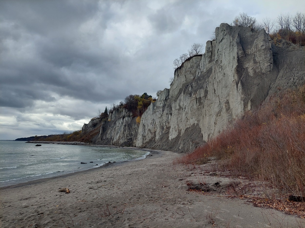
-
Article
Lake Simcoe
Lake Simcoe, 744 km2, elevation 219 m, is situated in southern Ontario between Georgian Bay and Lake Ontario, 65 km north of Toronto. In the north, The Narrows divides it from Lake Couchiching at Orillia, and both lakes drain northwesterly via the Severn River to Georgian Bay. On the south, it touches a fertile marshland that has developed into an extensive market-gardening area. Barrie lies at the head of the lake's deep western arm, Kempenfelt Bay.
"https://d3d0lqu00lnqvz.cloudfront.net/lakesimcoe/Sibbald_Point_Provincial_Park_Lake_Simcoe.jpg" // resources/views/front/categories/view.blade.php
https://d3d0lqu00lnqvz.cloudfront.net/lakesimcoe/Sibbald_Point_Provincial_Park_Lake_Simcoe.jpg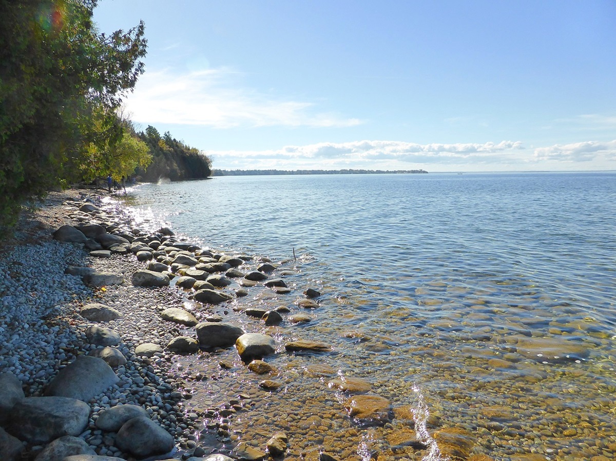
-
Article
Lake St. Clair
Lake St. Clair, 1,114 km, elevation 175 m, average depth 3.7 m, is bordered by the province of Ontario to the east and the state of Michigan to the west. Almost circular in shape, it has a length of 42 km and a maximum width of 39 km. It is connected to Lake Huron to the north by the St. Clair River and drains into Lake Erie to the south via the Detroit River. Lake St. Clair is part of the St. Lawrence Seaway, a significant transportation route stretching from Lake Superior through the Great Lakes to the Gulf of St. Lawrence. The cities of Windsor, Ontario, and Detroit, Michigan, are located at the southwest end of the lake, making it a popular site for recreational fishing and boating.
"https://d3d0lqu00lnqvz.cloudfront.net/media/media/a2d33512-9337-43be-82e2-70685b5a7326.jpg" // resources/views/front/categories/view.blade.php
https://d3d0lqu00lnqvz.cloudfront.net/media/media/a2d33512-9337-43be-82e2-70685b5a7326.jpg