
Browse "Places"
-
Article
Île Bonaventure
Despite its minute size, a favourable climate and abundant cod stocks induced French entrepreneurs to establish a seasonal fishery operation there in the 1600s. Simon Denys obtained seigneurial title (1674); his son Pierre had a chapel erected, soon thereafter razed by fire (1690).
"https://d3d0lqu00lnqvz.cloudfront.net/media/media/b2be0d1b-9e0f-4794-997a-2ec03cbfab51.jpg" // resources/views/front/categories/view.blade.php
https://d3d0lqu00lnqvz.cloudfront.net/media/media/b2be0d1b-9e0f-4794-997a-2ec03cbfab51.jpg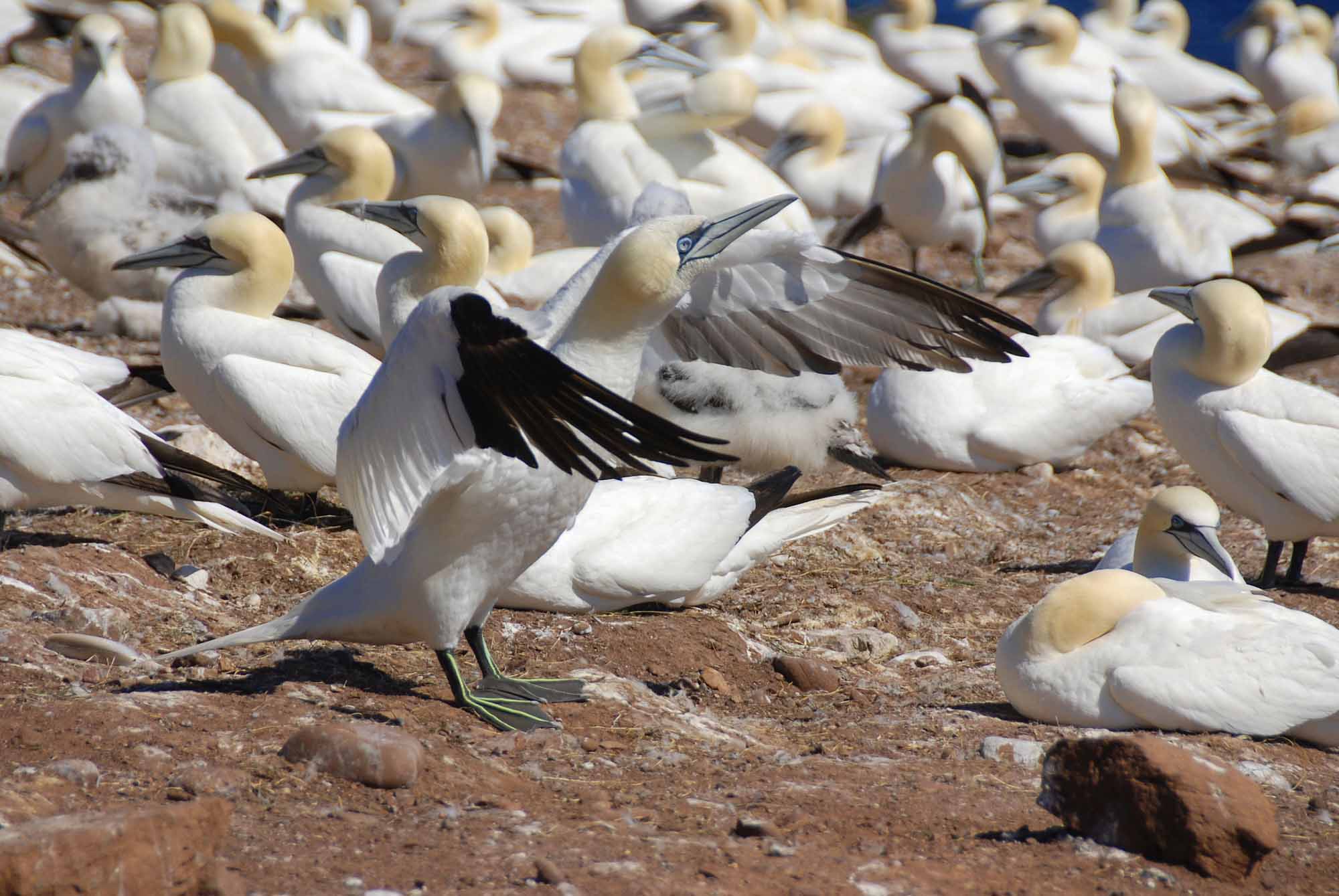
-
Article
Île d’Anticosti
Île d'Anticosti, 7,943 km2, 222 km long and 56 km at its widest point, is located in the Gulf of St. Lawrence, athwart the entrance to the St. Lawrence River. Though considerably larger than Prince Edward Island, its population is only about 200. In September 2023, the island was designated a UNESCO World Heritage Site.
"https://d3d0lqu00lnqvz.cloudfront.net/iledanticosti/RiviereHuileAnticosti.jpg" // resources/views/front/categories/view.blade.php
https://d3d0lqu00lnqvz.cloudfront.net/iledanticosti/RiviereHuileAnticosti.jpg
-
Article
Île d'Orléans
The island is connected by a suspension bridge to the North Shore near CHUTE MONTMORENCY. The largest island in the river after Île de Montréal, it is a relatively level plateau, 137 m at its highest point, and is quite steep-sided.
"https://d3d0lqu00lnqvz.cloudfront.net/media/media/fed833c0-33df-4cf6-81dc-9b2390d4d1ed.jpg" // resources/views/front/categories/view.blade.php
https://d3d0lqu00lnqvz.cloudfront.net/media/media/fed833c0-33df-4cf6-81dc-9b2390d4d1ed.jpg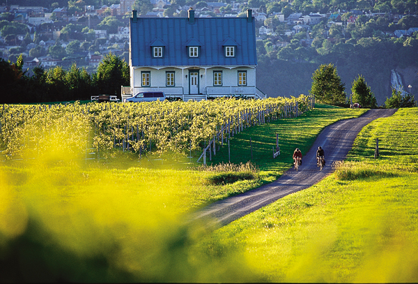
-
Article
Île de la Grande Entrée
Île de la Grande Entrée, Qué, is situated almost in the middle of the Gulf of ST LAWRENCE and flanked in the north by Île d' ANTICOSTI, in the south by PRINCE EDWARD ISLAND and on the east by CABOT STRAIT. It is one of the 16 islands and islets comprising Îles-de-la-MADELEINE.
"https://thecanadianencyclopedia.ca/images/tce_placeholder.jpg?v=e9dca980c9bdb3aa11e832e7ea94f5d9" // resources/views/front/categories/view.blade.php
https://thecanadianencyclopedia.ca/images/tce_placeholder.jpg?v=e9dca980c9bdb3aa11e832e7ea94f5d9
-
Article
Île du Bic
Bic, Île du, uninhabited island, 14 km2, is located in the ST LAWRENCE R, 30 km west of Rimouski, Qué. Because of its advantageous position at the mouth of the St Lawrence near the natural harbour of Bic, it played a key military role under the French regime.
"https://thecanadianencyclopedia.ca/images/tce_placeholder.jpg?v=e9dca980c9bdb3aa11e832e7ea94f5d9" // resources/views/front/categories/view.blade.php
https://thecanadianencyclopedia.ca/images/tce_placeholder.jpg?v=e9dca980c9bdb3aa11e832e7ea94f5d9
-
Article
Île du Cap aux Meules
Île du Cap aux Meules, Qué, 50 km2, is one island in the Îles de la MADELEINE archipelago, located in the middle of the Gulf of ST LAWRENCE. It is named after the sandstone hill that supplied the stone used to make grindstones (meules in French) for flour mills.
"https://thecanadianencyclopedia.ca/images/tce_placeholder.jpg?v=e9dca980c9bdb3aa11e832e7ea94f5d9" // resources/views/front/categories/view.blade.php
https://thecanadianencyclopedia.ca/images/tce_placeholder.jpg?v=e9dca980c9bdb3aa11e832e7ea94f5d9
-
Article
Île Lamèque
Île Lamèque, 150 km2, is located off the northeast corner of New Brunswick at the entrance to Chaleur Bay.
"https://thecanadianencyclopedia.ca/images/tce_placeholder.jpg?v=e9dca980c9bdb3aa11e832e7ea94f5d9" // resources/views/front/categories/view.blade.php
https://thecanadianencyclopedia.ca/images/tce_placeholder.jpg?v=e9dca980c9bdb3aa11e832e7ea94f5d9
-
Article
Îles de la Madeleine
Preceded by Basque fishermen, Jacques Cartier arrived at Île Brion in 1534; he named it in honour of the great French admiral. He christened the islands "Les Araynes" (arènes is a French poetry word for sand) because of the endless beaches of sand. Later French fishermen called them Îles Ramées.
"https://d3d0lqu00lnqvz.cloudfront.net/media/media/e3a0f397-8687-443d-a333-fd37c2506209.jpg" // resources/views/front/categories/view.blade.php
https://d3d0lqu00lnqvz.cloudfront.net/media/media/e3a0f397-8687-443d-a333-fd37c2506209.jpg
-
Article
Îles de Mingan
Native burial grounds indicate they were inhabited before Jacques Cartier first reported the islands in 1535. Surveys have also uncovered 16th-century Spanish coins and the remains of Basque habitations.
"https://d3d0lqu00lnqvz.cloudfront.net/media/media/233c4490-07ce-414e-b2d5-e30602befc75.jpg" // resources/views/front/categories/view.blade.php
https://d3d0lqu00lnqvz.cloudfront.net/media/media/233c4490-07ce-414e-b2d5-e30602befc75.jpg
-
Article
I'm Alone
I'm Alone, a rumrunner based in Lunenburg, NS, one of several hundred vessels that supplied illicit liquor to a PROHIBITION-bound US during the 1920s. In March 1929 a US Coast Guard cutter sighted it when it had engine trouble in the Gulf of Mexico.
"https://thecanadianencyclopedia.ca/images/tce_placeholder.jpg?v=e9dca980c9bdb3aa11e832e7ea94f5d9" // resources/views/front/categories/view.blade.php
https://thecanadianencyclopedia.ca/images/tce_placeholder.jpg?v=e9dca980c9bdb3aa11e832e7ea94f5d9
-
Article
Meteors, Meteorites and Impact Craters
The solar system contains many objects smaller than the planets (or their satellites) travelling in individual orbits about the sun; space between the planets also contains myriad dust grains in the micron size range. Near Earth, dust concentrations are only a few hundred particles per cubic kilometre, but 35,000 to 100,000 tonnes of extraterrestrial material enters the atmosphere annually, swept up by our planet from debris that is in its path or crosses its path.
"https://d3d0lqu00lnqvz.cloudfront.net/lakesincanada/Manicouagan-Reservoir.jpg" // resources/views/front/categories/view.blade.php
https://d3d0lqu00lnqvz.cloudfront.net/lakesincanada/Manicouagan-Reservoir.jpg
-
Article
Indian Head
Indian Head, Sask, incorporated as a town in 1902, population 1815 (2011c), 1634 (2006c). The Town of Indian Head is located in the heart of Saskatchewan's richest farming area, south of the Qu'Appelle Valley, 69 km east of
"https://thecanadianencyclopedia.ca/images/tce_placeholder.jpg?v=e9dca980c9bdb3aa11e832e7ea94f5d9" // resources/views/front/categories/view.blade.php
https://thecanadianencyclopedia.ca/images/tce_placeholder.jpg?v=e9dca980c9bdb3aa11e832e7ea94f5d9
-
List
Indigenous Names of Rivers and Lakes in Canada
The names of many rivers and lakes in Canada have Indigenous origins. These bodies of water are named for Indigenous people, places, and aspects of Indigenous culture. Some of these lakes and rivers still bear the original name given to them by Indigenous people. Others have been renamed using an Indigenous word as a means of recognizing Indigenous history and working toward reconciliation. This list article explores the Indigenous names of five rivers and five lakes in Canada (see Longest Rivers in Canada and Largest Lakes in Canada).
"https://d3d0lqu00lnqvz.cloudfront.net/media/media/19ec5b64-165b-4f1c-b539-c89700680c09.jpg" // resources/views/front/categories/view.blade.php
https://d3d0lqu00lnqvz.cloudfront.net/media/media/19ec5b64-165b-4f1c-b539-c89700680c09.jpg
-
Article
Ingersoll
Ingersoll, Ont, incorporated as a town in 1865, population 12 146 (2011c), 11 760 (2006c). The Town of Ingersoll is situated on the THAMES RIVER, 36 km east of London.
"https://thecanadianencyclopedia.ca/images/tce_placeholder.jpg?v=e9dca980c9bdb3aa11e832e7ea94f5d9" // resources/views/front/categories/view.blade.php
https://thecanadianencyclopedia.ca/images/tce_placeholder.jpg?v=e9dca980c9bdb3aa11e832e7ea94f5d9
-
Article
Innisfail
Innisfail, Alta, incorporated as a town in 1903, population 7876 (2011c), 7331 (2006c). The Town of Innisfail is located on the CP Rail line 121 km north of Calgary.
"https://d3d0lqu00lnqvz.cloudfront.net/media/media/1e459b6f-fe80-4090-8780-016a87e863bd.jpg" // resources/views/front/categories/view.blade.php
https://d3d0lqu00lnqvz.cloudfront.net/media/media/1e459b6f-fe80-4090-8780-016a87e863bd.jpg