
Browse "Places"
-
Article
Art Gallery of Ontario
The Art Gallery of Ontario, founded in 1900 as the Art Museum of Toronto, became the Art Gallery of Toronto in 1919 and in 1966 - reflecting an expanded role in the province - the Art Gallery of Ontario.
"https://d3d0lqu00lnqvz.cloudfront.net/media/media/9878b39f-4c3f-4d77-b188-ac1726650546.jpg" // resources/views/front/categories/view.blade.php
https://d3d0lqu00lnqvz.cloudfront.net/media/media/9878b39f-4c3f-4d77-b188-ac1726650546.jpg
-
Article
Art Gallery of Windsor
The Art Gallery of Windsor began in 1943 in Willistead Manor, where exhibitions borrowed from other galleries and organizations could be displayed. Incorporated in 1944, the gallery soon began building its own collection and presenting exhibitions and education programs.
"https://d3d0lqu00lnqvz.cloudfront.net/media/media/985f2ab8-ea48-43f3-820c-64c3582a7f28.jpg" // resources/views/front/categories/view.blade.php
https://d3d0lqu00lnqvz.cloudfront.net/media/media/985f2ab8-ea48-43f3-820c-64c3582a7f28.jpg
-
Article
Arthabaska
The founder of Arthabaska, Charles Beauchesne, arrived in 1834 and was impressed by the size of the trees and quality of the soil. The first industries were potash and maple-sugar production.
"https://d3d0lqu00lnqvz.cloudfront.net/media/media/4a328ded-ba4b-4436-9bf9-1636dd1a2779.jpg" // resources/views/front/categories/view.blade.php
https://d3d0lqu00lnqvz.cloudfront.net/media/media/4a328ded-ba4b-4436-9bf9-1636dd1a2779.jpg
-
Article
Arviat
Arviat, Nunavut, incorporated as a hamlet in 1977, population 2318 (2011c), 2060 (2006c). The Hamlet of Arviat is located on the west coast of Hudson Bay and is the southern-most community of mainland Nunavut.
"https://thecanadianencyclopedia.ca/images/tce_placeholder.jpg?v=e9dca980c9bdb3aa11e832e7ea94f5d9" // resources/views/front/categories/view.blade.php
https://thecanadianencyclopedia.ca/images/tce_placeholder.jpg?v=e9dca980c9bdb3aa11e832e7ea94f5d9
-
Article
Val-des-Sources (Asbestos)
Val-des-Sources, Quebec, incorporated as a village in 1899 and as a town in 1937, population 7,088 (2021 census), 6,786 (2016 census). The town of Val-des-Sources is located in the Eastern Townships region, 53 km north of Sherbrooke and 58 km southeast of Drummondville. Originally called Asbestos, the town was named after the mineral mined there from 1881 to 2011. During that time, Asbestos produced much of the world’s supply of the asbestos mineral, which is now banned in many countries because of its negative health effects. Asbestos was renamed Val-des-Sources in December 2020. Val-des-Sources is located on ancestral Abenaki lands. The land is unceded and is considered Indigenous territory.
"https://d3d0lqu00lnqvz.cloudfront.net/media/new_article_images/Asbestos/Jeffrey_Mine_1944.jpg" // resources/views/front/categories/view.blade.php
https://d3d0lqu00lnqvz.cloudfront.net/media/new_article_images/Asbestos/Jeffrey_Mine_1944.jpg
-
Article
Asbestos Strike of 1949 (Plain-Language Summary)
Asbestos is a mineral. It has many uses. For instance, it can be used for insulation, furnaces and brake pads. Quebec produced the most asbestos in the world by 1949, 85 per cent. In February 1949, thousands of miners in a town called Asbestos as well as Thetford Mines went on strike (see Val-des-Sources (Asbestos)). The government in Quebec was against the workers. It sided with the main employer, the American-owned Johns-Manville Company. The Catholic Church was for the workers (see Catholicism in Canada). This made the government and the Church clash. The strike is famous for two main reasons. First, it was violent. Second, it contributed to the creation of the Quiet Revolution in the 1960s. The Quiet Revolution was a time when francophones assumed more leadership positions in Quebec. This article is a plain-language summary of the Asbestos Strike of 1949. If you are interested in reading about this topic in more depth, please see our full-length entry, Asbestos Strike of 1949.
"https://d3d0lqu00lnqvz.cloudfront.net/media/new_article_images/Asbestos/Jeffrey_Mine_1944.jpg" // resources/views/front/categories/view.blade.php
https://d3d0lqu00lnqvz.cloudfront.net/media/new_article_images/Asbestos/Jeffrey_Mine_1944.jpg
-
Article
Ashcroft
Ashcroft, BC, incorporated as a village in 1952, population 1628 (2011c), 1664 (2006c). The Village of Ashcroft is situated on a flat bench above the Thompson River in the dry belt of the interior of southern British Columbia, about 90 km west of Kamloops.
"https://thecanadianencyclopedia.ca/images/tce_placeholder.jpg?v=e9dca980c9bdb3aa11e832e7ea94f5d9" // resources/views/front/categories/view.blade.php
https://thecanadianencyclopedia.ca/images/tce_placeholder.jpg?v=e9dca980c9bdb3aa11e832e7ea94f5d9
-
Article
Assiniboia
Assiniboia is a name derived from the Assiniboine, an Indigenous people. The name Assiniboia applied to two political units in the 19th century. The first was a district centred on the forks of the Red and Assiniboine rivers — which became the site of the Red River Resistance (1869–70) — forerunner to the province of Manitoba. The second was a provisional district of the ever-changing North-West Territories (1870–1905). Two political constituencies (one federal and one Manitoban), a rural municipality (in Manitoba), and a town (in Saskatchewan) have also been called Assiniboia.
"https://d3d0lqu00lnqvz.cloudfront.net/media/media/7c750db8-996c-4553-a3ce-505301222eaa.jpg" // resources/views/front/categories/view.blade.php
https://d3d0lqu00lnqvz.cloudfront.net/media/media/7c750db8-996c-4553-a3ce-505301222eaa.jpg
-
Article
Assiniboia (Sask)
Assiniboia, Sask, incorporated as a town in 1913, population 2418 (2011c), 2305 (2006c). The Town of Assiniboia is located on the Canadian Pacific Railway line, 105 km south of Moose Jaw.
"https://thecanadianencyclopedia.ca/images/tce_placeholder.jpg?v=e9dca980c9bdb3aa11e832e7ea94f5d9" // resources/views/front/categories/view.blade.php
https://thecanadianencyclopedia.ca/images/tce_placeholder.jpg?v=e9dca980c9bdb3aa11e832e7ea94f5d9
-
Article
Assiniboine Park and Zoo
Assiniboine Park and Zoo were established in 1904 as part of Winnipeg’s park planning policy. It is a rare surviving example of a combined park and zoo that remains a thriving and dynamic urban park. The park’s zoo is Canada's oldest remaining zoo. Parks Canada designated the Assiniboine Park and Zoo a national historic event in 2016. The modern Assiniboine Park Conservancy includes an indoor horticultural section in addition to the park and zoo. This article was created in collaboration with Parks Canada. It is drawn from report number 2014-27, which was prepared to support the Assiniboine Park and Zoo’s designation as a national historic event.
"https://d3d0lqu00lnqvz.cloudfront.net/assiniboineparkandzoo/polar-bear-assiniboine-1961.jpg" // resources/views/front/categories/view.blade.php
https://d3d0lqu00lnqvz.cloudfront.net/assiniboineparkandzoo/polar-bear-assiniboine-1961.jpg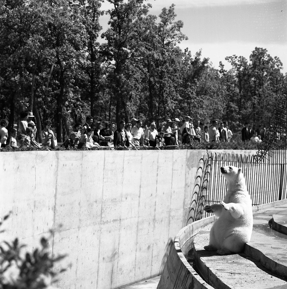
-
Article
Assiniboine River
The Assiniboine River, 1,070 km long and with a mean discharge of 45 m3/s, rises in southeastern Saskatchewan. Fed by the Lilian and Whitesand rivers, it swells into Lake of the Prairies and flows southeast across the Manitoba border, where it is joined by the Qu'Appelle River and, 30 km southeast of Brandon, the Souris River. Joining the Red River at the "forks" in Winnipeg, it cuts a wide, scenic valley through the Manitoba Escarpment, and drains a broad, fertile plain that is one of Canada's prime wheat-growing areas.
"https://d3d0lqu00lnqvz.cloudfront.net/media/media/aab596e1-824f-41f8-aaa0-003d7d08449f.jpg" // resources/views/front/categories/view.blade.php
https://d3d0lqu00lnqvz.cloudfront.net/media/media/aab596e1-824f-41f8-aaa0-003d7d08449f.jpg
-
Article
Athabasca
Athabasca, Alberta, incorporated as a town in 1911, population 2,965 (2016 census), 2,990 (2011 census). The town of Athabasca is located on the Athabasca River, 150 km north of Edmonton. Up until 1904 it was known as Athabasca Landing.
"https://d3d0lqu00lnqvz.cloudfront.net/media/media/2f641937-2de3-4d14-86ed-a71823bd4070.jpg" // resources/views/front/categories/view.blade.php
https://d3d0lqu00lnqvz.cloudfront.net/media/media/2f641937-2de3-4d14-86ed-a71823bd4070.jpg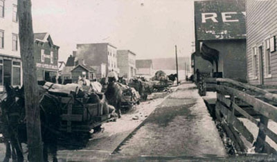
-
Article
Athabasca Landing Trail
Athabasca Landing Trail was established 1875 by Hudson's Bay Company between Edmonton and Athabasca Landing to improve and expand northern transportation.
"https://d3d0lqu00lnqvz.cloudfront.net/media/media/86a45811-ca7b-4681-85e6-0f4769979844.jpg" // resources/views/front/categories/view.blade.php
https://d3d0lqu00lnqvz.cloudfront.net/media/media/86a45811-ca7b-4681-85e6-0f4769979844.jpg
-
Article
Athabasca Pass
Athabasca Pass, elevation 1,748 m, is situated on the extreme southwest boundary of Jasper National Park, on the British Columbia-Alberta border.
"https://thecanadianencyclopedia.ca/images/tce_placeholder.jpg?v=e9dca980c9bdb3aa11e832e7ea94f5d9" // resources/views/front/categories/view.blade.php
https://thecanadianencyclopedia.ca/images/tce_placeholder.jpg?v=e9dca980c9bdb3aa11e832e7ea94f5d9
-
Article
Athabasca River
The Athabasca River is the longest river in Alberta (1,538 km). The first 168 km (located in Jasper National Park) are designated as a Canadian Heritage River. As a tributary to the Mackenzie River, water flowing on the Athabasca River eventually drains into the Arctic Ocean. River flow is highest during the summer and lowest during winter, and it is ice-covered from mid-November to mid-April.
"https://d3d0lqu00lnqvz.cloudfront.net/media/media/19887911-e879-4485-a00f-6bfd76cfe28c.jpg" // resources/views/front/categories/view.blade.php
https://d3d0lqu00lnqvz.cloudfront.net/media/media/19887911-e879-4485-a00f-6bfd76cfe28c.jpg