
Browse "Places"
-
Article
Hanover (Ont)
Hanover, Ont, incorporated as a town in 1904, population 7490 (2011c), 7147 (2006c). The Town of Hanover is located 70 km southwest of OWEN SOUND on the Saugeen River.
"https://d3d0lqu00lnqvz.cloudfront.net/media/media/0ae492cf-0c8f-489c-9da4-cdd28d818051.jpg" // resources/views/front/categories/view.blade.php
https://d3d0lqu00lnqvz.cloudfront.net/media/media/0ae492cf-0c8f-489c-9da4-cdd28d818051.jpg
-
Article
Hans Island
Hans Island, Nunavut, is a tiny (1.2 km2), unpopulated island south of the 81st parallel in the Kennedy Channel (the northern part of Nares Strait), almost equidistant between Ellesmere Island and Greenland. The Greenlandic word for the island is Tartupaluk (Greenlandic is a language spoken by Greenland Inuit). For decades, both Canada and Denmark claimed ownership of the island. On 14 June 2022, however, the two countries settled the dispute, dividing the island roughly equally between them.
"https://d3d0lqu00lnqvz.cloudfront.net/media/media/HansIsland.png" // resources/views/front/categories/view.blade.php
https://d3d0lqu00lnqvz.cloudfront.net/media/media/HansIsland.png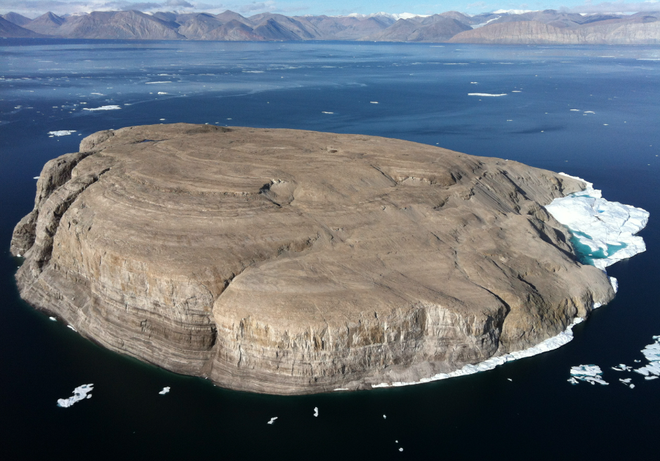
-
Article
Happy Valley-Goose Bay
Happy Valley-Goose Bay, Newfoundland and Labrador, incorporated as a town in 1973, population 8,109 (2016 census), 7,552 (2011 census). The town of Happy Valley-Goose Bay is the result of the amalgamation of two towns situated at the western end of Hamilton Inlet, Labrador. The community began with the construction of an air base during the Second World War. It remains home to a Canadian Forces Base and a small civilian population.
"https://d3d0lqu00lnqvz.cloudfront.net/media/media/dcdb9156-1ed7-43df-b8d3-36f7d617cd41.jpg" // resources/views/front/categories/view.blade.php
https://d3d0lqu00lnqvz.cloudfront.net/media/media/dcdb9156-1ed7-43df-b8d3-36f7d617cd41.jpg
-
Article
Harbour Breton
Harbour Breton, NL, incorporated as a town in 1952, population 1711 (2011c), 1877 (2006c). The Town of Harbour Breton is situated around a protected harbour near the mouth of Fortune Bay on Newfoundland's south coast.
"https://thecanadianencyclopedia.ca/images/tce_placeholder.jpg?v=e9dca980c9bdb3aa11e832e7ea94f5d9" // resources/views/front/categories/view.blade.php
https://thecanadianencyclopedia.ca/images/tce_placeholder.jpg?v=e9dca980c9bdb3aa11e832e7ea94f5d9
-
Article
Harbour Grace
Harbour Grace, NL, incorporated as a town in 1945, population 3131 (2011c), 3074 (2006c). The Town of Harbour Grace, with its commodious harbour in western Conception Bay, was named for the French Havre de Grâce.
"https://thecanadianencyclopedia.ca/images/tce_placeholder.jpg?v=e9dca980c9bdb3aa11e832e7ea94f5d9" // resources/views/front/categories/view.blade.php
https://thecanadianencyclopedia.ca/images/tce_placeholder.jpg?v=e9dca980c9bdb3aa11e832e7ea94f5d9
-
Article
Harrison River
Harrison River, 15 km long, flows SW from Harrison Lk to join the Fraser River about 100 km upriver from Vancouver in southern BC.
"https://thecanadianencyclopedia.ca/images/tce_placeholder.jpg?v=e9dca980c9bdb3aa11e832e7ea94f5d9" // resources/views/front/categories/view.blade.php
https://thecanadianencyclopedia.ca/images/tce_placeholder.jpg?v=e9dca980c9bdb3aa11e832e7ea94f5d9
-
Article
Hart House
Hart House, on UNIVERSITY OF TORONTO campus, was designed by the architectural firm of SPROATT AND ROLPH and was built 1911-19. Soldier's Tower, a memorial to the university's WWI dead, was added in 1924. Endowed by the Massey
"https://d3d0lqu00lnqvz.cloudfront.net/media/media/8db3f498-ce7c-4adf-a6b8-396d1782e4bd.jpg" // resources/views/front/categories/view.blade.php
https://d3d0lqu00lnqvz.cloudfront.net/media/media/8db3f498-ce7c-4adf-a6b8-396d1782e4bd.jpg
-
Article
Hart House
Hart House's facilities include the Great Hall located in the East Wing which functions as an event venue, conference centre, and concert hall and houses a Steinway grand piano. The Music Room in the West Wing also boasts a grand piano, and is used for smaller concerts, lectures and events.
"https://d3d0lqu00lnqvz.cloudfront.net/media/media/8db3f498-ce7c-4adf-a6b8-396d1782e4bd.jpg" // resources/views/front/categories/view.blade.php
https://d3d0lqu00lnqvz.cloudfront.net/media/media/8db3f498-ce7c-4adf-a6b8-396d1782e4bd.jpg
-
Article
Hartland
Hartland, NB, incorporated as a town in 1918, population 947 (2011c), 947 (2006c). The Town of Hartland is located at the mouth of Becaguimec Stream, 124 km upriver from Fredericton on the SAINT JOHN RIVER.
"https://d3d0lqu00lnqvz.cloudfront.net/media/media/47b24fcb-cb02-4988-ac93-8d8199dd5a7f.jpg" // resources/views/front/categories/view.blade.php
https://d3d0lqu00lnqvz.cloudfront.net/media/media/47b24fcb-cb02-4988-ac93-8d8199dd5a7f.jpg
-
Article
Haskell Free Library and Opera House
The Haskell Free Library and Opera House has the distinction of being partly in Canada (Stanstead, formerly Rock Island, QC) and partly in the United States (Derby Line, Vermont), making it a point of interest of Stanstead, one of Canada’s border towns. As its name implies, it contains a lavish 400-seat theatre as well as a library. Inside the century-old building, a line of black tape runs the international boundary between both countries. The portion of the Haskell Free Library and Opera House located within Canadian territory was designated a National Historic Site by the Historic Sites and Monuments Board of Canada in 1985. Similarly, the American portion is listed on the United States National Register of Historic Places.
"https://d3d0lqu00lnqvz.cloudfront.net/HaskellLibraryFront.jpg" // resources/views/front/categories/view.blade.php
https://d3d0lqu00lnqvz.cloudfront.net/HaskellLibraryFront.jpg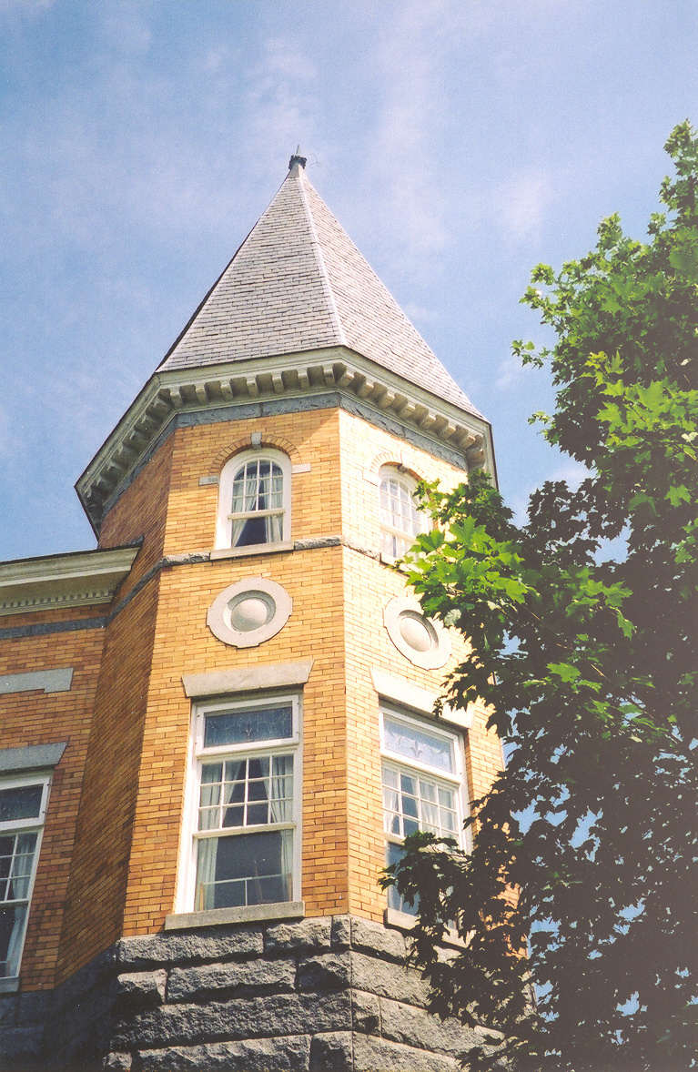
-
Article
Haunted Places in Canada
Haunted places gain a reputation through tragic events, historical individuals or their environment. In Canada, haunted places represent more than just a location suspected to be inhabited by ghosts and spirits; they are locations where storytelling and folklore continue to preserve history. This article explores three places that are both allegedly haunted and historically significant.
"https://d3d0lqu00lnqvz.cloudfront.net/hauntedplaces/Watson-s-Mill-outside.jpg" // resources/views/front/categories/view.blade.php
https://d3d0lqu00lnqvz.cloudfront.net/hauntedplaces/Watson-s-Mill-outside.jpg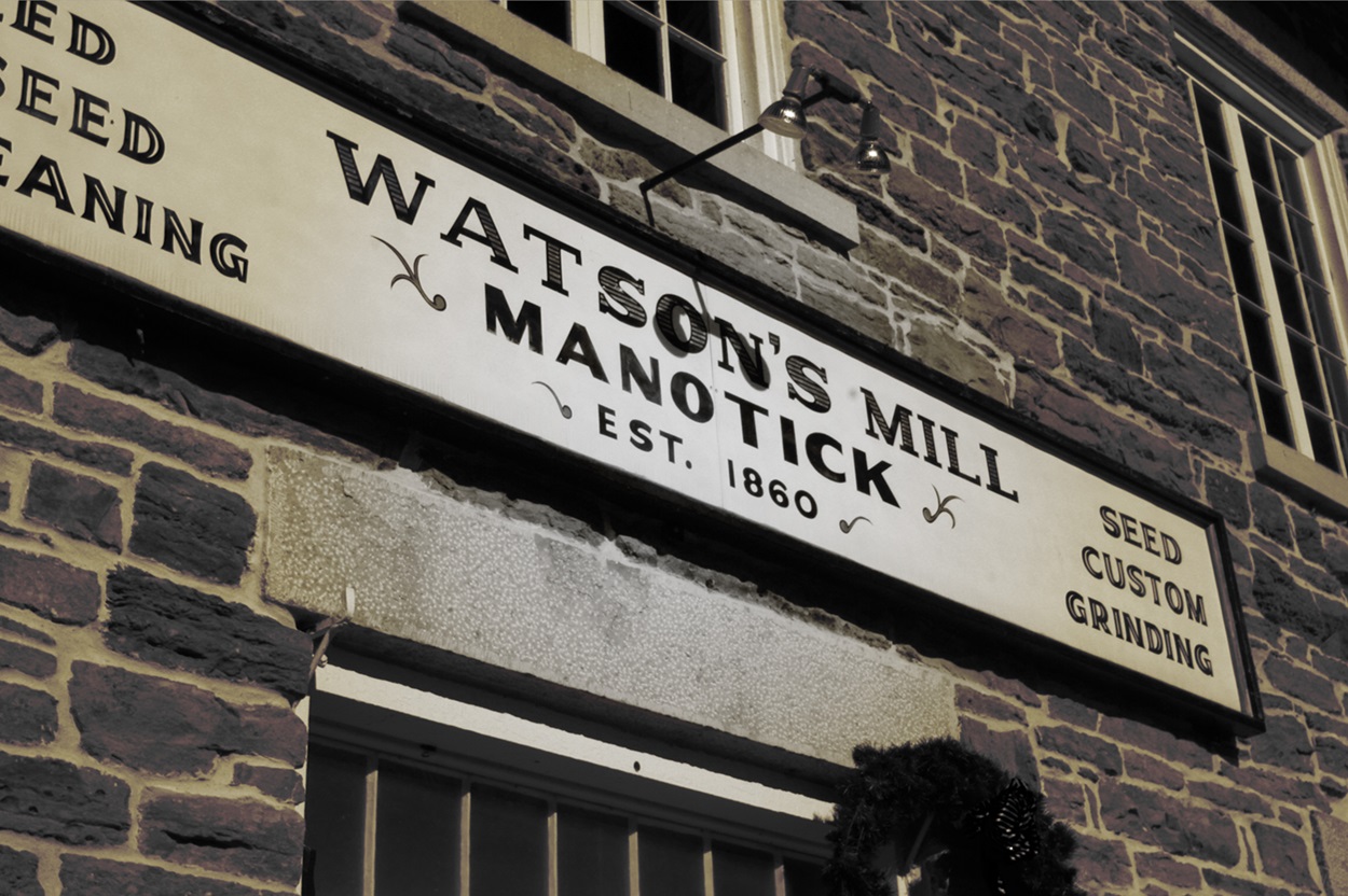
-
Article
Hawkesbury
Hawkesbury, Ontario, incorporated as a town in 1896, population 10,263 (2016 census), 10,551 (2011 census). The town of Hawkesbury is located on the Ottawa River, 95 km east of Ottawa.
"https://thecanadianencyclopedia.ca/images/tce_placeholder.jpg?v=e9dca980c9bdb3aa11e832e7ea94f5d9" // resources/views/front/categories/view.blade.php
https://thecanadianencyclopedia.ca/images/tce_placeholder.jpg?v=e9dca980c9bdb3aa11e832e7ea94f5d9
-
Article
Hay River
Hay River, Northwest Territories, incorporated as a town in 1963, population 3,169 (2021 census), 3,528 (2016 census). The town of Hay River is located on the south shore of Great Slave Lake at the mouth of the Hay River, about 200 air km southwest of Yellowknife.
"https://d3d0lqu00lnqvz.cloudfront.net/media/media/033734fa-dbda-414b-a290-f459d2a67b5a.jpg" // resources/views/front/categories/view.blade.php
https://d3d0lqu00lnqvz.cloudfront.net/media/media/033734fa-dbda-414b-a290-f459d2a67b5a.jpg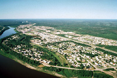
-
Article
Hayes River
The Hayes River, 483 km long, rises in Molson Lake (399 km2) northeast of Lake Winnipeg, flows northeast to Oxford Lake (401 km2) and Knee Lake, through the rock and bush of the Canadian Shield, across the clay flats of the Hudson Bay Lowlands and into the bay at YORK FACTORY.
"https://thecanadianencyclopedia.ca/images/tce_placeholder.jpg?v=e9dca980c9bdb3aa11e832e7ea94f5d9" // resources/views/front/categories/view.blade.php
https://thecanadianencyclopedia.ca/images/tce_placeholder.jpg?v=e9dca980c9bdb3aa11e832e7ea94f5d9
-
Article
Hazelton
Hazelton, British Columbia, incorporated as a village in 1956, population 270 (2011c), 293 (2006c). The Village of Hazelton is situated at the confluence of the Skeena and Bulkley rivers. The townsite was laid out by Edgar DEWDNEY in 1871 next to the GITKSAN village of Gitanmaax.
"https://thecanadianencyclopedia.ca/images/tce_placeholder.jpg?v=e9dca980c9bdb3aa11e832e7ea94f5d9" // resources/views/front/categories/view.blade.php
https://thecanadianencyclopedia.ca/images/tce_placeholder.jpg?v=e9dca980c9bdb3aa11e832e7ea94f5d9