Browse "Places"
-
Article
Golden
Golden, British Columbia, incorporated as a town in 1957, population 3,708 (2016 census), 3,701 (2011 census). The town of Golden is located on the Columbia River at its confluence with the Kicking Horse River. It is situated 260 km west of Calgary, Alberta, between the Purcell Mountain Range and Glacier National Park to the west, and the Rocky Mountains and Yoho National Park to the east. Golden is located on the traditional territory of the Ktunaxa and Secwepemc people (see Interior Salish).
"https://thecanadianencyclopedia.ca/images/tce_placeholder.jpg?v=e9dca980c9bdb3aa11e832e7ea94f5d9" // resources/views/front/categories/view.blade.php
https://thecanadianencyclopedia.ca/images/tce_placeholder.jpg?v=e9dca980c9bdb3aa11e832e7ea94f5d9
-
"https://thecanadianencyclopedia.ca/images/tce_placeholder.jpg?v=e9dca980c9bdb3aa11e832e7ea94f5d9" // resources/views/front/categories/view.blade.php
https://thecanadianencyclopedia.ca/images/tce_placeholder.jpg?v=e9dca980c9bdb3aa11e832e7ea94f5d9
-
Article
Government Building
Government has always been the most important patron of ARCHITECTURE in Canada, and this role has increased rapidly over the past few decades. As its duties and responsibilities expand, so do its building needs. Today all levels of government contribute to all aspects of our built environment.
"https://d3d0lqu00lnqvz.cloudfront.net/media/media/7d924fcf-8eec-4819-8503-5b8f85bbd7cb.jpg" // resources/views/front/categories/view.blade.php
https://d3d0lqu00lnqvz.cloudfront.net/media/media/7d924fcf-8eec-4819-8503-5b8f85bbd7cb.jpg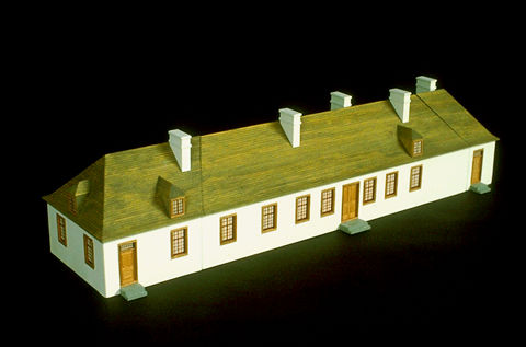
-
Article
Granby
Situated 84 km southeast of Montréal and about 48 km from the US border, Granby remained a modest agricultural centre until the 1940s.
"https://thecanadianencyclopedia.ca/images/tce_placeholder.jpg?v=e9dca980c9bdb3aa11e832e7ea94f5d9" // resources/views/front/categories/view.blade.php
https://thecanadianencyclopedia.ca/images/tce_placeholder.jpg?v=e9dca980c9bdb3aa11e832e7ea94f5d9
-
Article
Grand Bank
Grand Bank, NL, incorporated as a town in 1943, population 2415 (2011c), 2580 (2006c). The Town of Grand Bank is located on the west side of the Burin Peninsula.
"https://thecanadianencyclopedia.ca/images/tce_placeholder.jpg?v=e9dca980c9bdb3aa11e832e7ea94f5d9" // resources/views/front/categories/view.blade.php
https://thecanadianencyclopedia.ca/images/tce_placeholder.jpg?v=e9dca980c9bdb3aa11e832e7ea94f5d9
-
Article
Grand Banks
The water over the banks is mainly supplied by the southward-flowing cold LABRADOR CURRENT. This current splits as it approaches the Grand Banks, with one branch moving south along the coast of Newfoundland through Avalon Channel to St Pierre Bank.
"https://thecanadianencyclopedia.ca/images/tce_placeholder.jpg?v=e9dca980c9bdb3aa11e832e7ea94f5d9" // resources/views/front/categories/view.blade.php
https://thecanadianencyclopedia.ca/images/tce_placeholder.jpg?v=e9dca980c9bdb3aa11e832e7ea94f5d9
-
Article
Grand Bay-Westfield
Grand Bay-Westfield, NB, incorporated as a town in 1998, population 5117 (2011c), 4981 (2006c). The Town of Grand Bay-Westfield is located on the northern boundary of SAINT JOHN about 26 km from the city centre.
"https://thecanadianencyclopedia.ca/images/tce_placeholder.jpg?v=e9dca980c9bdb3aa11e832e7ea94f5d9" // resources/views/front/categories/view.blade.php
https://thecanadianencyclopedia.ca/images/tce_placeholder.jpg?v=e9dca980c9bdb3aa11e832e7ea94f5d9
-
"https://d3d0lqu00lnqvz.cloudfront.net/media/media/cf677f0f-c616-40f5-a13d-f4de367774a7.jpg" // resources/views/front/categories/view.blade.php
https://d3d0lqu00lnqvz.cloudfront.net/media/media/cf677f0f-c616-40f5-a13d-f4de367774a7.jpg
-
Article
Grand Falls (NB)
Grand Falls (or Grand-Sault), NB, incorporated as a town in 1890, population 5706 (2011c), 5650 (2006c). The Town of Grand Falls is located 228 km up the SAINT JOHN RIVER from Fredericton at the point where the Canada-US boundary begins to be designated by the river.
"https://d3d0lqu00lnqvz.cloudfront.net/media/media/955d7068-37c3-4046-ab9a-a37098f821e7.jpg" // resources/views/front/categories/view.blade.php
https://d3d0lqu00lnqvz.cloudfront.net/media/media/955d7068-37c3-4046-ab9a-a37098f821e7.jpg
-
Article
Grand Falls-Windsor
Grand Falls-Windsor, NL, incorporated as a town in 1991, population 13 725 (2011c), 13 558 (2006c). The Town of Grand Falls-Windsor is comprised of two towns, which were amalgamated in 1991. It is located in central Newfoundland on the Exploits River.
"https://thecanadianencyclopedia.ca/images/tce_placeholder.jpg?v=e9dca980c9bdb3aa11e832e7ea94f5d9" // resources/views/front/categories/view.blade.php
https://thecanadianencyclopedia.ca/images/tce_placeholder.jpg?v=e9dca980c9bdb3aa11e832e7ea94f5d9
-
Article
Grand Forks
Grand Forks, BC, incorporated as a city in 1897, population 3985 (2011c), 4036 (2006c). The City of Grand Forks is at the junction of the Kettle and Granby rivers, 124 km east of Osoyoos and 140 km west of Nelson.
"https://thecanadianencyclopedia.ca/images/tce_placeholder.jpg?v=e9dca980c9bdb3aa11e832e7ea94f5d9" // resources/views/front/categories/view.blade.php
https://thecanadianencyclopedia.ca/images/tce_placeholder.jpg?v=e9dca980c9bdb3aa11e832e7ea94f5d9
-
Article
Grand Lake
Grand Lake, 534 km2, elevation 85 m, max length 100 km, up to 300 m deep, largest lake on the Island of Newfoundland, is located on the west side of the Island, 24 km southeast of CORNER BROOK.
"https://thecanadianencyclopedia.ca/images/tce_placeholder.jpg?v=e9dca980c9bdb3aa11e832e7ea94f5d9" // resources/views/front/categories/view.blade.php
https://thecanadianencyclopedia.ca/images/tce_placeholder.jpg?v=e9dca980c9bdb3aa11e832e7ea94f5d9
-
Article
Grand Manan Island
With a population of about 2500 - chiefly in the villages of North Head, Grand Harbour and Seal Cove - its chief industries are scallops, herring, lobster and salmon aquaculture, dulse (seaweed) gathering and tourism.
"https://d3d0lqu00lnqvz.cloudfront.net/media/media/03d8b7c6-bc2b-4575-97ec-f3d453f5bf34.jpg" // resources/views/front/categories/view.blade.php
https://d3d0lqu00lnqvz.cloudfront.net/media/media/03d8b7c6-bc2b-4575-97ec-f3d453f5bf34.jpg
-
Article
Grand-Mère
The first French missionary contact with the indigenous people, the MONTAGNAIS, took place in 1651, but the region remained virtually unsettled for nearly 200 years.
"https://thecanadianencyclopedia.ca/images/tce_placeholder.jpg?v=e9dca980c9bdb3aa11e832e7ea94f5d9" // resources/views/front/categories/view.blade.php
https://thecanadianencyclopedia.ca/images/tce_placeholder.jpg?v=e9dca980c9bdb3aa11e832e7ea94f5d9
-
Article
Grand Portage
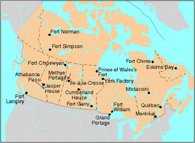
Grand Portage was a fur-trade depot and route of the voyageurs at the western extremity of Lake Superior.
"https://d3d0lqu00lnqvz.cloudfront.net/media/media/a4d6e476-5e53-4126-9ee6-313b64235660.jpg" // resources/views/front/categories/view.blade.php
https://d3d0lqu00lnqvz.cloudfront.net/media/media/a4d6e476-5e53-4126-9ee6-313b64235660.jpg