
Browse "Places"
-
Article
Rideau Hall
A sophisticated estate that incorporated the primary elements of English landscape style, Rideau Hall was thought to be in keeping with the stature and lifestyle of the Queen's representative in Canada.
"https://d3d0lqu00lnqvz.cloudfront.net/media/media/65601146-87c4-4c0a-9747-e9ea04708cd6.jpg" // resources/views/front/categories/view.blade.php
https://d3d0lqu00lnqvz.cloudfront.net/media/media/65601146-87c4-4c0a-9747-e9ea04708cd6.jpg
-
Article
Rideau Lakes
Rideau Lakes, 65 km2, elev 123 m, mean depth 12.3 m, is a commonly used collective name for 3 lakes: Big Rideau, Upper Rideau and Lower Rideau.
"https://d3d0lqu00lnqvz.cloudfront.net/media/media/3f6f49a4-9e6a-4764-8ac0-b535a8fed146.jpg" // resources/views/front/categories/view.blade.php
https://d3d0lqu00lnqvz.cloudfront.net/media/media/3f6f49a4-9e6a-4764-8ac0-b535a8fed146.jpg
-
Article
Rideau River
The Rideau River flows 100 km northwards from the Rideau Lakes in eastern Ontario to the Ottawa River at Ottawa. The river traverses flat agricultural lands underlain by limestone, which was once an ancient seabed. The soils are rich, and the land gently rolling. The river spills into the Ottawa River over a dramatic limestone ledge in a wall of white spray, inspiring explorer Samuel de Champlain, the first European to see it, to name it rideau, meaning "curtain" in French.
"https://d3d0lqu00lnqvz.cloudfront.net/media/media/7d8b1603-093b-431d-9c12-aa68e477912f.jpg" // resources/views/front/categories/view.blade.php
https://d3d0lqu00lnqvz.cloudfront.net/media/media/7d8b1603-093b-431d-9c12-aa68e477912f.jpg
-
Article
Riding Mountain National Park
Riding Mountain National Park (est 1929, 2,973.1 km2) is located 265 km northwest of Winnipeg, perched almost 500 m above the prairie on the Manitoba Escarpment. The park is the "core protected area" of Riding Mountain Biosphere Reserve.
"https://d3d0lqu00lnqvz.cloudfront.net/media/media/c9679ffa-5ed0-4a59-995b-e07de3516e05.jpg" // resources/views/front/categories/view.blade.php
https://d3d0lqu00lnqvz.cloudfront.net/media/media/c9679ffa-5ed0-4a59-995b-e07de3516e05.jpg
-
Article
Rimouski
In the 18th century, agriculture and seasonal fishing were the only occupations, but the area experienced some growth when Québec City merchants, including William Price, began to develop the forest resources and built several sawmills.
"https://thecanadianencyclopedia.ca/images/tce_placeholder.jpg?v=e9dca980c9bdb3aa11e832e7ea94f5d9" // resources/views/front/categories/view.blade.php
https://thecanadianencyclopedia.ca/images/tce_placeholder.jpg?v=e9dca980c9bdb3aa11e832e7ea94f5d9
-
Article
Music in Rimouski
City situated on the south shore of the St Lawrence River, 300 kilometres east of Quebec City. The name, meaning 'moose sanctuary,' comes from the Micmac language.
"https://thecanadianencyclopedia.ca/images/tce_placeholder.jpg?v=e9dca980c9bdb3aa11e832e7ea94f5d9" // resources/views/front/categories/view.blade.php
https://thecanadianencyclopedia.ca/images/tce_placeholder.jpg?v=e9dca980c9bdb3aa11e832e7ea94f5d9
-
Article
Riverboat
The Riverboat. Coffeehouse in Toronto's Yorkville district. Seating about 100 in the narrow basement of a house at 134 Yorkville Ave, it was opened in October 1964 by Bernie Fiedler and became the best-known coffeehouse in Canada.
"https://thecanadianencyclopedia.ca/images/tce_placeholder.jpg?v=e9dca980c9bdb3aa11e832e7ea94f5d9" // resources/views/front/categories/view.blade.php
https://thecanadianencyclopedia.ca/images/tce_placeholder.jpg?v=e9dca980c9bdb3aa11e832e7ea94f5d9
-
Article
Riverdale
Riverdale, Manitoba, incorporated as a municipality in 2015, population 1,803 (2021 census), 2,133 (2016 census). This municipality resulted from the amalgamation of the now-dissolved town of Rivers and municipality of Daly. The community of Rivers developed as a railway and military centre, 235 km west of Winnipeg.
"https://d3d0lqu00lnqvz.cloudfront.net/riverdale/Rivers_Train_Station.jpg" // resources/views/front/categories/view.blade.php
https://d3d0lqu00lnqvz.cloudfront.net/riverdale/Rivers_Train_Station.jpg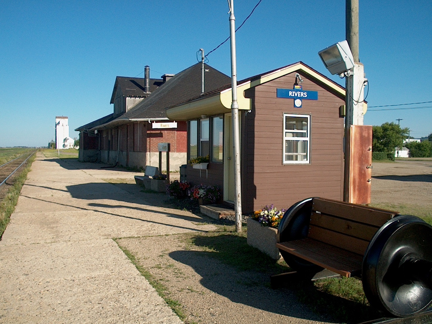
-
Article
Riverview
Riverview, incorporated as a town in 1973, population 19 128 (2011c), 17 832 (2006c). The Town of Riverview is situated on the Petitcodiac River opposite MONCTON.
"https://thecanadianencyclopedia.ca/images/tce_placeholder.jpg?v=e9dca980c9bdb3aa11e832e7ea94f5d9" // resources/views/front/categories/view.blade.php
https://thecanadianencyclopedia.ca/images/tce_placeholder.jpg?v=e9dca980c9bdb3aa11e832e7ea94f5d9
-
Article
Rivière Chaudière
Rivière Chaudière, 193 km long and with a basin 6690 km2, is located in southern Québec. It is named after the waters that "boil" from its falls or after the numerous glacial erosion kettles (chaudière is French for boiler and also for bucket).
"https://thecanadianencyclopedia.ca/images/tce_placeholder.jpg?v=e9dca980c9bdb3aa11e832e7ea94f5d9" // resources/views/front/categories/view.blade.php
https://thecanadianencyclopedia.ca/images/tce_placeholder.jpg?v=e9dca980c9bdb3aa11e832e7ea94f5d9
-
Article
Rivière de Rupert
Rivière de Rupert is 763 km long to the head of Lac Témiscamie. It drains Lac Mistassini and then follows a twisted course through a series of lakes and across a flat coastal plain to discharge into southeastern James Bay.
"https://thecanadianencyclopedia.ca/images/tce_placeholder.jpg?v=e9dca980c9bdb3aa11e832e7ea94f5d9" // resources/views/front/categories/view.blade.php
https://thecanadianencyclopedia.ca/images/tce_placeholder.jpg?v=e9dca980c9bdb3aa11e832e7ea94f5d9
-
Article
Rivière Dumoine
The Dumoine, 129 km long, rises in Lac Dumoine in southwest Québec and flows off the south edge of the Laurentian Highlands through a series of waterfalls, wild rapids and long chutes into the Ottawa River.
"https://thecanadianencyclopedia.ca/images/tce_placeholder.jpg?v=e9dca980c9bdb3aa11e832e7ea94f5d9" // resources/views/front/categories/view.blade.php
https://thecanadianencyclopedia.ca/images/tce_placeholder.jpg?v=e9dca980c9bdb3aa11e832e7ea94f5d9
-
Article
Rivière Eastmain
The Rivière Eastmain, 756 km long, rises in the central part of Québec on the side of a low drainage divide from which streams flow west to James Bay.
"https://thecanadianencyclopedia.ca/images/tce_placeholder.jpg?v=e9dca980c9bdb3aa11e832e7ea94f5d9" // resources/views/front/categories/view.blade.php
https://thecanadianencyclopedia.ca/images/tce_placeholder.jpg?v=e9dca980c9bdb3aa11e832e7ea94f5d9
-
Article
Rivière Koksoak
Koksoak, Rivière, 874 km long (to head of Caniapiscau River), final leg of a river system that drains a vast area (133 000 km2) of northern Québec.
"https://thecanadianencyclopedia.ca/images/tce_placeholder.jpg?v=e9dca980c9bdb3aa11e832e7ea94f5d9" // resources/views/front/categories/view.blade.php
https://thecanadianencyclopedia.ca/images/tce_placeholder.jpg?v=e9dca980c9bdb3aa11e832e7ea94f5d9
-
Article
Rivière Manicouagan
The Rivière Manicouagan, 560 km long, rises in east-central Québec near the Labrador border and flows south through the Réservoir Manicouagan to the St Lawrence River near Baie-Comeau.
"https://d3d0lqu00lnqvz.cloudfront.net/media/media/6be9c93a-1849-439f-b16a-f87c91691760.jpg" // resources/views/front/categories/view.blade.php
https://d3d0lqu00lnqvz.cloudfront.net/media/media/6be9c93a-1849-439f-b16a-f87c91691760.jpg