
Browse "Places"
-
Article
Physical Geography
Physical geography is that branch of geography concerned with describing and analysing the distribution of physical and biochemical elements of the environment; interpreting environmental systems located at or near a boundary between atmosphere, lithosphere (the rigid part of Earth's crust), biosphere or hydrosphere (Earth's water); and determining the resilience of such systems to human activities at or near Earth's surface. In Europe, geomorphology is a subfield of physical geography. In North America, it is frequently a branch of geology. Both traditions are found in Canadian universities.
"https://d3d0lqu00lnqvz.cloudfront.net/lakesincanada/Oxbow-Lakes.jpg" // resources/views/front/categories/view.blade.php
https://d3d0lqu00lnqvz.cloudfront.net/lakesincanada/Oxbow-Lakes.jpg
-
Article
Physiographic Regions
Canada may be divided into seven physiographic regions. The Canadian Shield is the largest and oldest of these regions. The other six physiographic regions are younger and form two concentric rings around the Canadian Shield. The outer, older ring contains the Western Cordillera, Canadian Arctic and Appalachian Region. The second, younger ring contains the Interior Plains, Hudson Bay Lowlands and the St. Lawrence Lowlands. These regions may be further sub-divided based on their structure, relief and the presence or absence of permafrost and forest cover (see Natural Regions). Areas quoted for these regions are the land areas and do not include adjacent continental shelves or bodies of ocean water within Canada's territorial limits. Readers should also note that the abbreviation “masl” stands for “metres above sea level.” Click here for definitions of key terms used in this article. This article is a full-length entry about physiographic regions. For a plain-language summary, please see Physiographic Regions (Plain-Language Summary).
"https://d3d0lqu00lnqvz.cloudfront.net/PhysiographicRegions/physigraphic-regions-EN.jpg" // resources/views/front/categories/view.blade.php
https://d3d0lqu00lnqvz.cloudfront.net/PhysiographicRegions/physigraphic-regions-EN.jpg
-
Article
Physiographic Regions (Plain-Language Summary)
The term physiographic refers to physical geography. There are seven physiographic regions in Canada. These regions are the Canadian Shield, the Western Cordillera, the Canadian Arctic, the Appalachian Region, the Interior Plains, the Hudson Bay Lowlands, and the St. Lawrence Lowlands. This article is a plain-language summary of physiographic regions. If you are interested in reading about this topic more in depth, please see our full-length entry, Physiographic Regions.
"https://d3d0lqu00lnqvz.cloudfront.net/PhysiographicRegions/physigraphic-regions-EN.jpg" // resources/views/front/categories/view.blade.php
https://d3d0lqu00lnqvz.cloudfront.net/PhysiographicRegions/physigraphic-regions-EN.jpg
-
Article
Pickering
Pickering, Ontario, incorporated as a city in 2000, population 91,771 (2016 census), 88,721 (2011 census). The city of Pickering is located 43 km east of Toronto on Lake Ontario. It was named after the town of Pickering in Yorkshire, England. Pickering is also part of the Regional Municipality of Durham.
"https://d3d0lqu00lnqvz.cloudfront.net/media/new_article_images/Pickering/Pickering.jpg" // resources/views/front/categories/view.blade.php
https://d3d0lqu00lnqvz.cloudfront.net/media/new_article_images/Pickering/Pickering.jpg
-
Article
Pictou
Pictou, NS, incorporated as a town in 1873, population 3,107 (2021 census), 3,186 (2016 census). The Town of Pictou, shire town of Pictou County, is located on Pictou Harbour adjacent to Northumberland Strait and the Gulf of St Lawrence.
"https://d3d0lqu00lnqvz.cloudfront.net/media/media/f72429be-c916-4e70-8c4b-1e168306831d.jpg" // resources/views/front/categories/view.blade.php
https://d3d0lqu00lnqvz.cloudfront.net/media/media/f72429be-c916-4e70-8c4b-1e168306831d.jpg
-
Article
Pier 21
Pier 21 was an immigration depot on the Halifax harbourfront that operated from 1928 to 1971.
"https://d3d0lqu00lnqvz.cloudfront.net/media/media/fd704360-23a5-4333-9dc4-fed52fcc81b8.jpg" // resources/views/front/categories/view.blade.php
https://d3d0lqu00lnqvz.cloudfront.net/media/media/fd704360-23a5-4333-9dc4-fed52fcc81b8.jpg
-
Article
Pierrefonds
Pierrefonds dates back to the founding of the parish of Sainte-Geneviève in 1741. Its boundaries have since been broken up into 3 municipalities: ROXBORO (1914), DOLLARD-DES-ORMEAUX (1924) and Pierrefonds.
"https://d3d0lqu00lnqvz.cloudfront.net/media/media/155a7579-e941-4167-813d-2dd444d91b31.jpg" // resources/views/front/categories/view.blade.php
https://d3d0lqu00lnqvz.cloudfront.net/media/media/155a7579-e941-4167-813d-2dd444d91b31.jpg
-
Article
Pilot Butte
Pilot Butte is now a residential community for Regina, appealing to those who prefer a more rural lifestyle. This upward trend in population bucks the general Saskatchewan trend of depopulation of rural areas. A violent storm hit the area on 26 August 1995, damaging most homes in the community.
"https://d3d0lqu00lnqvz.cloudfront.net/media/media/9802efc9-814b-473e-8cfb-222b4b819ec1.jpg" // resources/views/front/categories/view.blade.php
https://d3d0lqu00lnqvz.cloudfront.net/media/media/9802efc9-814b-473e-8cfb-222b4b819ec1.jpg
-
Article
Pinawa
Pinawa, Manitoba, incorporated as a local government district in 1963, population 1444 (2011c), 1450 (2006c). The Local Government District of Pinawa is located 110 km northeast of Winnipeg on the Winnipeg River at the entrance of the Pinawa Channel.
"https://thecanadianencyclopedia.ca/images/tce_placeholder.jpg?v=e9dca980c9bdb3aa11e832e7ea94f5d9" // resources/views/front/categories/view.blade.php
https://thecanadianencyclopedia.ca/images/tce_placeholder.jpg?v=e9dca980c9bdb3aa11e832e7ea94f5d9
-
Article
Pincher Creek
Pincher Creek, Alberta, incorporated as a town in 1906, population 3,642 (2016 census), 3,685 (2011 census). The town of Pincher Creek is located in southwestern Alberta at the eastern edge of the Rocky Mountains. It was established in 1878 as a North-West Mounted Police post and farm on Pincher Creek. The creek received its name after a pair of pincers (a tool used to trim horses’ hooves) was found along its banks.
"https://thecanadianencyclopedia.ca/images/tce_placeholder.jpg?v=e9dca980c9bdb3aa11e832e7ea94f5d9" // resources/views/front/categories/view.blade.php
https://thecanadianencyclopedia.ca/images/tce_placeholder.jpg?v=e9dca980c9bdb3aa11e832e7ea94f5d9
-
Article
Pincourt
Pincourt, Quebec, incorporated as a town in 1959, population 14,751 (2021 census), 14,558 (2016 census). Pincourt is one of the four municipalities covering the territory of Île Perrot, an island located off the western end of Île de Montréal, at the mouth of the Ottawa River, between lakes Saint-Louis and Deux-Montagnes. The three other municipalities are L'Île-Perrot, Notre-Dame-de-l'Île-Perrot and Terrasse-Vaudreuil. Pincourt, some 40 km west of Montreal, occupies the western portion of the island. Across the channel is the city of Vaudreuil-Dorion.
"https://d3d0lqu00lnqvz.cloudfront.net/Pincourt_QC.jpg" // resources/views/front/categories/view.blade.php
https://d3d0lqu00lnqvz.cloudfront.net/Pincourt_QC.jpg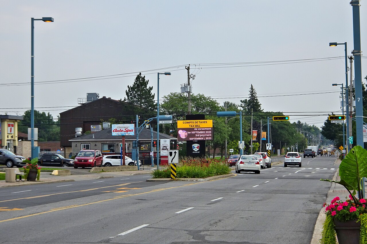
-
Article
Pine Pass
Pine Pass, at an elevation of 874 m, crosses the continental divide northwest-southeast in northeastern British Columbia. The Pine River rises southwest of the pass, then flows northwest to meet the Peace River, near Fort St John.
"https://d3d0lqu00lnqvz.cloudfront.net/pinepass/pine-pass-bc-rockies.jpg" // resources/views/front/categories/view.blade.php
https://d3d0lqu00lnqvz.cloudfront.net/pinepass/pine-pass-bc-rockies.jpg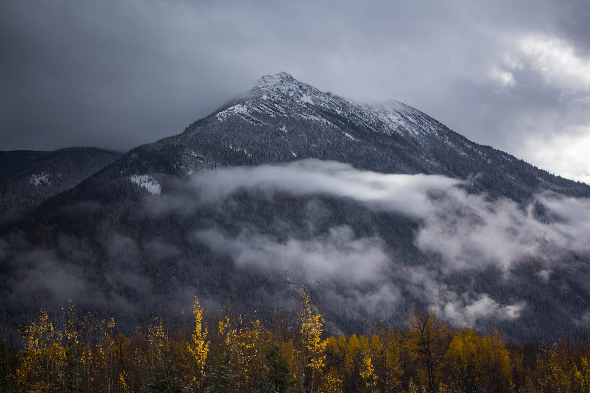
-
Article
Pine Point
Pine Point, Northwest Territories, was a town located 10 km inland from the south shore of GREAT SLAVE LAKE , 87 km east of Hay River.
"https://thecanadianencyclopedia.ca/images/tce_placeholder.jpg?v=e9dca980c9bdb3aa11e832e7ea94f5d9" // resources/views/front/categories/view.blade.php
https://thecanadianencyclopedia.ca/images/tce_placeholder.jpg?v=e9dca980c9bdb3aa11e832e7ea94f5d9
-
Article
Pintendre
Pintendre, Quebec, population 7,171 (2019), 6,209 (2001 census). Originally incorporated in 1901, Pintendre is now part of Lévis since 2002. The area is located on the south bank of the St. Lawrence River. Pintendre is situated on the agricultural plain next to the Appalachian mountains. (See Mountain Range.) Three rivers flow through the area’s boundaries: Etchemin, la Scie and des Couture.
"https://d3d0lqu00lnqvz.cloudfront.net/media/media/fe50872c-9b16-4ab6-9cf3-8634facdf226.jpg" // resources/views/front/categories/view.blade.php
https://d3d0lqu00lnqvz.cloudfront.net/media/media/fe50872c-9b16-4ab6-9cf3-8634facdf226.jpg
-
Article
Pitt Meadows
Pitt Meadows, BC, incorporated as a city in 2007, population 17 736 (2011c), 15 623 (2006c). The City of Pitt Meadows is an agricultural community located in the lower Fraser Valley east of VANCOUVER on the north side of the FRASER RIVER at its junction with the Pitt River.
"https://thecanadianencyclopedia.ca/images/tce_placeholder.jpg?v=e9dca980c9bdb3aa11e832e7ea94f5d9" // resources/views/front/categories/view.blade.php
https://thecanadianencyclopedia.ca/images/tce_placeholder.jpg?v=e9dca980c9bdb3aa11e832e7ea94f5d9