
Browse "Provinces & Territories"
-
Article
Klondike Gold Rush
The discovery of gold in the Yukon in 1896 led to a stampede to the Klondike region between 1897 and 1899. This led to the establishment of Dawson City (1896) and subsequently, the Yukon Territory (1898). The Klondike gold rush solidified the public’s image of the North as more than a barren wasteland and left a body of literature that has popularized and romanticized the Yukon. (See also Gold Rushes in Canada)
"https://d3d0lqu00lnqvz.cloudfront.net/media/media/f8badbbb-95b8-44cf-a053-5589845ee1ef.jpg" // resources/views/front/categories/view.blade.php
https://d3d0lqu00lnqvz.cloudfront.net/media/media/f8badbbb-95b8-44cf-a053-5589845ee1ef.jpg
-
Article
Lillian Elias
Lillian Elias (whose Inuvialuktun name is Panigavluk), ONWT, teacher, language activist (born 1943 in the Mackenzie Delta, NT). Influenced by her time at residential school, where administrators attempted to forcefully strip her of her language and culture, Lillian Elias has spent much of her life promoting and preserving her first language, Inuvialuktun (see Inuvialuit).
"https://d3d0lqu00lnqvz.cloudfront.net/LillianElias/Lillian-Elias_Screencap_Tweetonly.jpg" // resources/views/front/categories/view.blade.php
https://d3d0lqu00lnqvz.cloudfront.net/LillianElias/Lillian-Elias_Screencap_Tweetonly.jpg
-
Article
Lower Canada
Lower Canada was a British colony from 1791 to 1840. Its geographical boundaries comprised the southern portion of present-day Quebec. In 1791, Britain divided the Province of Quebec into Upper Canada and Lower Canada. (See: Constitutional Act 1791.) Britain had followed a similar policy of territorial division twice before. Prince Edward Island was detached from Nova Scotia in 1769. The provinces of Cape Breton and New Brunswick were created in 1784 in response to the wave of Loyalist immigration (which also occurred in Quebec). In 1841, Upper Canada and Lower Canada were renamed Canada West and Canada East, respectively. They were united as the single colony of the Province of Canada.
"https://d3d0lqu00lnqvz.cloudfront.net/media/media/0a40188b-4ef4-4e9e-90bb-ec21d39c1c45.jpg" // resources/views/front/categories/view.blade.php
https://d3d0lqu00lnqvz.cloudfront.net/media/media/0a40188b-4ef4-4e9e-90bb-ec21d39c1c45.jpg
-
Article
Maisie Hurley
Maisie Hurley, née Maisie Amy Campbell-Johnston, Vancouver-area political activist, Indigenous ally (see Indigenous Peoples in Canada), newspaper founder and art collector (born 27 November 1887 in Swansea, Wales; died 3 October 1964 in North Vancouver, British Columbia). Although Hurley had no formal legal training or law degree (see Legal Education), she worked on several legal cases and advocated for Indigenous peoples’ basic human rights as well as for changes to the Indian Act. In 1946, Hurley started a newspaper called The Native Voice that aimed to bring attention to important issues concerning Indigenous communities across Canada (see Rights of Indigenous Peoples in Canada). In 2011, Hurley’s collection of Indigenous art was displayed at the North Vancouver Museum.
"https://d3d0lqu00lnqvz.cloudfront.net/Untitled-11.jpg" // resources/views/front/categories/view.blade.php
https://d3d0lqu00lnqvz.cloudfront.net/Untitled-11.jpg
-
Timelines
Manitoba
Sometimes referred to as the “keystone” province because of its position in the centre of the country, Manitoba is bounded by Nunavut and Hudson Bay to the north, Ontario to the east, the United States to the south and Saskatchewan to the west.
"https://d3d0lqu00lnqvz.cloudfront.net/media/media/631b3ba1-7b69-4d3b-9c8f-68ec97fdfdfb.jpg" // resources/views/front/categories/view.blade.php
https://d3d0lqu00lnqvz.cloudfront.net/media/media/631b3ba1-7b69-4d3b-9c8f-68ec97fdfdfb.jpg
-
Article
Maritime Provinces
The word Maritimes is a regional designation for the Canadian provinces of Prince Edward Island, Nova Scotia and New Brunswick. These provinces constitute a cluster of peninsulas and islands that form the northeastern extension of the Appalachian Highlands and are also significantly affected by the Atlantic Ocean. Together, the Maritime provinces cover 133,850 km2 — or just a little more than 1 per cent of Canada's land surface.
"https://d3d0lqu00lnqvz.cloudfront.net/media/media/276c48ba-ecfb-4c4a-aec6-e7bba279abf9.jpg" // resources/views/front/categories/view.blade.php
https://d3d0lqu00lnqvz.cloudfront.net/media/media/276c48ba-ecfb-4c4a-aec6-e7bba279abf9.jpg
-
Article
Métis Experiences at Residential School
Although the first residential schools in Canada were established with the intention of assimilating First Nations children into Euro-Canadian culture, Métis and Inuit children were also institutionalized in such facilities. Métis children experienced similar day-to-day conditions to those of other students in residential schools, but they were often considered “outsiders” by their peers and administrators. This perception affected their experiences within these institutions in particular ways.
"https://d3d0lqu00lnqvz.cloudfront.net/MetisExperiences/Webp.net-resizeimage.jpg" // resources/views/front/categories/view.blade.php
https://d3d0lqu00lnqvz.cloudfront.net/MetisExperiences/Webp.net-resizeimage.jpg
-
Article
Native People's Caravan
The Native People’s Caravan was a cross-country mobile protest that took place in 1974. Its main purpose was to raise awareness about the poor living conditions and discrimination experienced by Indigenous peoples in Canada. It travelled from Vancouver to Ottawa, where the subsequent occupation of a vacant warehouse on Victoria Island, near Parliament Hill, extended into 1975. The caravan brought various Indigenous groups together in protest of broken treaties, as well as a lack of government-supported education, housing and health care. As a result, meetings between Cabinet ministers and Indigenous leaders became more frequent. The protest is remembered as an important turning point in Indigenous activism in Canada.
"https://d3d0lqu00lnqvz.cloudfront.net/media/media/e9e4a925-a033-404d-9819-a3bb46fe9c8e.jpg" // resources/views/front/categories/view.blade.php
https://d3d0lqu00lnqvz.cloudfront.net/media/media/e9e4a925-a033-404d-9819-a3bb46fe9c8e.jpg
-
Article
New Brunswick
New Brunswick is one of three provinces collectively known as the "Maritimes." Joined to Nova Scotia by the narrow Chignecto Isthmus and separated from Prince Edward Island by the Northumberland Strait, New Brunswick forms the land bridge linking this region to continental North America. It is bounded in the north by Quebec and in the west by the US (Maine). In 1784, the British divided Nova Scotia at the Chignecto Isthmus, naming the west and north portion New Brunswick after the German duchy of Brunswick-Lunenburg. New Brunswick is now the only officially bilingual province in Canada.
"https://d3d0lqu00lnqvz.cloudfront.net/media/media/0ad6e160-c61e-4c22-b4ad-5db332fb3e11.jpg" // resources/views/front/categories/view.blade.php
https://d3d0lqu00lnqvz.cloudfront.net/media/media/0ad6e160-c61e-4c22-b4ad-5db332fb3e11.jpg
-
Timelines
New Brunswick
New Brunswick is one of three provinces collectively known as the "Maritimes." Joined to Nova Scotia by the narrow Chignecto Isthmus and separated from Prince Edward Island by the Northumberland Strait, New Brunswick forms the land bridge linking this region to continental North America.
"https://d3d0lqu00lnqvz.cloudfront.net/media/media/06045521-0423-40e4-bb35-b6789d7556cf.jpg" // resources/views/front/categories/view.blade.php
https://d3d0lqu00lnqvz.cloudfront.net/media/media/06045521-0423-40e4-bb35-b6789d7556cf.jpg
-
Article
New Brunswick and Confederation
New Brunswick became one of the founding members of the Dominion of Canada on 1 July 1867 when it joined Nova Scotia, Ontario and Quebec in Confederation. Arthur Hamilton Gordon, the lieutenant-governor of New Brunswick, helped organize the Charlottetown Conference (1–9 September 1864), where a federal union of British North American colonies was first discussed. By 1865, however, a majority in the New Brunswick legislature had swung against it. Albert Smith defeated pro-Confederation premier Samuel Tilley in a snap election that year. But the Fenian Raids in 1866 fueled New Brunswick’s sense of insecurity and increased support for Confederation. After Tilley’s party won another election in 1866, the legislature voted 38–1 in favour of Confederation.
"https://d3d0lqu00lnqvz.cloudfront.net/media/media/bb8000df-c2b6-4d69-821d-db39907e5078.jpg" // resources/views/front/categories/view.blade.php
https://d3d0lqu00lnqvz.cloudfront.net/media/media/bb8000df-c2b6-4d69-821d-db39907e5078.jpg
-
Timelines
Newfoundland and Labrador
Newfoundland, the youngest of the Canadian provinces, joined Confederation in 1949. Some portion of its coast was undoubtedly one of the first parts of the continent seen by Europeans. Its total area is 405, 720 km2, of which Labrador makes up almost three-quarters (294,330 km2).
"https://d3d0lqu00lnqvz.cloudfront.net/media/media/53e7a7d6-7939-4450-81d0-3d467d000af0.jpg" // resources/views/front/categories/view.blade.php
https://d3d0lqu00lnqvz.cloudfront.net/media/media/53e7a7d6-7939-4450-81d0-3d467d000af0.jpg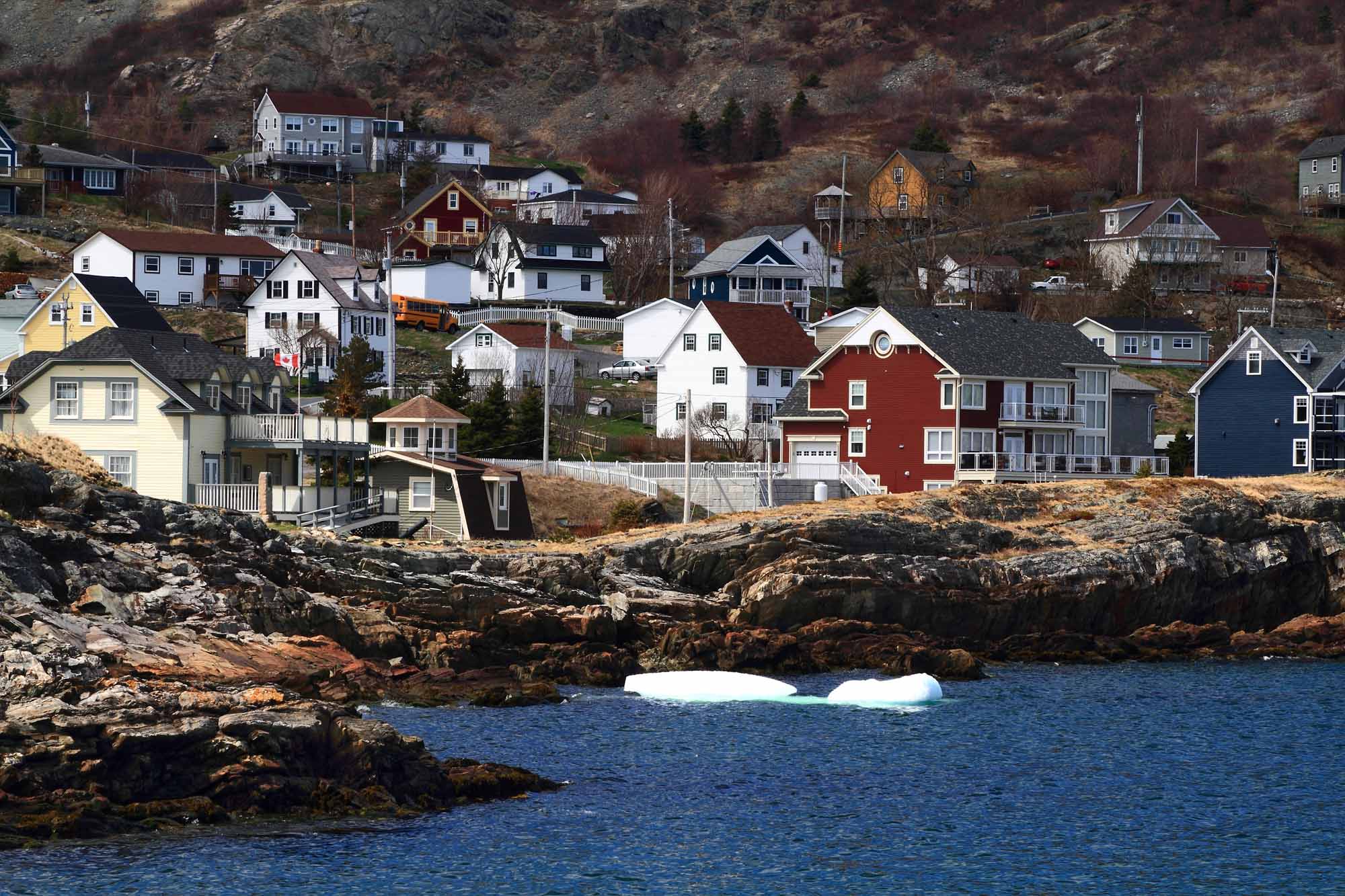
-
Article
Newfoundland and Labrador and Confederation
Attempts to bring Newfoundland into Confederation in the 1860s and 1890s were met with lukewarm interest in the colony. In 1934, Newfoundland was in bankruptcy during the Great Depression. It suspended responsible government and accepted an unelected Commission Government directed by Britain. In a 1948 referendum, Newfoundlanders were given the choice to either continue with the Commission Government, join Canada, or seek a return to responsible government as an independent dominion. The independence option won the first vote. But the Confederation option won a run-off vote with 52.3 percent support. The British and Canadian parliaments approved of the union. Newfoundland became Canada’s 10th province on 31 March 1949. In 2001, the province’s name was officially changed to Newfoundland and Labrador.
"https://d3d0lqu00lnqvz.cloudfront.net/TCEImages/f6d1eaf9-8a3d-4e63-b541-3f932d9b4746.jpg" // resources/views/front/categories/view.blade.php
https://d3d0lqu00lnqvz.cloudfront.net/TCEImages/f6d1eaf9-8a3d-4e63-b541-3f932d9b4746.jpg
-
Editorial
Editorial: How the “Canadianized” Community of Newfoundland Joined Canada
The following article is an editorial written by The Canadian Encyclopedia staff. Editorials are not usually updated. When the Parliament Buildings in Ottawa were repaired after a fire during the First World War, stone plaques were erected over the entrance to the Peace Tower. There were ten of them — nine bearing the coats of arms of the provinces and one left bare, to await the day when Newfoundland joined Canada.
"https://thecanadianencyclopedia.ca/images/tce_placeholder.jpg?v=e9dca980c9bdb3aa11e832e7ea94f5d9" // resources/views/front/categories/view.blade.php
https://thecanadianencyclopedia.ca/images/tce_placeholder.jpg?v=e9dca980c9bdb3aa11e832e7ea94f5d9
-
Article
North-West Territories (1870–1905)
The North-West Territories was the first Canadian territory. It was Established on 15 July 1870. As a territory, the region became part of Canada. But it lacked the population, economic and infrastructure resources to attain provincial status. It thus fell under the jurisdiction of the federal government. It covered a vast area, stretching west from a disputed boundary with Labrador, across the northern portions of present-day Quebec and Ontario, through the Prairies to British Columbia, and north from the 49th parallel to the Arctic Ocean. The territory was subject to numerous boundary changes before 1905. At that time, the provinces of Saskatchewan and Alberta were carved out of the southwest portion of the region. In 1906, the remaining territory was renamed the Northwest Territories.
"https://d3d0lqu00lnqvz.cloudfront.net/media/media/1ca2e02a-e2e8-4709-acee-5581d6051d5c.jpg" // resources/views/front/categories/view.blade.php
https://d3d0lqu00lnqvz.cloudfront.net/media/media/1ca2e02a-e2e8-4709-acee-5581d6051d5c.jpg