
Browse "Geographical Features"
-
Article
French River
The French River, 290 km long (to head of Sturgeon River), rises from Lake Nipissing in northeastern Ontario and flows 110 km west towards Georgian Bay.
"https://thecanadianencyclopedia.ca/images/tce_placeholder.jpg?v=e9dca980c9bdb3aa11e832e7ea94f5d9" // resources/views/front/categories/view.blade.php
https://thecanadianencyclopedia.ca/images/tce_placeholder.jpg?v=e9dca980c9bdb3aa11e832e7ea94f5d9
-
Article
French Shore
The French Shore was an area of coastal Newfoundland where French fishermen enjoyed treaty rights granted by the British from 1713 to 1904.
"https://thecanadianencyclopedia.ca/images/tce_placeholder.jpg?v=e9dca980c9bdb3aa11e832e7ea94f5d9" // resources/views/front/categories/view.blade.php
https://thecanadianencyclopedia.ca/images/tce_placeholder.jpg?v=e9dca980c9bdb3aa11e832e7ea94f5d9
-
Article
Frobisher Bay
Iqaluit is near a traditional South Baffin Inuit fishing camp, where a summer camp was established each year to fish (photo by Barbara Brundege and Eugene Fisher).\r\n Frobisher Bay is a deep indentation in the extreme southeast coastline of BAFFIN ISLAND, over 230 km long and 40 km wide at the mouth, narrowing to 20 km towards its head. The configuration of the bay has a funnelling effect, so that the harbour of the city...
"https://d3d0lqu00lnqvz.cloudfront.net/media/media/66fc9616-fe99-4ef4-a49a-d7528ad2566e.jpg" // resources/views/front/categories/view.blade.php
https://d3d0lqu00lnqvz.cloudfront.net/media/media/66fc9616-fe99-4ef4-a49a-d7528ad2566e.jpg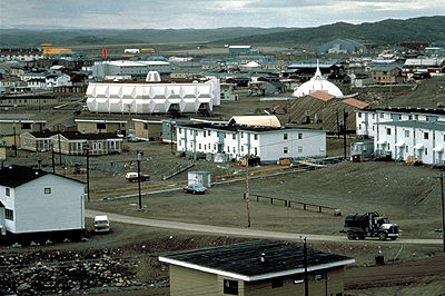
-
Article
Funk Island
Funk Island, 25 ha, is a flat, 15 m high, wedge-shaped granite island 800 m by 400 m lying 60 km off Newfoundland's northeast coast, east of FOGO ISLAND. The origin of the name is unknown, though it may have been inspired by the smell of the guano that covers much of the island.
"https://thecanadianencyclopedia.ca/images/tce_placeholder.jpg?v=e9dca980c9bdb3aa11e832e7ea94f5d9" // resources/views/front/categories/view.blade.php
https://thecanadianencyclopedia.ca/images/tce_placeholder.jpg?v=e9dca980c9bdb3aa11e832e7ea94f5d9
-
Article
Fury and Hecla Strait
Fury and Hecla Strait is located at the northern end of Foxe Basin, connecting the basin with the Gulf of Boothia, and separating Melville Peninsula on the mainland and Baffin Island to the north.
"https://d3d0lqu00lnqvz.cloudfront.net/media/media/4aad02e3-72bd-400c-87ab-d1380ccad4dc.jpg" // resources/views/front/categories/view.blade.php
https://d3d0lqu00lnqvz.cloudfront.net/media/media/4aad02e3-72bd-400c-87ab-d1380ccad4dc.jpg
-
Article
Galiano Island
Galiano Island, 5787 ha, is one of BC's GULF ISLANDS, named for Spanish navy commander Dionisio Alcalá-Galiano, who explored the area in 1792. It has the driest climate of the islands.
"https://thecanadianencyclopedia.ca/images/tce_placeholder.jpg?v=e9dca980c9bdb3aa11e832e7ea94f5d9" // resources/views/front/categories/view.blade.php
https://thecanadianencyclopedia.ca/images/tce_placeholder.jpg?v=e9dca980c9bdb3aa11e832e7ea94f5d9
-
Article
Gander River
Gander River, 175 km long, drainage basin 6,400 km2, is the principal river of northeast Newfoundland, emptying into Gander Bay.
"https://d3d0lqu00lnqvz.cloudfront.net/Gander_River-_Newfoundland-_Canada.jpg" // resources/views/front/categories/view.blade.php
https://d3d0lqu00lnqvz.cloudfront.net/Gander_River-_Newfoundland-_Canada.jpg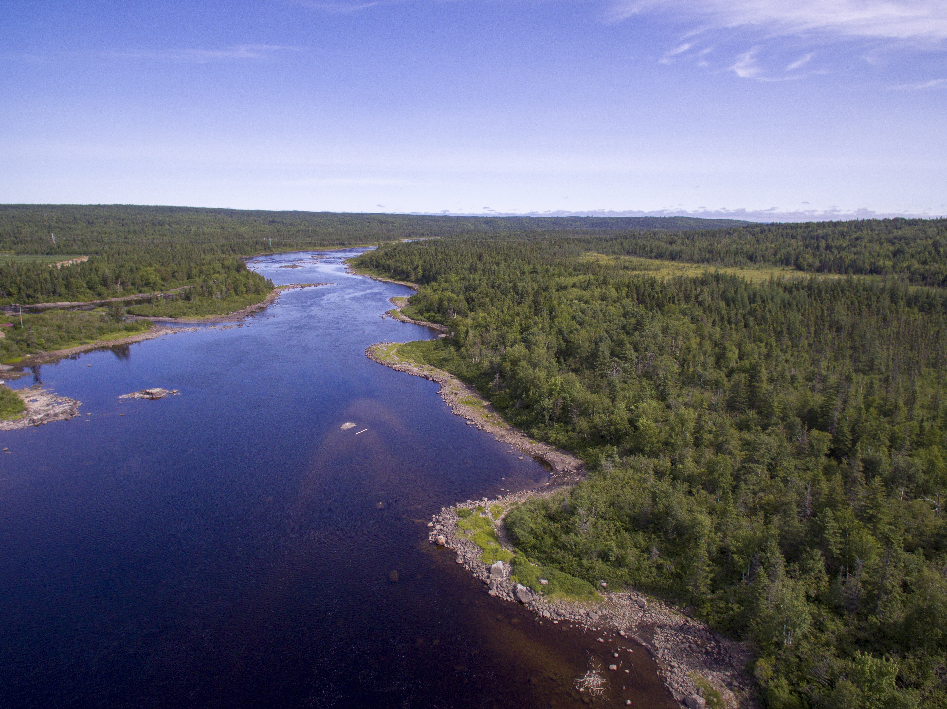
-
Article
Geography
The core of geography deals with the description and analysis of physical and environmental phenomena and their interrelationships, and with the changing patterns of human population and their activities as they affect Earth. As history interprets temporal sequences, so geography interprets spatial sequences and associations.
"https://d3d0lqu00lnqvz.cloudfront.net/hainesjunction/haines-junction-sunrise.jpg" // resources/views/front/categories/view.blade.php
https://d3d0lqu00lnqvz.cloudfront.net/hainesjunction/haines-junction-sunrise.jpg
-
Article
Geological Regions (Plain-Language Summary)
Geology is the study of what the Earth is made of and how it has changed over time. There are six geological regions in Canada. These regions are the Canadian Shield, the Interior Platform, the Appalachian Orogen, the Innuitian Orogen, the Cordillera and Western Canada Sedimentary Basin, and the Eastern Continental Margin. This article is a plain-language summary of the geological regions of Canada. If you are interested in reading about this topic in more depth, please see the full-length entry, Geological Regions.
"https://d3d0lqu00lnqvz.cloudfront.net/media/media/e6e2df67-a33a-46cb-ab6d-dc659323ec1d.jpg" // resources/views/front/categories/view.blade.php
https://d3d0lqu00lnqvz.cloudfront.net/media/media/e6e2df67-a33a-46cb-ab6d-dc659323ec1d.jpg
-
Article
George River
George River, 560 km long, in northern Québec, drains N into the E side of Ungava Bay. Its southern and eastern divides, along with those of tributary rivers Ford and De Pas, extend along much of the Québec-Newfoundland and Labrador border.
"https://thecanadianencyclopedia.ca/images/tce_placeholder.jpg?v=e9dca980c9bdb3aa11e832e7ea94f5d9" // resources/views/front/categories/view.blade.php
https://thecanadianencyclopedia.ca/images/tce_placeholder.jpg?v=e9dca980c9bdb3aa11e832e7ea94f5d9
-
Article
Georges Bank
Georges Bank is a large submarine bank (250 km by 150 km) at the edge of the Atlantic continental shelf between Cape Cod and Nova Scotia. Typical water depths are 50-80 m, but in some areas the water shoals to 10 m and less.
"https://d3d0lqu00lnqvz.cloudfront.net/media/media/1e88d9f5-39be-4e62-9ef7-b8f4444e4965.jpg" // resources/views/front/categories/view.blade.php
https://d3d0lqu00lnqvz.cloudfront.net/media/media/1e88d9f5-39be-4e62-9ef7-b8f4444e4965.jpg
-
Article
Georgian Bay
Georgian Bay is the northeast arm of Lake Huron in southcentral Ontario. It is shielded from the lake by the limestone spine of the Niagara Escarpment, which extends in a great arc northwest up the Bruce Peninsula. The bay is fed from Lake Superior via the North Channel, between Manitoulin Island and the north shore, and independently by the Mississagi, Spanish, French, Magnetawan, Muskoka, Severn and Nottawasaga rivers. The strait between the Bruce Peninsula and Manitoulin Island is called Main Channel (25 km wide).
"https://d3d0lqu00lnqvz.cloudfront.net/georgianbay/Beausoleil-Island-Coast.jpg" // resources/views/front/categories/view.blade.php
https://d3d0lqu00lnqvz.cloudfront.net/georgianbay/Beausoleil-Island-Coast.jpg
-
"https://thecanadianencyclopedia.ca/images/tce_placeholder.jpg?v=e9dca980c9bdb3aa11e832e7ea94f5d9" // resources/views/front/categories/view.blade.php
https://thecanadianencyclopedia.ca/images/tce_placeholder.jpg?v=e9dca980c9bdb3aa11e832e7ea94f5d9
-
Article
Grand Banks
The water over the banks is mainly supplied by the southward-flowing cold LABRADOR CURRENT. This current splits as it approaches the Grand Banks, with one branch moving south along the coast of Newfoundland through Avalon Channel to St Pierre Bank.
"https://thecanadianencyclopedia.ca/images/tce_placeholder.jpg?v=e9dca980c9bdb3aa11e832e7ea94f5d9" // resources/views/front/categories/view.blade.php
https://thecanadianencyclopedia.ca/images/tce_placeholder.jpg?v=e9dca980c9bdb3aa11e832e7ea94f5d9
-
Article
Grand Lake
Grand Lake, 534 km2, elevation 85 m, max length 100 km, up to 300 m deep, largest lake on the Island of Newfoundland, is located on the west side of the Island, 24 km southeast of CORNER BROOK.
"https://thecanadianencyclopedia.ca/images/tce_placeholder.jpg?v=e9dca980c9bdb3aa11e832e7ea94f5d9" // resources/views/front/categories/view.blade.php
https://thecanadianencyclopedia.ca/images/tce_placeholder.jpg?v=e9dca980c9bdb3aa11e832e7ea94f5d9