
Browse "Geographical Features"
-
Article
Cedar Dunes Provincial Park
Tucked into the westernmost corner of Prince Edward Island, Cedar Dunes Provincial Park (established 1962, 37 ha) has been developed around an historic lighthouse. Known as West Point, the site is the result of centuries of accretion of sand from a north to south coastal current.
"https://thecanadianencyclopedia.ca/images/tce_placeholder.jpg?v=e9dca980c9bdb3aa11e832e7ea94f5d9" // resources/views/front/categories/view.blade.php
https://thecanadianencyclopedia.ca/images/tce_placeholder.jpg?v=e9dca980c9bdb3aa11e832e7ea94f5d9
-
Article
Cedar Lake
Cedar Lake, 1353 km2, 62.5 km long, elev 253 m, is located in west-central Manitoba, north of Lake WINNIPEGOSIS. The lake draws most of its waters from the huge SASKATCHEWAN RIVER drainage basin. Construction of an earthfill dam and 25.6 km of dikes in 1961-64 caused lake levels to rise 3.
"https://thecanadianencyclopedia.ca/images/tce_placeholder.jpg?v=e9dca980c9bdb3aa11e832e7ea94f5d9" // resources/views/front/categories/view.blade.php
https://thecanadianencyclopedia.ca/images/tce_placeholder.jpg?v=e9dca980c9bdb3aa11e832e7ea94f5d9
-
Article
Chaleur Bay
Chaleur Bay, which lies between the Gaspé Peninsula, Québec, and northern New Brunswick, is the largest bay in the Gulf of St Lawrence. At its entrance lies Miscou Island.
"https://thecanadianencyclopedia.ca/images/tce_placeholder.jpg?v=e9dca980c9bdb3aa11e832e7ea94f5d9" // resources/views/front/categories/view.blade.php
https://thecanadianencyclopedia.ca/images/tce_placeholder.jpg?v=e9dca980c9bdb3aa11e832e7ea94f5d9
-
Article
Cheltenham Badlands
The Cheltenham Badlands are a rock formation in Southern Ontario made of red-coloured ridges and gullies. They are located in the Town of Caledon within the Regional Municipality of Peel, Ontario, within a 36.6-hectare property of the same name owned by the Ontario Heritage Trust. The badlands are an exposed section of the Queenston Shale, a vast swath of shale rock that crosses Southern Ontario. Exposed through erosion caused by early farming practices, the badlands are a curious case of a natural wonder created through human activity.
"https://d3d0lqu00lnqvz.cloudfront.net/Caledon/CaledonBadlands.jpg" // resources/views/front/categories/view.blade.php
https://d3d0lqu00lnqvz.cloudfront.net/Caledon/CaledonBadlands.jpg
-
Article
Chesterfield Inlet
Chesterfield Inlet is a narrow, fiordlike arm of the northwest coast of Hudson Bay that stretches 160 km inland to the Thelon River.
"https://thecanadianencyclopedia.ca/images/tce_placeholder.jpg?v=e9dca980c9bdb3aa11e832e7ea94f5d9" // resources/views/front/categories/view.blade.php
https://thecanadianencyclopedia.ca/images/tce_placeholder.jpg?v=e9dca980c9bdb3aa11e832e7ea94f5d9
-
Article
Chignecto Bay
Chignecto Bay, northeastern arm of the Bay of Fundy. The name comes from the Indigenous word sigunikt, usually said to mean "foot cloth," perhaps from a Mi'kmaq legend. The area around present-day Sackville, NB, was first settled by Acadians in 1671 and by Yorkshire Methodists about 100 years later.
"https://thecanadianencyclopedia.ca/images/tce_placeholder.jpg?v=e9dca980c9bdb3aa11e832e7ea94f5d9" // resources/views/front/categories/view.blade.php
https://thecanadianencyclopedia.ca/images/tce_placeholder.jpg?v=e9dca980c9bdb3aa11e832e7ea94f5d9
-
Article
Chilkoot Pass
Chilkoot Pass, elevation 1,067 m, is situated on the British Columbia-Alaska border.
"https://d3d0lqu00lnqvz.cloudfront.net/media/media/f8badbbb-95b8-44cf-a053-5589845ee1ef.jpg" // resources/views/front/categories/view.blade.php
https://d3d0lqu00lnqvz.cloudfront.net/media/media/f8badbbb-95b8-44cf-a053-5589845ee1ef.jpg
-
Article
Chilkoot Trail
Today the trail has been somewhat improved and restored by US and Canadian park officials and offers designated campsites and other amenities. However, for the some 2000 people yearly who seek its adventure, it still represents a challenging 4-5 day hike.
"https://d3d0lqu00lnqvz.cloudfront.net/media/media/f8badbbb-95b8-44cf-a053-5589845ee1ef.jpg" // resources/views/front/categories/view.blade.php
https://d3d0lqu00lnqvz.cloudfront.net/media/media/f8badbbb-95b8-44cf-a053-5589845ee1ef.jpg
-
Article
Chute Montmorency
Chute Montmorency, located 13 km east of Québec City at the mouth of Rivière Montmorency where it empties into the St Lawrence River, is the highest waterfall in the province of Québec and the eighth-highest in Canada.
"https://d3d0lqu00lnqvz.cloudfront.net/media/media/03429e37-1294-429a-8066-983ea6195911.jpg" // resources/views/front/categories/view.blade.php
https://d3d0lqu00lnqvz.cloudfront.net/media/media/03429e37-1294-429a-8066-983ea6195911.jpg
-
Article
Clayoquot Sound
Clayoquot Sound is a dramatically varied inlet of the Pacific Ocean nearly 100 km wide on the west coast of Vancouver Island (estimated area, water 784.25 km2; land including freshwater 2715.75 km2 ). Clayoquot ("clah quat") Sound takes in the highly scenic islands and mainland drainages from Quisitis Point northwest to Escalante Point. Population is concentrated at Tofino, a fishing, tourism and wilderness recreation centre at the terminus of Highway 4. Most Indigenous communities are accessible only by air or water.
"https://d3d0lqu00lnqvz.cloudfront.net/media/media/90cececc-c640-4ea8-bfdc-87f67c45f230.jpg" // resources/views/front/categories/view.blade.php
https://d3d0lqu00lnqvz.cloudfront.net/media/media/90cececc-c640-4ea8-bfdc-87f67c45f230.jpg
-
Article
Clearwater River
Clearwater River, 280 km long, rises in Patterson, Forest and Lloyd lakes in northwest Saskatchewan, flows southeast to Careen Lake and abruptly turns west to join the ATHABASCA RIVER at Fort McMurray, Alberta.
"https://thecanadianencyclopedia.ca/images/tce_placeholder.jpg?v=e9dca980c9bdb3aa11e832e7ea94f5d9" // resources/views/front/categories/view.blade.php
https://thecanadianencyclopedia.ca/images/tce_placeholder.jpg?v=e9dca980c9bdb3aa11e832e7ea94f5d9
-
Article
Coast Mountains
The Coast Mountains are a continuous mountain chain extending from the Fraser Lowlands near Vancouver, 1,600 km north into the Yukon.
"https://thecanadianencyclopedia.ca/images/tce_placeholder.jpg?v=e9dca980c9bdb3aa11e832e7ea94f5d9" // resources/views/front/categories/view.blade.php
https://thecanadianencyclopedia.ca/images/tce_placeholder.jpg?v=e9dca980c9bdb3aa11e832e7ea94f5d9
-
Article
Coastal Waters
Canada has the longest coastlines of any country in the world (60,180 km excluding islands, 202,080 including all measurable islands). Canadian coastal waters support valuable biological resources (e.g., fish, crustaceans, molluscs, marine mammals and seaweeds) and are important for transportation, recreation and the mineral and hydrocarbon resources in the seafloor beneath them.
"https://d3d0lqu00lnqvz.cloudfront.net/scenicplaces/Keji-seaside-lia.jpg" // resources/views/front/categories/view.blade.php
https://d3d0lqu00lnqvz.cloudfront.net/scenicplaces/Keji-seaside-lia.jpg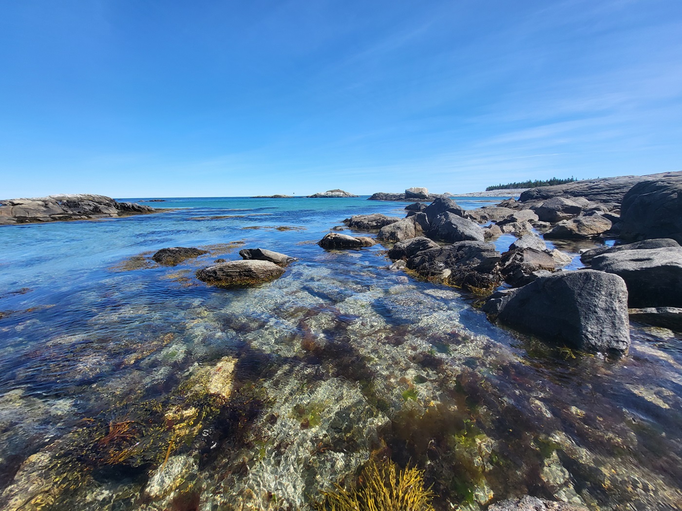
-
Article
Coats Island
Coats Island, Nunavut, 5,498 km2, is one of several islands that guard the northern entrance to Hudson Bay. Known originally as Cary Swan Nest, a name still applied to its southeast point, it received its modern name from William Coats, a sea captain who made many voyages into the bay for the Hudson's Bay Company between 1727 and 1751.
"https://d3d0lqu00lnqvz.cloudfront.net/media/media/853eb7cd-5eb0-46fe-b229-8f9b8b0136b4.jpg" // resources/views/front/categories/view.blade.php
https://d3d0lqu00lnqvz.cloudfront.net/media/media/853eb7cd-5eb0-46fe-b229-8f9b8b0136b4.jpg
-
Article
Columbia Icefield
The Columbia Icefield is a mass of ice covering a high plateau between Mount Columbia (3747 m), the highest point in Alberta, and Mount Athabasca (3491 m), located between Banff and Jasper national parks, along the BC-Alberta border.
"https://d3d0lqu00lnqvz.cloudfront.net/media/media/4f68d2f4-7717-496d-a427-bbafb71196fd.jpg" // resources/views/front/categories/view.blade.php
https://d3d0lqu00lnqvz.cloudfront.net/media/media/4f68d2f4-7717-496d-a427-bbafb71196fd.jpg