
Browse "Geographical Features"
-
Article
Rideau Lakes
Rideau Lakes, 65 km2, elev 123 m, mean depth 12.3 m, is a commonly used collective name for 3 lakes: Big Rideau, Upper Rideau and Lower Rideau.
"https://d3d0lqu00lnqvz.cloudfront.net/media/media/3f6f49a4-9e6a-4764-8ac0-b535a8fed146.jpg" // resources/views/front/categories/view.blade.php
https://d3d0lqu00lnqvz.cloudfront.net/media/media/3f6f49a4-9e6a-4764-8ac0-b535a8fed146.jpg
-
Article
Rivière Chaudière
Rivière Chaudière, 193 km long and with a basin 6690 km2, is located in southern Québec. It is named after the waters that "boil" from its falls or after the numerous glacial erosion kettles (chaudière is French for boiler and also for bucket).
"https://thecanadianencyclopedia.ca/images/tce_placeholder.jpg?v=e9dca980c9bdb3aa11e832e7ea94f5d9" // resources/views/front/categories/view.blade.php
https://thecanadianencyclopedia.ca/images/tce_placeholder.jpg?v=e9dca980c9bdb3aa11e832e7ea94f5d9
-
Article
Rivière de Rupert
Rivière de Rupert is 763 km long to the head of Lac Témiscamie. It drains Lac Mistassini and then follows a twisted course through a series of lakes and across a flat coastal plain to discharge into southeastern James Bay.
"https://thecanadianencyclopedia.ca/images/tce_placeholder.jpg?v=e9dca980c9bdb3aa11e832e7ea94f5d9" // resources/views/front/categories/view.blade.php
https://thecanadianencyclopedia.ca/images/tce_placeholder.jpg?v=e9dca980c9bdb3aa11e832e7ea94f5d9
-
Article
Rivière Dumoine
The Dumoine, 129 km long, rises in Lac Dumoine in southwest Québec and flows off the south edge of the Laurentian Highlands through a series of waterfalls, wild rapids and long chutes into the Ottawa River.
"https://thecanadianencyclopedia.ca/images/tce_placeholder.jpg?v=e9dca980c9bdb3aa11e832e7ea94f5d9" // resources/views/front/categories/view.blade.php
https://thecanadianencyclopedia.ca/images/tce_placeholder.jpg?v=e9dca980c9bdb3aa11e832e7ea94f5d9
-
Article
Rivière Eastmain
The Rivière Eastmain, 756 km long, rises in the central part of Québec on the side of a low drainage divide from which streams flow west to James Bay.
"https://thecanadianencyclopedia.ca/images/tce_placeholder.jpg?v=e9dca980c9bdb3aa11e832e7ea94f5d9" // resources/views/front/categories/view.blade.php
https://thecanadianencyclopedia.ca/images/tce_placeholder.jpg?v=e9dca980c9bdb3aa11e832e7ea94f5d9
-
Article
Rivière Koksoak
Koksoak, Rivière, 874 km long (to head of Caniapiscau River), final leg of a river system that drains a vast area (133 000 km2) of northern Québec.
"https://thecanadianencyclopedia.ca/images/tce_placeholder.jpg?v=e9dca980c9bdb3aa11e832e7ea94f5d9" // resources/views/front/categories/view.blade.php
https://thecanadianencyclopedia.ca/images/tce_placeholder.jpg?v=e9dca980c9bdb3aa11e832e7ea94f5d9
-
Article
Rivière Manicouagan
The Rivière Manicouagan, 560 km long, rises in east-central Québec near the Labrador border and flows south through the Réservoir Manicouagan to the St Lawrence River near Baie-Comeau.
"https://d3d0lqu00lnqvz.cloudfront.net/media/media/6be9c93a-1849-439f-b16a-f87c91691760.jpg" // resources/views/front/categories/view.blade.php
https://d3d0lqu00lnqvz.cloudfront.net/media/media/6be9c93a-1849-439f-b16a-f87c91691760.jpg
-
Article
Rivière Moisie
Rivière Moisie, 410 km long, rises in eastern Québec from Lac Opocopa and flows south to the St. Lawrence River. With a drainage basin of 19,200 km2 and a mean discharge of 490 m3/s, it is the river of greatest volume along the middle north Shore of the St. Lawrence.
"https://thecanadianencyclopedia.ca/images/tce_placeholder.jpg?v=e9dca980c9bdb3aa11e832e7ea94f5d9" // resources/views/front/categories/view.blade.php
https://thecanadianencyclopedia.ca/images/tce_placeholder.jpg?v=e9dca980c9bdb3aa11e832e7ea94f5d9
-
Article
Rivière Nottaway
Rivière Nottaway, 776 km (via Rivière Bell to head of Rivière Mégiscane), rises in west-central Québec and flows north via Lacs Parent and Quévillon into Lac Matagami. Here it is joined by its chief headstream, Rivière Waswanipi, and then drains northwest through Lac Soscumica.
"https://thecanadianencyclopedia.ca/images/tce_placeholder.jpg?v=e9dca980c9bdb3aa11e832e7ea94f5d9" // resources/views/front/categories/view.blade.php
https://thecanadianencyclopedia.ca/images/tce_placeholder.jpg?v=e9dca980c9bdb3aa11e832e7ea94f5d9
-
Article
Rivière Romaine
Rivière Romaine, 496 km long with a 14 350 km2 basin, rises (elev 760 m) in the Québec-Labrador lacustrine plateau, 45 km southwest of the CHURCHILL RIVER, and forms part of the Québec-Labrador boundary north of the 52nd parallel.
"https://thecanadianencyclopedia.ca/images/tce_placeholder.jpg?v=e9dca980c9bdb3aa11e832e7ea94f5d9" // resources/views/front/categories/view.blade.php
https://thecanadianencyclopedia.ca/images/tce_placeholder.jpg?v=e9dca980c9bdb3aa11e832e7ea94f5d9
-
Article
Rouge River (Québec)
The Rouge River is a tributary of the Ottawa River. Its source is Lac de la Fougère, in the northeast part of Rouge-Matawin Wildlife Reserve in Québec.
"https://d3d0lqu00lnqvz.cloudfront.net/media/media/6953ea93-69d2-40dd-a80d-f44f0be8c655.JPG" // resources/views/front/categories/view.blade.php
https://d3d0lqu00lnqvz.cloudfront.net/media/media/6953ea93-69d2-40dd-a80d-f44f0be8c655.JPG
-
Article
Rivière Saint-François
Located in southern Quebec, Rivière Saint-François is 280 km long, with a drainage basin of 10,230 km2.
"https://d3d0lqu00lnqvz.cloudfront.net/Riviere_Saint-Francois-du-Lac_02.jpg" // resources/views/front/categories/view.blade.php
https://d3d0lqu00lnqvz.cloudfront.net/Riviere_Saint-Francois-du-Lac_02.jpg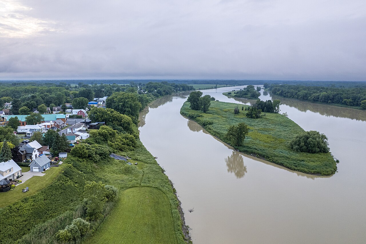
-
Article
Rivière Saint-Maurice
Rivière Saint-Maurice, 563 km long, rises upstream from Réservoir Gouin, 200 km west of Lac Saint-Jean, Québec. It drains a basin of 43 300 km2. After its confluence with Rivière Manouane, it feeds Réservoir Blanc and then takes in the Vermillon, Trenche, Croche, Mattawin and Mékinac rivers.
"https://d3d0lqu00lnqvz.cloudfront.net/media/media/26ddf9e4-78b9-4850-b1ab-94971048ce2e.jpg" // resources/views/front/categories/view.blade.php
https://d3d0lqu00lnqvz.cloudfront.net/media/media/26ddf9e4-78b9-4850-b1ab-94971048ce2e.jpg
-
Article
Rocky Mountain Trench
The Rocky Mountain Trench is a long and deep valley extending approximately 1,500 km from the Bitterroot Valley in northwest Montana through British Columbia to the Liard Plain just south of the Yukon Territory. Its predominantly flat floor is 3–20 km wide and ranges in elevation between 600 m and 1,000 m above sea level. With walls made of sedimentary, volcanic and igneous rock, the Trench is sometimes referred to as the “Valley of a Thousand Peaks” because of the towering mountain ranges on either side: the Rocky Mountains to the east and the Columbia, Omineca and Cassiar mountains to the west. Humans have relied on the rich resources provided by this distinctive landscape from pre-colonial times to the present.
"https://d3d0lqu00lnqvz.cloudfront.net/media/media/061fe992-a3bf-45bc-906d-216d1bef45c7.jpg" // resources/views/front/categories/view.blade.php
https://d3d0lqu00lnqvz.cloudfront.net/media/media/061fe992-a3bf-45bc-906d-216d1bef45c7.jpg
-
Article
Saanich Peninsula
Saanich Peninsula, BC, forms part of the Nanaimo Lowlands, along Vancouver Island's east coast. It extends from Sidney in the north to Victoria in the south, and is 33 km long and averages 4 km in width; 90 per cent of its perimeter is fronted by sea. The dominant geographical features are Mount Newton and Saanich Inlet.
"https://thecanadianencyclopedia.ca/images/tce_placeholder.jpg?v=e9dca980c9bdb3aa11e832e7ea94f5d9" // resources/views/front/categories/view.blade.php
https://thecanadianencyclopedia.ca/images/tce_placeholder.jpg?v=e9dca980c9bdb3aa11e832e7ea94f5d9