
Browse "Geographical Features"
-
Article
Axel Heiberg Island
Axel Heiberg Island, Nunavut, is Canada’s second northernmost island, located in the High Arctic approximately 1,200 km from the North Pole.
"https://d3d0lqu00lnqvz.cloudfront.net/media/media/0dc72b02-1baf-4d5c-b7f6-1e64d9a7440c.JPG" // resources/views/front/categories/view.blade.php
https://d3d0lqu00lnqvz.cloudfront.net/media/media/0dc72b02-1baf-4d5c-b7f6-1e64d9a7440c.JPG
-
Article
Badlands
Badlands are dramatic landforms characterized by a network of deep, narrow and winding gullies, along with occasional hoodoo rocks. Their steep, barren slopes provide striking evidence of the force of erosion by wind and water — a source of continual change in their terrain. Badlands are found in several places in Canada, most notably in southern Alberta. While the badlands of the Áísínai’pi (Writing-on-Stone) archeological site hold great cultural significance to the Siksika (Blackfoot) people, European explorers found the badlands unfamiliar and difficult to navigate, which is the source of their current name.
"https://d3d0lqu00lnqvz.cloudfront.net/media/media/251b5d36-82cc-4ec1-80e8-471cfd59098a.jpg" // resources/views/front/categories/view.blade.php
https://d3d0lqu00lnqvz.cloudfront.net/media/media/251b5d36-82cc-4ec1-80e8-471cfd59098a.jpg
-
Article
Baffin Bay
Circulation is generally anticlockwise; off Greenland, relatively warm, salty water moves north, while along Baffin Island, cold, fresher water originating from the Arctic Ocean flows south. Icebergs, formed by calving off the Greenland glaciers, appear year-round, but are most numerous in August.
"https://d3d0lqu00lnqvz.cloudfront.net/media/media/9dc94550-4e3e-4264-9c68-78b71ac3e6e1.jpg" // resources/views/front/categories/view.blade.php
https://d3d0lqu00lnqvz.cloudfront.net/media/media/9dc94550-4e3e-4264-9c68-78b71ac3e6e1.jpg
-
Article
Balaklava Island
Balaklava Island, 8 km2, situated off the N coast of Vancouver Island, is located between Nigel and Hurst islands, and is flanked by Queen Charlotte Str in the N and Goletas Channel in the S. It is 15 km NW of Port Hardy, BC. This tiny island has a lighthouse at Scarlett Pt (1905) to aid shipping.
"https://thecanadianencyclopedia.ca/images/tce_placeholder.jpg?v=e9dca980c9bdb3aa11e832e7ea94f5d9" // resources/views/front/categories/view.blade.php
https://thecanadianencyclopedia.ca/images/tce_placeholder.jpg?v=e9dca980c9bdb3aa11e832e7ea94f5d9
-
Article
Banks Island
Banks Island, 70 028 km2, fifth-largest island in Canada, is the westernmost island of the Arctic Archipelago.
"https://d3d0lqu00lnqvz.cloudfront.net/media/media/79d1e122-c898-4f67-8500-8c2d799e7700.jpg" // resources/views/front/categories/view.blade.php
https://d3d0lqu00lnqvz.cloudfront.net/media/media/79d1e122-c898-4f67-8500-8c2d799e7700.jpg
-
Article
Bathurst Inlet
Bathurst Inlet, a southeastern extension of Coronation Gulf, penetrating the arctic shore for some 200 km. The hamlet of Bathurst Inlet is located at the mouth of the Burnside River, which drains Contwoyto Lake to the southwest.
"https://d3d0lqu00lnqvz.cloudfront.net/media/media/b504d03a-1419-4bf4-ab27-00b5e8cc89a0.jpg" // resources/views/front/categories/view.blade.php
https://d3d0lqu00lnqvz.cloudfront.net/media/media/b504d03a-1419-4bf4-ab27-00b5e8cc89a0.jpg
-
Article
Bathurst Island
Bathurst Island, 16 042 km2 and over 18 000 km2 including its offshore islands, is located in the Arctic Archipelago. The present position of the North magnetic pole is near its northern end.
"https://thecanadianencyclopedia.ca/images/tce_placeholder.jpg?v=e9dca980c9bdb3aa11e832e7ea94f5d9" // resources/views/front/categories/view.blade.php
https://thecanadianencyclopedia.ca/images/tce_placeholder.jpg?v=e9dca980c9bdb3aa11e832e7ea94f5d9
-
Article
Bay d'Espoir
Bay d'Espoir is a fjord-like arm of Hermitage Bay on Newfoundland’s south coast. More than 50 km from mouth to head, Bay d'Espoir — French for “hope” — is ice-free, with sheer cliffs and steep-sided hills rising 180 to 300 m. The bay divides into two principal arms to the north and northeast of Bois Island. Because of the tremendous watershed from a surrounding glacial plateau, the area is the site of a hydroelectric generating plant. Opened in 1967, today the plant has a generating capacity of more than 600 MW.
"https://d3d0lqu00lnqvz.cloudfront.net/media/media/c5f9ff74-e069-4e91-a4d9-baed4c78f3ba.jpg" // resources/views/front/categories/view.blade.php
https://d3d0lqu00lnqvz.cloudfront.net/media/media/c5f9ff74-e069-4e91-a4d9-baed4c78f3ba.jpg
-
Article
Bay of Fundy and Gulf of Maine
Between about 15 000 and 10 000 years ago, as the glaciers retreated from the last ice age, parts of Georges Bank and other shallow areas were dry land; fragments of trees and mammoth teeth from this era are still found occasionally in fishing trawls.
"https://d3d0lqu00lnqvz.cloudfront.net/media/media/4bc5b21a-e673-4f22-9e76-db46b45d42b6.jpg" // resources/views/front/categories/view.blade.php
https://d3d0lqu00lnqvz.cloudfront.net/media/media/4bc5b21a-e673-4f22-9e76-db46b45d42b6.jpg
-
Article
Beaufort Sea
The Beaufort Sea can be taken to include the whole of the clockwise gyre of the Canada Basin of the Arctic Ocean north of Alaska, Yukon and the Mackenzie Delta coast, bounded on the east by Banks Island and Prince Patrick Island. Alternatively, it has been defined as that part of the Arctic Ocean lying south and east of a line connecting Point Barrow, Alaska, and Lands End, Prince Patrick Island.
"https://d3d0lqu00lnqvz.cloudfront.net/beaufortsea/beaufort-sea-icebreaker.jpg" // resources/views/front/categories/view.blade.php
https://d3d0lqu00lnqvz.cloudfront.net/beaufortsea/beaufort-sea-icebreaker.jpg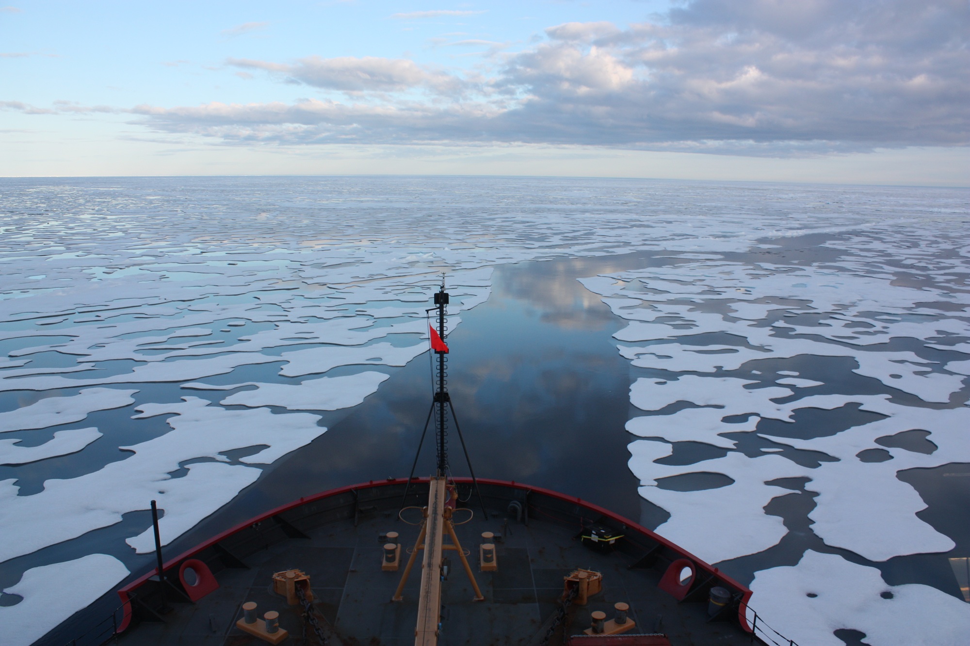
-
Article
Beechey Island
Beechey Island is on the north side of Lancaster Sound off the southwest corner of Devon Island at the entrance to Wellington Channel in the Arctic Archipelago.
"https://d3d0lqu00lnqvz.cloudfront.net/media/media/b504d03a-1419-4bf4-ab27-00b5e8cc89a0.jpg" // resources/views/front/categories/view.blade.php
https://d3d0lqu00lnqvz.cloudfront.net/media/media/b504d03a-1419-4bf4-ab27-00b5e8cc89a0.jpg
-
Article
Belcher Islands
Belcher Islands are located in southeastern Hudson Bay, 100 km west of Grande Rivière de la Baleine, Québec. The total land mass of about 13 000 km2 is composed of a group of long, narrow islands, lying northeast/southwest along a very extensive coastline.
"https://thecanadianencyclopedia.ca/images/tce_placeholder.jpg?v=e9dca980c9bdb3aa11e832e7ea94f5d9" // resources/views/front/categories/view.blade.php
https://thecanadianencyclopedia.ca/images/tce_placeholder.jpg?v=e9dca980c9bdb3aa11e832e7ea94f5d9
-
Article
Bell Island
Bell Island, 34 km2, the largest island in Conception Bay, off Newfoundland's Avalon Peninsula, is a flat outcropping of Ordovician sandstone and shale interbedded with red hematite, an iron ore.
"https://d3d0lqu00lnqvz.cloudfront.net/media/media/c7ca9119-de49-4838-87c5-680c9e09a389.jpg" // resources/views/front/categories/view.blade.php
https://d3d0lqu00lnqvz.cloudfront.net/media/media/c7ca9119-de49-4838-87c5-680c9e09a389.jpg
-
Article
Bellot Strait
Bellot Strait, at 71° 58´ N, separates Somerset Island from the Boothia Peninsula, marking the northernmost point on the mainland of North America.
"https://thecanadianencyclopedia.ca/images/tce_placeholder.jpg?v=e9dca980c9bdb3aa11e832e7ea94f5d9" // resources/views/front/categories/view.blade.php
https://thecanadianencyclopedia.ca/images/tce_placeholder.jpg?v=e9dca980c9bdb3aa11e832e7ea94f5d9
-
Article
Beringia
The importance of Beringia is twofold: it provided a pathway for intercontinental exchanges of plants and animals during glacial periods and for interoceanic exchanges during interglacials; it has been a centre of evolution and has supported apparently unique plant and animal communities.
"https://d3d0lqu00lnqvz.cloudfront.net/media/media/b91c5592-6724-4e23-8a45-aa3a4ce223f0.jpg" // resources/views/front/categories/view.blade.php
https://d3d0lqu00lnqvz.cloudfront.net/media/media/b91c5592-6724-4e23-8a45-aa3a4ce223f0.jpg