
Browse "Geographical Features"
-
Article
Pacific Rim
The term Pacific Rim has been used to refer to all those countries with coastlines bordering the Pacific Ocean. However, in recent years the term has become synonymous with the Asia Pacific region which encompasses East and Southeast Asia, South Asia, Australia, New Zealand and North America.
"https://thecanadianencyclopedia.ca/images/tce_placeholder.jpg?v=e9dca980c9bdb3aa11e832e7ea94f5d9" // resources/views/front/categories/view.blade.php
https://thecanadianencyclopedia.ca/images/tce_placeholder.jpg?v=e9dca980c9bdb3aa11e832e7ea94f5d9
-
Article
Parry Channel
Parry Channel is a sea passage running east to west through the arctic islands.
"https://thecanadianencyclopedia.ca/images/tce_placeholder.jpg?v=e9dca980c9bdb3aa11e832e7ea94f5d9" // resources/views/front/categories/view.blade.php
https://thecanadianencyclopedia.ca/images/tce_placeholder.jpg?v=e9dca980c9bdb3aa11e832e7ea94f5d9
-
Article
Parry Islands
The Parry Islands are a group of high arctic islands comprising Melville, Bathurst and Cornwallis islands, as well as a number of smaller ones. Melville is the largest of the 3 main islands and is also the highest, exceeding 1000 m in places.
"https://thecanadianencyclopedia.ca/images/tce_placeholder.jpg?v=e9dca980c9bdb3aa11e832e7ea94f5d9" // resources/views/front/categories/view.blade.php
https://thecanadianencyclopedia.ca/images/tce_placeholder.jpg?v=e9dca980c9bdb3aa11e832e7ea94f5d9
-
Article
Partridge Island
Partridge Island is located in the Bay of Fundy, about 1 km from the shoreline and the city of Saint John, New Brunswick. The island was set aside as a quarantine station in 1785 and operated as such between 1830 and 1941. Many immigrants arriving to Canada by ship, including thousands of Irish in 1847, were isolated on the island before being allowed to enter the country. This was done in an effort to prevent the spread of infectious diseases common on overcrowded vessels. In 1974, the Partridge Island quarantine station was designated a national historic site. Other important events are associated with the island, including the installation of the world’s first steam-operated fog alarm in 1859 (see also Robert Foulis).
"https://d3d0lqu00lnqvz.cloudfront.net/media/media/0332fe7a-6266-457b-b839-06a558ff5047.jpg" // resources/views/front/categories/view.blade.php
https://d3d0lqu00lnqvz.cloudfront.net/media/media/0332fe7a-6266-457b-b839-06a558ff5047.jpg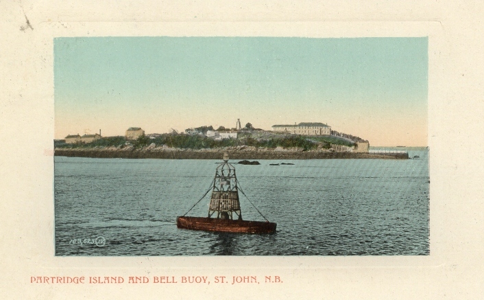
-
Article
Passamaquoddy Bay
Passamaquoddy Bay is a small inlet near the mouth of the Bay of Fundy. Its mouth is restricted by a chain of islands, including Deer and Campobello, and strong tides (range 8.3 m) prevail in the region.
"https://thecanadianencyclopedia.ca/images/tce_placeholder.jpg?v=e9dca980c9bdb3aa11e832e7ea94f5d9" // resources/views/front/categories/view.blade.php
https://thecanadianencyclopedia.ca/images/tce_placeholder.jpg?v=e9dca980c9bdb3aa11e832e7ea94f5d9
-
Article
Peace River Lowland
The Peace River Lowland is a gently rolling lowland without clearly defined outer boundaries, extending east of the Rocky Mountains on both sides of the Peace River, sloping downward to the north and east.
"https://d3d0lqu00lnqvz.cloudfront.net/media/media/13c13382-db21-45b1-a110-45d06d282f6e.jpg" // resources/views/front/categories/view.blade.php
https://d3d0lqu00lnqvz.cloudfront.net/media/media/13c13382-db21-45b1-a110-45d06d282f6e.jpg
-
Article
Percé Rock
Percé Rock (or Rocher Percé) is a monolith off the Gaspé Peninsula, 750 km east of Québec City, near its namesake, the town of Percé.
"https://d3d0lqu00lnqvz.cloudfront.net/media/media/ad3866be-b4ea-484b-a7c6-4e112b36cf85.jpg" // resources/views/front/categories/view.blade.php
https://d3d0lqu00lnqvz.cloudfront.net/media/media/ad3866be-b4ea-484b-a7c6-4e112b36cf85.jpg
-
Article
Physical Geography
Physical geography is that branch of geography concerned with describing and analysing the distribution of physical and biochemical elements of the environment; interpreting environmental systems located at or near a boundary between atmosphere, lithosphere (the rigid part of Earth's crust), biosphere or hydrosphere (Earth's water); and determining the resilience of such systems to human activities at or near Earth's surface. In Europe, geomorphology is a subfield of physical geography. In North America, it is frequently a branch of geology. Both traditions are found in Canadian universities.
"https://d3d0lqu00lnqvz.cloudfront.net/lakesincanada/Oxbow-Lakes.jpg" // resources/views/front/categories/view.blade.php
https://d3d0lqu00lnqvz.cloudfront.net/lakesincanada/Oxbow-Lakes.jpg
-
Article
Pine Pass
Pine Pass, at an elevation of 874 m, crosses the continental divide northwest-southeast in northeastern British Columbia. The Pine River rises southwest of the pass, then flows northwest to meet the Peace River, near Fort St John.
"https://d3d0lqu00lnqvz.cloudfront.net/pinepass/pine-pass-bc-rockies.jpg" // resources/views/front/categories/view.blade.php
https://d3d0lqu00lnqvz.cloudfront.net/pinepass/pine-pass-bc-rockies.jpg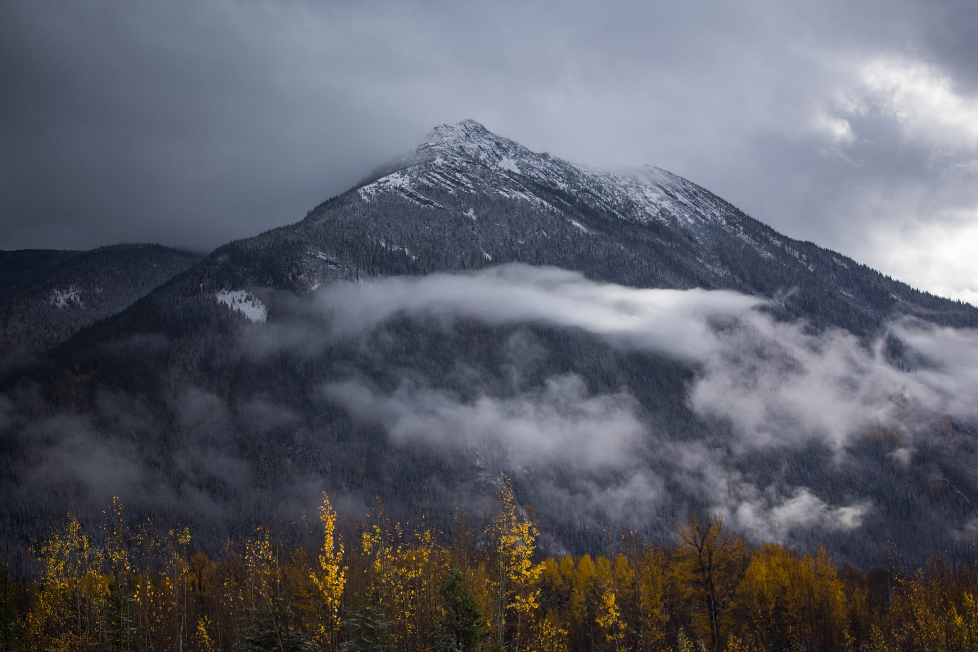
-
Article
Placentia Bay
Placentia Bay, from the French plaisance (meaning a "pleasant place"), is a large, deep bay formed by Newfoundland's Burin Peninsula to the west, and the southwestern Avalon Peninsula to the east.
"https://d3d0lqu00lnqvz.cloudfront.net/media/media/1156688e-36f0-43f0-b71a-c95ed49e88d0.jpg" // resources/views/front/categories/view.blade.php
https://d3d0lqu00lnqvz.cloudfront.net/media/media/1156688e-36f0-43f0-b71a-c95ed49e88d0.jpg
-
Article
Port-au-Port Peninsula
Port-au-Port peninsula is a roughly triangular peninsula with 130 km of rocky coastline but no harbours. The peninsula is joined to southwestern Newfoundland via a strip of land west of Stephenville. Port-au-Port is home to Newfoundland’s oldest francophone communities (see Francophones of Newfoundland and Labrador).
"https://thecanadianencyclopedia.ca/images/tce_placeholder.jpg?v=e9dca980c9bdb3aa11e832e7ea94f5d9" // resources/views/front/categories/view.blade.php
https://thecanadianencyclopedia.ca/images/tce_placeholder.jpg?v=e9dca980c9bdb3aa11e832e7ea94f5d9
-
Article
Port Refuge
Port Refuge is a small bay on the south coast of Grinnell Peninsula, Devon I, in the high Arctic.
"https://thecanadianencyclopedia.ca/images/tce_placeholder.jpg?v=e9dca980c9bdb3aa11e832e7ea94f5d9" // resources/views/front/categories/view.blade.php
https://thecanadianencyclopedia.ca/images/tce_placeholder.jpg?v=e9dca980c9bdb3aa11e832e7ea94f5d9
-
Article
Portage
Portage is a way by land around an interruption in a water route. Until the early 19th century most inhabitants of what is now Canada travelled mainly by water. Alexander Mackenzie and Simon Fraser demonstrated that it is possible, by portaging 100 times, to canoe from the St Lawrence to the Arctic or Pacific oceans.
"https://d3d0lqu00lnqvz.cloudfront.net/media/media/6a52818a-3f78-427a-a201-5e6bc9c5d874.jpg" // resources/views/front/categories/view.blade.php
https://d3d0lqu00lnqvz.cloudfront.net/media/media/6a52818a-3f78-427a-a201-5e6bc9c5d874.jpg
-
Article
Portage La Loche (Methye Portage)
Portage La Loche (Methye Portage), in present-day northern Saskatchewan, was the longest portage (20 km) in the regular fur trade, traversing the height of land between the Hudson Bay watershed and the Arctic watershed.
"https://thecanadianencyclopedia.ca/images/tce_placeholder.jpg?v=e9dca980c9bdb3aa11e832e7ea94f5d9" // resources/views/front/categories/view.blade.php
https://thecanadianencyclopedia.ca/images/tce_placeholder.jpg?v=e9dca980c9bdb3aa11e832e7ea94f5d9
-
Article
Prairie
Prairies are a form of grassland reflecting the depositional features of the Wisconsinan glaciation. While often considered featureless flatlands, they actually contain great diversity. Topography ranges from broad undulating plains to rolling hills and plateaus, often dissected by beautiful valleys and escarpments.
"https://d3d0lqu00lnqvz.cloudfront.net/media/media/cff65572-5482-4d44-b068-c0b7b910cc49.jpg" // resources/views/front/categories/view.blade.php
https://d3d0lqu00lnqvz.cloudfront.net/media/media/cff65572-5482-4d44-b068-c0b7b910cc49.jpg