
Browse "Geographical Features"
-
Article
Lake Superior
Lake Superior is one of the largest bodies of fresh water in the world, containing more water than all the other Great Lakes combined. With an area of 82,100 km2 (of which 28,750 km2 lies in Canada), when including the American portion, Lake Superior is Canada’s largest lake. It has a shoreline of 2,938 km, with the north shore bordering on Ontario and the south shore on the states of Michigan, Wisconsin and Minnesota. The lake is 563 km long, 257 km wide, with a mean depth of 147 m and a maximum depth of 406 m. It has an elevation of 183 m.
"https://d3d0lqu00lnqvz.cloudfront.net/media/media/670a98ba-b8c3-47aa-92f9-ac92cf084645.jpg" // resources/views/front/categories/view.blade.php
https://d3d0lqu00lnqvz.cloudfront.net/media/media/670a98ba-b8c3-47aa-92f9-ac92cf084645.jpg
-
Article
Lake Timiskaming
Lake Timiskaming (Lac Témiscamingue), 304 km2, 108 km long, elev 180 m, is located on the Ontario and Québec border in the southwestern corner of Québec. Varying from a few hundred metres to 8 km in width, Lake Timiskaming straddles the boundary, half in Ontario and half in Québec.
"https://thecanadianencyclopedia.ca/images/tce_placeholder.jpg?v=e9dca980c9bdb3aa11e832e7ea94f5d9" // resources/views/front/categories/view.blade.php
https://thecanadianencyclopedia.ca/images/tce_placeholder.jpg?v=e9dca980c9bdb3aa11e832e7ea94f5d9
-
Article
Lake Winnipeg
Lake Winnipeg, 23,750 km2, elevation 217 m, estimated maximum depth 36 m, sixth-largest freshwater lake in Canada, is located in central Manitoba. Extending 416 km north-south, it drains approximately 984,200 km2 of land by way of the Saskatchewan, Red-Assiniboine and Winnipeg river systems. (See also Largest Lakes in Canada.)
"https://d3d0lqu00lnqvz.cloudfront.net/media/new_article_images/CartographyInCanada1600to1763/LaVerendryeExpeditionMap.jpg" // resources/views/front/categories/view.blade.php
https://d3d0lqu00lnqvz.cloudfront.net/media/new_article_images/CartographyInCanada1600to1763/LaVerendryeExpeditionMap.jpg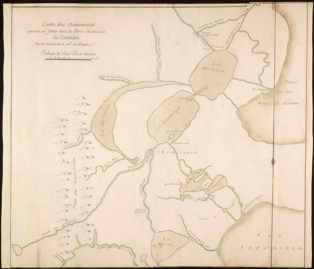
-
Article
Lake Winnipegosis
Winnipegosis, Lake, 5370 km2, 195 km long, elev 254 m, maximum depth 12 m, Canada's eleventh-largest lake, is located in west-central Manitoba.
"https://thecanadianencyclopedia.ca/images/tce_placeholder.jpg?v=e9dca980c9bdb3aa11e832e7ea94f5d9" // resources/views/front/categories/view.blade.php
https://thecanadianencyclopedia.ca/images/tce_placeholder.jpg?v=e9dca980c9bdb3aa11e832e7ea94f5d9
-
Article
Lancaster Sound
Lancaster Sound, an arm of Baffin Bay and a major passage through the Arctic Archipelago, is 400 km long and some 100 km wide.
"https://thecanadianencyclopedia.ca/images/tce_placeholder.jpg?v=e9dca980c9bdb3aa11e832e7ea94f5d9" // resources/views/front/categories/view.blade.php
https://thecanadianencyclopedia.ca/images/tce_placeholder.jpg?v=e9dca980c9bdb3aa11e832e7ea94f5d9
-
Article
Land
Land, in law, is an area of Earth's solid surface that is the property of an individual, group or state. Hence, the Canadian polity controls a total of 9,215,430 km2 of land and 755,180 km2 of freshwater, for a total territory of 9,970,610 km2, the second-largest national territory in the world after Russia.
"https://d3d0lqu00lnqvz.cloudfront.net/georgianbay/Beausoleil-Island-Coast.jpg" // resources/views/front/categories/view.blade.php
https://d3d0lqu00lnqvz.cloudfront.net/georgianbay/Beausoleil-Island-Coast.jpg
-
Article
Landsat Island
A small island 20 km off the northeast Labrador coast, named in recognition of the fact that it was first detected on imagery from the satellite Landsat-1. This satellite, designed for Earth-monitoring, was the first of a continuing series launched by the US having transmissions received in Canada.
"https://thecanadianencyclopedia.ca/images/tce_placeholder.jpg?v=e9dca980c9bdb3aa11e832e7ea94f5d9" // resources/views/front/categories/view.blade.php
https://thecanadianencyclopedia.ca/images/tce_placeholder.jpg?v=e9dca980c9bdb3aa11e832e7ea94f5d9
-
Article
Laurentian Highlands
Although the other limits are less well defined, the highlands may be considered to extend 100-200 km northward from the scarps and to stretch from the Gatineau River in the west (mean elevation 400 m) some 550 km to the SAGUENAY RIVER in the northeast.
"https://d3d0lqu00lnqvz.cloudfront.net/media/media/081947b9-bef7-47f0-b7c2-f8dbb47f7f9a.jpg" // resources/views/front/categories/view.blade.php
https://d3d0lqu00lnqvz.cloudfront.net/media/media/081947b9-bef7-47f0-b7c2-f8dbb47f7f9a.jpg
-
Article
Lesser Slave Lake
The earliest non-Indigenous settlement in the area evolved at the west end of the lake, off Buffalo Bay, where the North West Company established a post (1802) and the Roman Catholic Church followed with a mission (1872).
"https://d3d0lqu00lnqvz.cloudfront.net/media/media/4ec4a212-b4ef-4fde-844a-ba30ef433515.jpg" // resources/views/front/categories/view.blade.php
https://d3d0lqu00lnqvz.cloudfront.net/media/media/4ec4a212-b4ef-4fde-844a-ba30ef433515.jpg
-
Article
Little Manitou Lake
Little Manitou Lake, 13.3 km2, is a saline lake that lies in the rich, rolling prairie of south-central Saskatchewan near Watrous.
"https://thecanadianencyclopedia.ca/images/tce_placeholder.jpg?v=e9dca980c9bdb3aa11e832e7ea94f5d9" // resources/views/front/categories/view.blade.php
https://thecanadianencyclopedia.ca/images/tce_placeholder.jpg?v=e9dca980c9bdb3aa11e832e7ea94f5d9
-
Article
Long Point
Long Point is a 40-km-long sand spit on the north shore of Lake Erie. The longest spit in Canada, Long Point, is the best-surviving example of a wetland and dune ecosystem in the Great Lakes basin. The southerly location and the moderating effect of Lake Erie allow rare and endangered species to thrive. Two sedges and a spikerush are unique to Canada. Long Point is also home to Cambarus diogenes, one of the rarest crayfish in Canada, and the endangered eastern spiny softshell turtle.
"https://d3d0lqu00lnqvz.cloudfront.net/sandhillcrane/Sandhill-Cranes-Longpoint.jpg" // resources/views/front/categories/view.blade.php
https://d3d0lqu00lnqvz.cloudfront.net/sandhillcrane/Sandhill-Cranes-Longpoint.jpg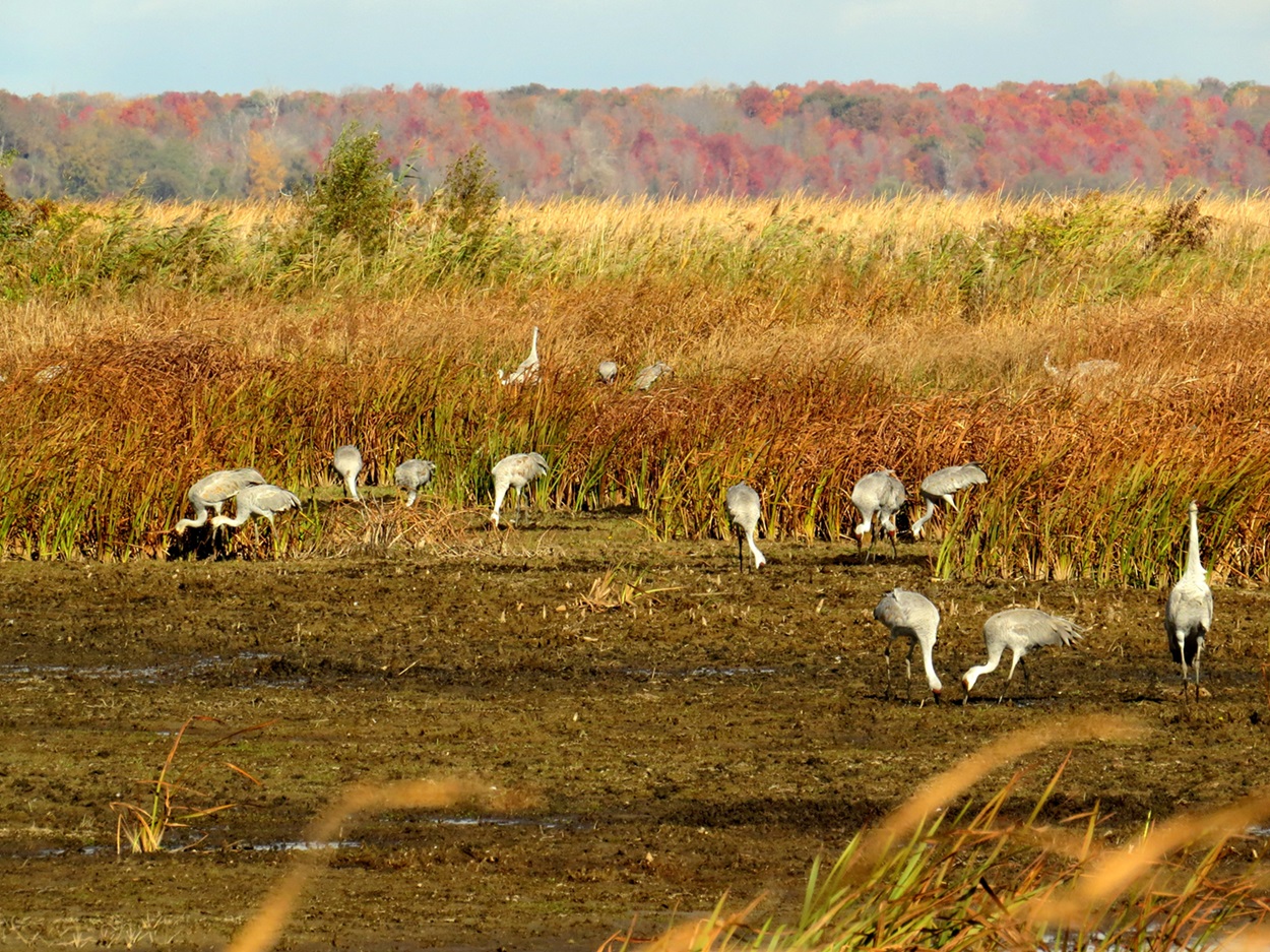
-
Article
Long Range Mountains
The range, generally steep on the coastal side and scarred by deep glaciation and faulting, reaches highland plateaus and flat-topped peaks before sloping away more gently to the east. In places deep fjords and bays cut into its base, and rivers, such as the HUMBER RIVER, flow through its valleys.
"https://d3d0lqu00lnqvz.cloudfront.net/media/media/efe7172c-e877-4f96-a652-0d67fdf65947.jpg" // resources/views/front/categories/view.blade.php
https://d3d0lqu00lnqvz.cloudfront.net/media/media/efe7172c-e877-4f96-a652-0d67fdf65947.jpg
-
Article
Mackenzie King Island
Mackenzie King Island, 5048 km2, is one of the central islands in the Queen Elizabeth Islands of the Arctic Archipelago.
"https://thecanadianencyclopedia.ca/images/tce_placeholder.jpg?v=e9dca980c9bdb3aa11e832e7ea94f5d9" // resources/views/front/categories/view.blade.php
https://thecanadianencyclopedia.ca/images/tce_placeholder.jpg?v=e9dca980c9bdb3aa11e832e7ea94f5d9
-
Article
Mackenzie Mountains
Named after Prime Minister Alexander Mackenzie, they are a northern continuation, 800 km long, of the eastern system of the Rocky Mountains, composed almost entirely of folded sedimentary strata.
"https://d3d0lqu00lnqvz.cloudfront.net/TCEImages/ffb07091-94d9-4b4d-bca4-707831bf46a6.jpg" // resources/views/front/categories/view.blade.php
https://d3d0lqu00lnqvz.cloudfront.net/TCEImages/ffb07091-94d9-4b4d-bca4-707831bf46a6.jpg
-
Article
Mackenzie River
The Mackenzie River’s main stem is 1,738 km long, making it one of the longest rivers in Canada. The Mackenzie River system, which includes tributaries such as the Liard River, is 4,241 km. The Mackenzie River runs northwest through the Northwest Territories, from Great Slave Lake to the Beaufort Sea. Its total drainage basin — 1.8 million km2 — is the largest of any river in Canada and its mean discharge of 9,700 m3/s is second only to that of the St. Lawrence. The river's peak discharge occurs in June, but its flow is generally uniform because of the flat topography east of the river and the many large lakes in the system. The break-up of ice begins at the Liard Riverin late April, early May. The river is free of ice by early June and stays open until November.
"https://d3d0lqu00lnqvz.cloudfront.net/media/new_article_images/NaturalResources/dreamstime_xl_51730435.jpg" // resources/views/front/categories/view.blade.php
https://d3d0lqu00lnqvz.cloudfront.net/media/new_article_images/NaturalResources/dreamstime_xl_51730435.jpg