
Browse "Geographical Features"
-
Article
Île du Cap aux Meules
Île du Cap aux Meules, Qué, 50 km2, is one island in the Îles de la MADELEINE archipelago, located in the middle of the Gulf of ST LAWRENCE. It is named after the sandstone hill that supplied the stone used to make grindstones (meules in French) for flour mills.
"https://thecanadianencyclopedia.ca/images/tce_placeholder.jpg?v=e9dca980c9bdb3aa11e832e7ea94f5d9" // resources/views/front/categories/view.blade.php
https://thecanadianencyclopedia.ca/images/tce_placeholder.jpg?v=e9dca980c9bdb3aa11e832e7ea94f5d9
-
Article
Île Lamèque
Île Lamèque, 150 km2, is located off the northeast corner of New Brunswick at the entrance to Chaleur Bay.
"https://thecanadianencyclopedia.ca/images/tce_placeholder.jpg?v=e9dca980c9bdb3aa11e832e7ea94f5d9" // resources/views/front/categories/view.blade.php
https://thecanadianencyclopedia.ca/images/tce_placeholder.jpg?v=e9dca980c9bdb3aa11e832e7ea94f5d9
-
Article
Îles de la Madeleine
Preceded by Basque fishermen, Jacques Cartier arrived at Île Brion in 1534; he named it in honour of the great French admiral. He christened the islands "Les Araynes" (arènes is a French poetry word for sand) because of the endless beaches of sand. Later French fishermen called them Îles Ramées.
"https://d3d0lqu00lnqvz.cloudfront.net/media/media/e3a0f397-8687-443d-a333-fd37c2506209.jpg" // resources/views/front/categories/view.blade.php
https://d3d0lqu00lnqvz.cloudfront.net/media/media/e3a0f397-8687-443d-a333-fd37c2506209.jpg
-
Article
Îles de Mingan
Native burial grounds indicate they were inhabited before Jacques Cartier first reported the islands in 1535. Surveys have also uncovered 16th-century Spanish coins and the remains of Basque habitations.
"https://d3d0lqu00lnqvz.cloudfront.net/media/media/233c4490-07ce-414e-b2d5-e30602befc75.jpg" // resources/views/front/categories/view.blade.php
https://d3d0lqu00lnqvz.cloudfront.net/media/media/233c4490-07ce-414e-b2d5-e30602befc75.jpg
-
List
Indigenous Names of Rivers and Lakes in Canada
The names of many rivers and lakes in Canada have Indigenous origins. These bodies of water are named for Indigenous people, places, and aspects of Indigenous culture. Some of these lakes and rivers still bear the original name given to them by Indigenous people. Others have been renamed using an Indigenous word as a means of recognizing Indigenous history and working toward reconciliation. This list article explores the Indigenous names of five rivers and five lakes in Canada (see Longest Rivers in Canada and Largest Lakes in Canada).
"https://d3d0lqu00lnqvz.cloudfront.net/media/media/19ec5b64-165b-4f1c-b539-c89700680c09.jpg" // resources/views/front/categories/view.blade.php
https://d3d0lqu00lnqvz.cloudfront.net/media/media/19ec5b64-165b-4f1c-b539-c89700680c09.jpg
-
Article
Innuitian Region
The Innuitian Region (also known as the Innuitian Orogen) is one of Canada’s six geological regions.
"https://d3d0lqu00lnqvz.cloudfront.net/media/media/5176d9ce-bf5f-4fdf-9453-c0f71b3128e6.jpg" // resources/views/front/categories/view.blade.php
https://d3d0lqu00lnqvz.cloudfront.net/media/media/5176d9ce-bf5f-4fdf-9453-c0f71b3128e6.jpg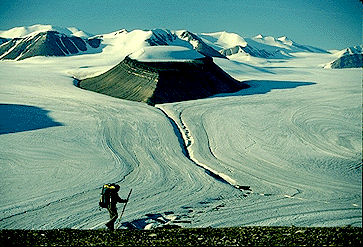
-
Article
Islands in Canada
An island is a piece of land surrounded by water. By custom it is agreed that this definition does not apply to the five largest pieces of land that form the continents (see plate tectonics). The largest island in the world is Greenland (2,175,596 km2); the largest in Canada is Baffin Island (507,451 km2). Seventeen other Canadian islands exceed 10,000 km2 in area. The islands lying north of the mainland of Canada, are generally referred to as the Canadian Arctic Archipelago. They include the Queen Elizabeth Islands, those lying north of the strait (known successively from west to east as M'Clure Strait, Viscount Melville Sound, Barrow Strait and Lancaster Sound), which extends east-west approximately along 74° north latitude. Manitoulin Island (2,765 km2), the largest island in the world located in a freshwater lake (as distinct from a flowing river), itself contains 17 lakes containing islands.
"https://d3d0lqu00lnqvz.cloudfront.net/scenicplaces/haida-gwaii-aerial.jpg" // resources/views/front/categories/view.blade.php
https://d3d0lqu00lnqvz.cloudfront.net/scenicplaces/haida-gwaii-aerial.jpg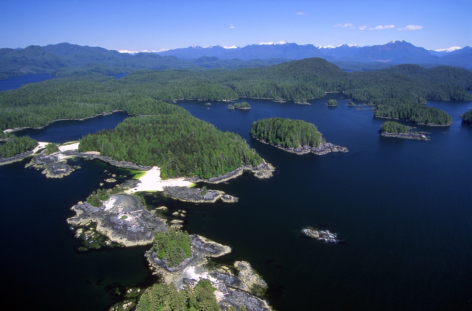
-
Article
James Bay
James Bay is the southern appendage of Hudson Bay. It is about 160 km wide between Pointe-à-Louis-XIV on the east coast and Cape Henrietta Marie on the west. The Quebec-Ontario border is at the bottom of the bay, and its numerous islands were administered by the Northwest Territories but are now part of the territory of Nunavut. Akimiski is the largest island with an area of 3,001 km2.
"https://d3d0lqu00lnqvz.cloudfront.net/jamesbay/Canadian_Shield_James_Bay_04.jpg" // resources/views/front/categories/view.blade.php
https://d3d0lqu00lnqvz.cloudfront.net/jamesbay/Canadian_Shield_James_Bay_04.jpg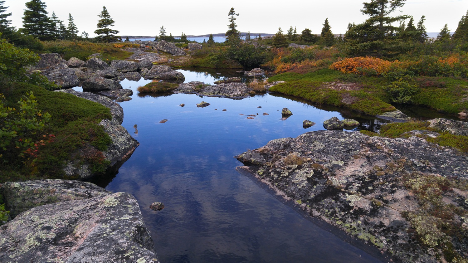
-
Article
Joggins Fossil Cliffs
The Joggins Fossil Cliffs are located in Nova Scotia, on the shores of Cumberland Basin in the upper Bay of Fundy. They contain an exceptional fossil record of the carboniferous period. In 2008, these cliffs were designated a UNESCO World Heritage Site.
"https://thecanadianencyclopedia.ca/images/tce_placeholder.jpg?v=e9dca980c9bdb3aa11e832e7ea94f5d9" // resources/views/front/categories/view.blade.php
https://thecanadianencyclopedia.ca/images/tce_placeholder.jpg?v=e9dca980c9bdb3aa11e832e7ea94f5d9
-
Article
Juan de Fuca Strait
Juan de Fuca Strait is an inlet of the Pacific Ocean between Vancouver Island and Washington State, connecting the Strait of Georgia and Puget Sound to the outer ocean.
"https://thecanadianencyclopedia.ca/images/tce_placeholder.jpg?v=e9dca980c9bdb3aa11e832e7ea94f5d9" // resources/views/front/categories/view.blade.php
https://thecanadianencyclopedia.ca/images/tce_placeholder.jpg?v=e9dca980c9bdb3aa11e832e7ea94f5d9
-
Article
Jumbo Pass
Jumbo Pass, elevation 2,270 m, is situated in the central Purcell Mountains of British Columbia.
"https://thecanadianencyclopedia.ca/images/tce_placeholder.jpg?v=e9dca980c9bdb3aa11e832e7ea94f5d9" // resources/views/front/categories/view.blade.php
https://thecanadianencyclopedia.ca/images/tce_placeholder.jpg?v=e9dca980c9bdb3aa11e832e7ea94f5d9
-
Article
Kane Basin
Kane Basin is a broad expanse of water, about 3900 km2, that leads northward between the eastern shore of ELLESMERE ISLAND and the west coast of Greenland. It is relatively shallow; for the most part depths reach 180 m. Ice conditions are a severe impediment to navigation.
"https://thecanadianencyclopedia.ca/images/tce_placeholder.jpg?v=e9dca980c9bdb3aa11e832e7ea94f5d9" // resources/views/front/categories/view.blade.php
https://thecanadianencyclopedia.ca/images/tce_placeholder.jpg?v=e9dca980c9bdb3aa11e832e7ea94f5d9
-
Article
Kawartha Lakes
The Kawartha Lakes are a chain of interconnected lakes in south-central Ontario, forming the Trent River's upper watershed. These lakes range in size from 2 to 83 km2. Most of the lakes are located in the city of Kawartha Lakes and Peterborough County.
"https://d3d0lqu00lnqvz.cloudfront.net/kawarthalakes/Bobcaygeon.jpg" // resources/views/front/categories/view.blade.php
https://d3d0lqu00lnqvz.cloudfront.net/kawarthalakes/Bobcaygeon.jpg
-
Article
Kazan River
Kazan River, 850 km long, rises near Kasba Lake in southern Nunavut near the Saskatchewan border. Flowing north it follows an irregular course through several lakes, draining a large part of the Barren Lands.
"https://thecanadianencyclopedia.ca/images/tce_placeholder.jpg?v=e9dca980c9bdb3aa11e832e7ea94f5d9" // resources/views/front/categories/view.blade.php
https://thecanadianencyclopedia.ca/images/tce_placeholder.jpg?v=e9dca980c9bdb3aa11e832e7ea94f5d9
-
Article
Kettle Valley
Kettle Valley is a dry, forested area in the Okanagan Highland of southern BC. The name relates either to rock formations in the waterfalls at the confluence of the Kettle and COLUMBIA rivers in Washington state or to the shape of baskets woven by Salish people there.
"https://thecanadianencyclopedia.ca/images/tce_placeholder.jpg?v=e9dca980c9bdb3aa11e832e7ea94f5d9" // resources/views/front/categories/view.blade.php
https://thecanadianencyclopedia.ca/images/tce_placeholder.jpg?v=e9dca980c9bdb3aa11e832e7ea94f5d9