
Browse "Geographical Features"
-
Article
Herschel Island
Herschel Island, 101 km 2 , lies in the Beaufort Sea off the north coast of the Yukon Territory.
"https://d3d0lqu00lnqvz.cloudfront.net/media/media/b504d03a-1419-4bf4-ab27-00b5e8cc89a0.jpg" // resources/views/front/categories/view.blade.php
https://d3d0lqu00lnqvz.cloudfront.net/media/media/b504d03a-1419-4bf4-ab27-00b5e8cc89a0.jpg
-
Article
Hillsborough River
The Hillsborough River begins near the white sand beaches of the north shore and winds 45 km through rich farm country to its mouth (Charlottetown Harbour) on the south shore of Prince Edward Island. At its mouth, the North and West rivers come together to meet the Hillsborough.
"https://thecanadianencyclopedia.ca/images/tce_placeholder.jpg?v=e9dca980c9bdb3aa11e832e7ea94f5d9" // resources/views/front/categories/view.blade.php
https://thecanadianencyclopedia.ca/images/tce_placeholder.jpg?v=e9dca980c9bdb3aa11e832e7ea94f5d9
-
Article
Holland Marsh
Holland Marsh, 2900 ha of organic (muck) soil, is located near Bradford West Gwillimbury, Ont, 50 km north of Toronto.
"https://d3d0lqu00lnqvz.cloudfront.net/media/media/01f0989f-5102-44b1-82b6-1b7a44b8ff1d.jpg" // resources/views/front/categories/view.blade.php
https://d3d0lqu00lnqvz.cloudfront.net/media/media/01f0989f-5102-44b1-82b6-1b7a44b8ff1d.jpg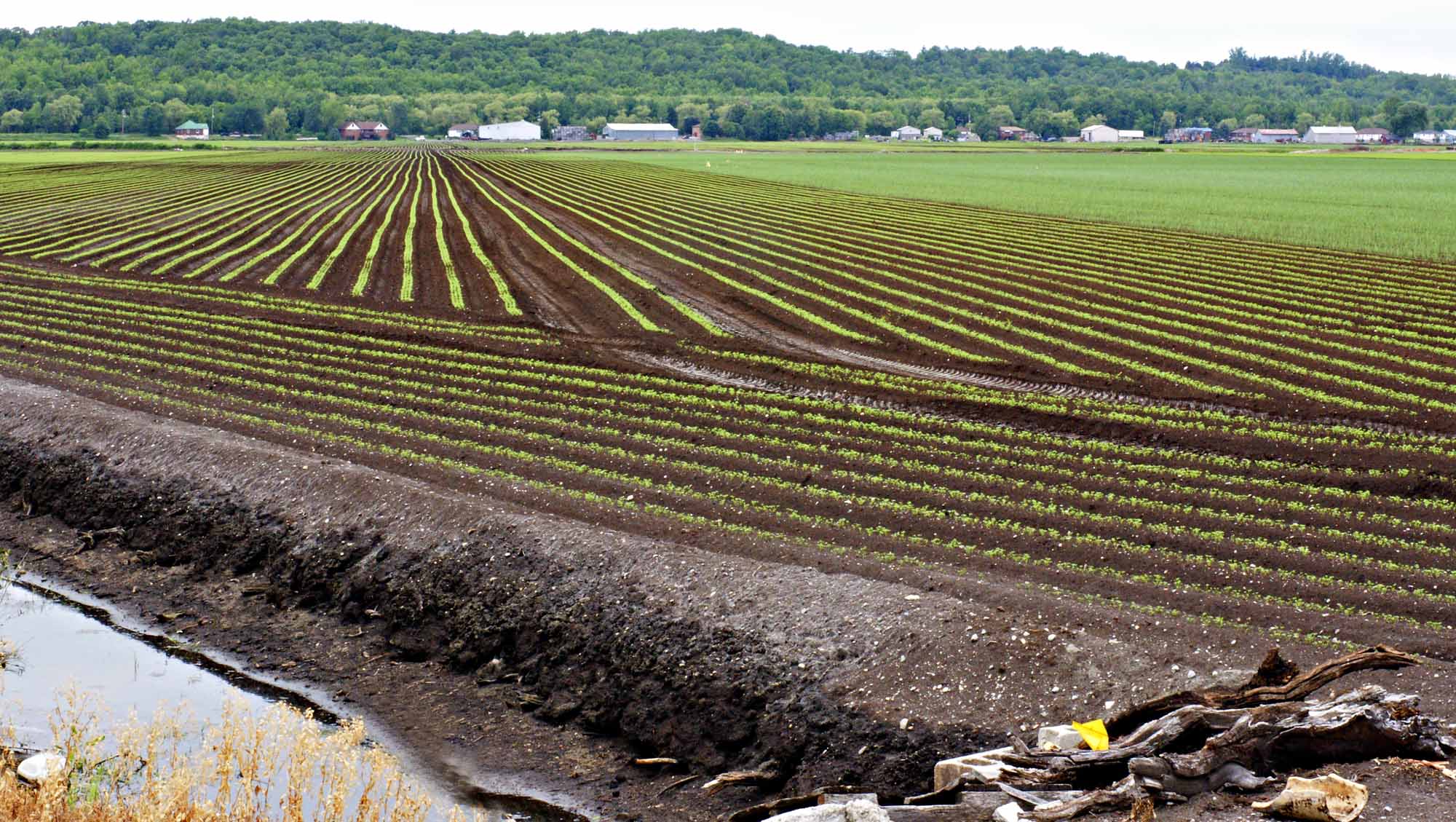
-
Article
Hoodoo Rock
Hoodoo rocks are often fantastically shaped, naturally carved rocks or earth pedestals, pillars or columns. The term appears to be largely restricted to western North America.
"https://d3d0lqu00lnqvz.cloudfront.net/media/media/251b5d36-82cc-4ec1-80e8-471cfd59098a.jpg" // resources/views/front/categories/view.blade.php
https://d3d0lqu00lnqvz.cloudfront.net/media/media/251b5d36-82cc-4ec1-80e8-471cfd59098a.jpg
-
Article
Hornby Island
Hornby Island lies in the Strait of Georgia between Vancouver Island and mainland British Columbia, southeast of the island community of Courtenay . It is a wooded island with a shoreline of sandbanks and rock shelves.
"https://d3d0lqu00lnqvz.cloudfront.net/media/media/44ecf87e-919b-40ea-8039-8eefd6a41399.jpg" // resources/views/front/categories/view.blade.php
https://d3d0lqu00lnqvz.cloudfront.net/media/media/44ecf87e-919b-40ea-8039-8eefd6a41399.jpg
-
Article
Horton Plain
The vegetation is low arctic tundra in the N, dominated by dwarf shrubs and grasses, and woodland in the S, consisting of scattered, stunted spruce with a lichen carpet. The summer range and calving grounds of the large Bluenose caribou herd lie within this region.
"https://thecanadianencyclopedia.ca/images/tce_placeholder.jpg?v=e9dca980c9bdb3aa11e832e7ea94f5d9" // resources/views/front/categories/view.blade.php
https://thecanadianencyclopedia.ca/images/tce_placeholder.jpg?v=e9dca980c9bdb3aa11e832e7ea94f5d9
-
Article
Hudson Strait
Hudson Strait is an arm of the sea connecting the Atlantic Ocean with Hudson Bay and Foxe Channel and separating Baffin Island from the Ungava Peninsula of Québec. The eastern gap is between Cape Chidley, at the northern tip of Labrador, and Resolution Island.
"https://thecanadianencyclopedia.ca/images/tce_placeholder.jpg?v=e9dca980c9bdb3aa11e832e7ea94f5d9" // resources/views/front/categories/view.blade.php
https://thecanadianencyclopedia.ca/images/tce_placeholder.jpg?v=e9dca980c9bdb3aa11e832e7ea94f5d9
-
Article
Humber River (Newfoundland)
The Humber River, 153 km long, drainage basin 7680 km2, is the principal river of western Newfoundland.
"https://thecanadianencyclopedia.ca/images/tce_placeholder.jpg?v=e9dca980c9bdb3aa11e832e7ea94f5d9" // resources/views/front/categories/view.blade.php
https://thecanadianencyclopedia.ca/images/tce_placeholder.jpg?v=e9dca980c9bdb3aa11e832e7ea94f5d9
-
Article
Humber River (Ontario)
Encompassing 908 km2 in total, the Humber River watershed is the largest in the Toronto region. The 126-kilometre long Humber River has its headwaters in the ancient rock of the NIAGARA ESCARPMENT and the glacial hills of the Oak Ridges Moraine.
"https://thecanadianencyclopedia.ca/images/tce_placeholder.jpg?v=e9dca980c9bdb3aa11e832e7ea94f5d9" // resources/views/front/categories/view.blade.php
https://thecanadianencyclopedia.ca/images/tce_placeholder.jpg?v=e9dca980c9bdb3aa11e832e7ea94f5d9
-
Article
Île aux Coudres
Île aux Coudres, 30 km 2 , 11 km long, 4.3 km wide, 92 m high, is situated 60 km downstream from Québec City in the ST LAWRENCE RIVER estuary. The island consists of 2 Appalachian ridges joined by an embankment.
"https://d3d0lqu00lnqvz.cloudfront.net/media/media/bc348064-f5a1-419f-97b9-befa81a5bdb1.jpg" // resources/views/front/categories/view.blade.php
https://d3d0lqu00lnqvz.cloudfront.net/media/media/bc348064-f5a1-419f-97b9-befa81a5bdb1.jpg
-
Article
Île Bonaventure
Despite its minute size, a favourable climate and abundant cod stocks induced French entrepreneurs to establish a seasonal fishery operation there in the 1600s. Simon Denys obtained seigneurial title (1674); his son Pierre had a chapel erected, soon thereafter razed by fire (1690).
"https://d3d0lqu00lnqvz.cloudfront.net/media/media/b2be0d1b-9e0f-4794-997a-2ec03cbfab51.jpg" // resources/views/front/categories/view.blade.php
https://d3d0lqu00lnqvz.cloudfront.net/media/media/b2be0d1b-9e0f-4794-997a-2ec03cbfab51.jpg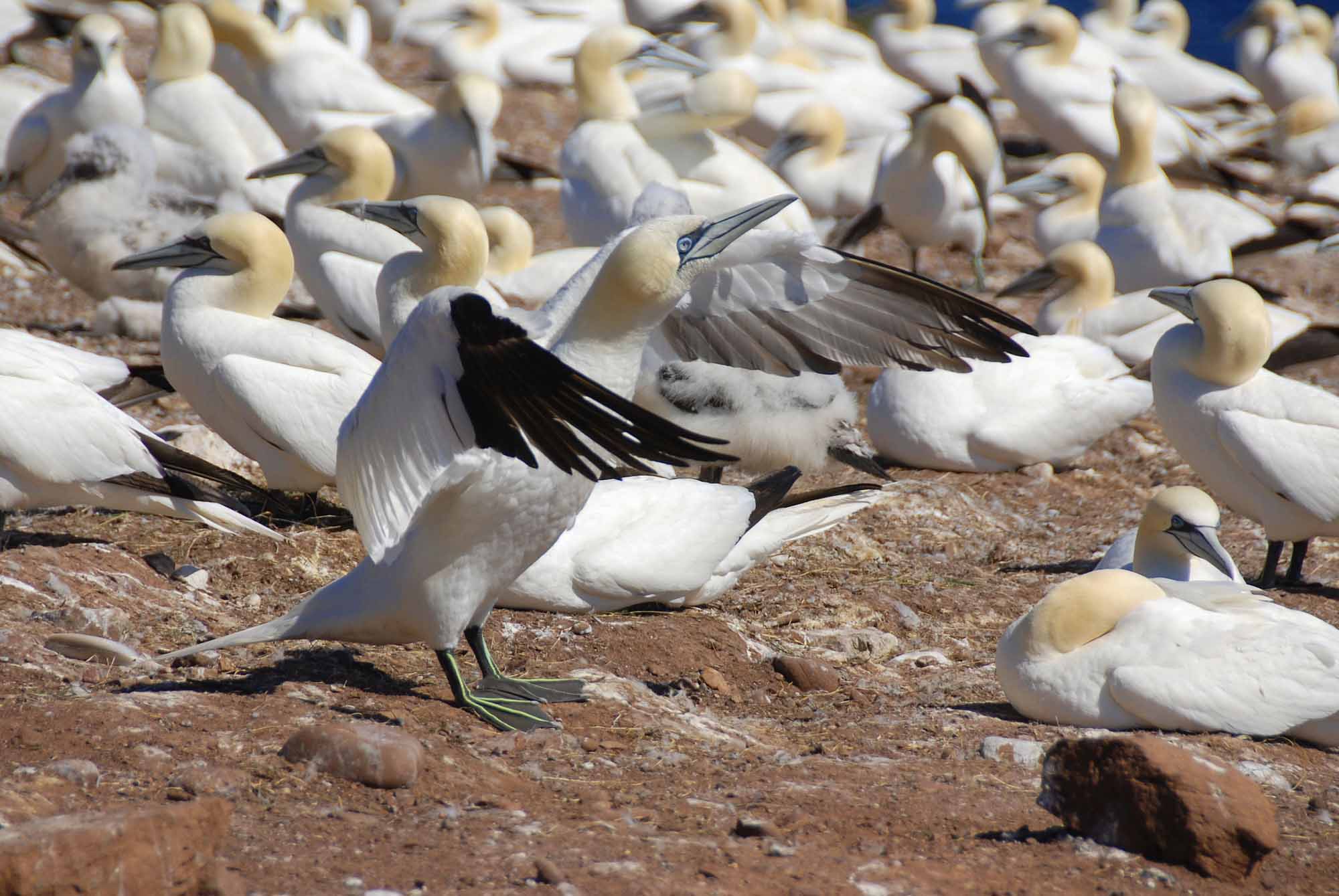
-
Article
Île d’Anticosti
Île d'Anticosti, 7,943 km2, 222 km long and 56 km at its widest point, is located in the Gulf of St. Lawrence, athwart the entrance to the St. Lawrence River. Though considerably larger than Prince Edward Island, its population is only about 200. In September 2023, the island was designated a UNESCO World Heritage Site.
"https://d3d0lqu00lnqvz.cloudfront.net/iledanticosti/RiviereHuileAnticosti.jpg" // resources/views/front/categories/view.blade.php
https://d3d0lqu00lnqvz.cloudfront.net/iledanticosti/RiviereHuileAnticosti.jpg
-
Article
Île d'Orléans
The island is connected by a suspension bridge to the North Shore near CHUTE MONTMORENCY. The largest island in the river after Île de Montréal, it is a relatively level plateau, 137 m at its highest point, and is quite steep-sided.
"https://d3d0lqu00lnqvz.cloudfront.net/media/media/fed833c0-33df-4cf6-81dc-9b2390d4d1ed.jpg" // resources/views/front/categories/view.blade.php
https://d3d0lqu00lnqvz.cloudfront.net/media/media/fed833c0-33df-4cf6-81dc-9b2390d4d1ed.jpg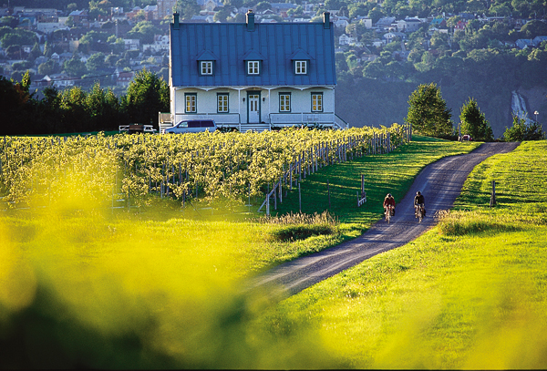
-
Article
Île de la Grande Entrée
Île de la Grande Entrée, Qué, is situated almost in the middle of the Gulf of ST LAWRENCE and flanked in the north by Île d' ANTICOSTI, in the south by PRINCE EDWARD ISLAND and on the east by CABOT STRAIT. It is one of the 16 islands and islets comprising Îles-de-la-MADELEINE.
"https://thecanadianencyclopedia.ca/images/tce_placeholder.jpg?v=e9dca980c9bdb3aa11e832e7ea94f5d9" // resources/views/front/categories/view.blade.php
https://thecanadianencyclopedia.ca/images/tce_placeholder.jpg?v=e9dca980c9bdb3aa11e832e7ea94f5d9
-
Article
Île du Bic
Bic, Île du, uninhabited island, 14 km2, is located in the ST LAWRENCE R, 30 km west of Rimouski, Qué. Because of its advantageous position at the mouth of the St Lawrence near the natural harbour of Bic, it played a key military role under the French regime.
"https://thecanadianencyclopedia.ca/images/tce_placeholder.jpg?v=e9dca980c9bdb3aa11e832e7ea94f5d9" // resources/views/front/categories/view.blade.php
https://thecanadianencyclopedia.ca/images/tce_placeholder.jpg?v=e9dca980c9bdb3aa11e832e7ea94f5d9