
Browse "Geographical Features"
-
Article
Grand Manan Island
With a population of about 2500 - chiefly in the villages of North Head, Grand Harbour and Seal Cove - its chief industries are scallops, herring, lobster and salmon aquaculture, dulse (seaweed) gathering and tourism.
"https://d3d0lqu00lnqvz.cloudfront.net/media/media/03d8b7c6-bc2b-4575-97ec-f3d453f5bf34.jpg" // resources/views/front/categories/view.blade.php
https://d3d0lqu00lnqvz.cloudfront.net/media/media/03d8b7c6-bc2b-4575-97ec-f3d453f5bf34.jpg
-
Article
Grand River
From its source just south of Georgian Bay, the Grand River winds 266 km to Lake Erie, dropping 352 m along the way. Together with its major tributaries, the Speed, Nith, Conestogo and Eramosa rivers, it drains 6200 km2, the largest watershed in southern Ontario.
"https://thecanadianencyclopedia.ca/images/tce_placeholder.jpg?v=e9dca980c9bdb3aa11e832e7ea94f5d9" // resources/views/front/categories/view.blade.php
https://thecanadianencyclopedia.ca/images/tce_placeholder.jpg?v=e9dca980c9bdb3aa11e832e7ea94f5d9
-
Article
Great Bear Lake
Great Bear Lake is located in the Northwest Territories. With a surface area of 31,328 km2, Great Bear Lake is the largest lake located entirely inside Canadian borders. It is also the fourth largest in North America and the eighth largest in the world. Water flows out of the lake into the Great Bear River, then into the Mackenzie River. Other rivers connected to the lake include the Dease, Camsell and Johnny Hoe. Great Bear Lake is made up of five separate arms, each with their own names: Dease, McTavish, McVicar, Keith and Smith. (See also Largest Lakes in Canada.)
"https://d3d0lqu00lnqvz.cloudfront.net/media/media/b3f3c222-8825-473d-834b-5d76b45c35df.jpg" // resources/views/front/categories/view.blade.php
https://d3d0lqu00lnqvz.cloudfront.net/media/media/b3f3c222-8825-473d-834b-5d76b45c35df.jpg
-
Article
Great Lakes
The Great Lakes are the largest group in a chain of large lakes (including Winnipeg, Athabasca, Great Slave and Great Bear) that lies along the southern boundary of the Canadian Shield. From west to east the Great Lakes comprise lakes Superior, Michigan (entirely in the US), Huron, St. Clair, Erie and Ontario. They have a total area of approximately 244,100 km 2 and drop from 183 m above sea level at Lake Superior to 74 m at Lake Ontario — the most dramatic drop occurring at Niagara Falls. Lake St Clair, while not properly a “great lake,” is considered part of this Laurentian chain.
"https://d3d0lqu00lnqvz.cloudfront.net/lakesincanada/Great-Lakes.jpg" // resources/views/front/categories/view.blade.php
https://d3d0lqu00lnqvz.cloudfront.net/lakesincanada/Great-Lakes.jpg
-
Article
Gulf Islands
Their bucolic charm, calm waters, rich bird and marine life and mild climate, in the driest zone on Canada's Pacific coast, have attracted homesteaders and cottagers since about 1859. Stands of tall timber growing in deep soil were logged early in this century.
"https://d3d0lqu00lnqvz.cloudfront.net/media/media/2eb4a133-4037-49ab-af23-cc43cde9708f.jpg" // resources/views/front/categories/view.blade.php
https://d3d0lqu00lnqvz.cloudfront.net/media/media/2eb4a133-4037-49ab-af23-cc43cde9708f.jpg
-
Article
Gulf of Boothia
The Gulf of Boothia is entered through Prince Regent Inlet. To the east it is bounded by the northwest coast of Baffin Island, and to the west by the Boothia Peninsula. Depths are generally about 275 m, decreasing southward.
"https://thecanadianencyclopedia.ca/images/tce_placeholder.jpg?v=e9dca980c9bdb3aa11e832e7ea94f5d9" // resources/views/front/categories/view.blade.php
https://thecanadianencyclopedia.ca/images/tce_placeholder.jpg?v=e9dca980c9bdb3aa11e832e7ea94f5d9
-
Article
Gulf of St Lawrence
The Gulf of St Lawrence, a large (250,000 km2), roughly triangular inland sea receiving on average 10,100 m3/s of fresh water from the St. Lawrence River at its northwest apex, is connected to the Atlantic by the Strait of Belle Isle at the northeast and Cabot Strait at the southeast corners.
"https://d3d0lqu00lnqvz.cloudfront.net/gulfofstlawrence/Gulf-of-St-Lawrence.jpg" // resources/views/front/categories/view.blade.php
https://d3d0lqu00lnqvz.cloudfront.net/gulfofstlawrence/Gulf-of-St-Lawrence.jpg
-
Article
Hamilton Inlet
Hamilton Inlet, together with Lk Melville, forms the largest estuary, over 250 km long, 40 km wide (at the western end) and 150 m deep, on the Labrador coast.
"https://thecanadianencyclopedia.ca/images/tce_placeholder.jpg?v=e9dca980c9bdb3aa11e832e7ea94f5d9" // resources/views/front/categories/view.blade.php
https://thecanadianencyclopedia.ca/images/tce_placeholder.jpg?v=e9dca980c9bdb3aa11e832e7ea94f5d9
-
Article
Harrison River
Harrison River, 15 km long, flows SW from Harrison Lk to join the Fraser River about 100 km upriver from Vancouver in southern BC.
"https://thecanadianencyclopedia.ca/images/tce_placeholder.jpg?v=e9dca980c9bdb3aa11e832e7ea94f5d9" // resources/views/front/categories/view.blade.php
https://thecanadianencyclopedia.ca/images/tce_placeholder.jpg?v=e9dca980c9bdb3aa11e832e7ea94f5d9
-
Article
Hayes River
The Hayes River, 483 km long, rises in Molson Lake (399 km2) northeast of Lake Winnipeg, flows northeast to Oxford Lake (401 km2) and Knee Lake, through the rock and bush of the Canadian Shield, across the clay flats of the Hudson Bay Lowlands and into the bay at YORK FACTORY.
"https://thecanadianencyclopedia.ca/images/tce_placeholder.jpg?v=e9dca980c9bdb3aa11e832e7ea94f5d9" // resources/views/front/categories/view.blade.php
https://thecanadianencyclopedia.ca/images/tce_placeholder.jpg?v=e9dca980c9bdb3aa11e832e7ea94f5d9
-
Article
Hecate Strait
Hecate Strait is a body of water 48–140 km wide, underlain by a shallow basin (less than 45 m at the north end) separating Haida Gwaii from mainland British Columbia. Marine weather conditions are severe: winter storms originating in the Gulf of Alaska bring high waves through the strait and winds persistently higher than 40 km/h off the south end of Moresby Island. The open strait and numerous sheltered inlets are rich in marine life.
"https://d3d0lqu00lnqvz.cloudfront.net/hecatestrait/HecateStrait-PittIsland.jpg" // resources/views/front/categories/view.blade.php
https://d3d0lqu00lnqvz.cloudfront.net/hecatestrait/HecateStrait-PittIsland.jpg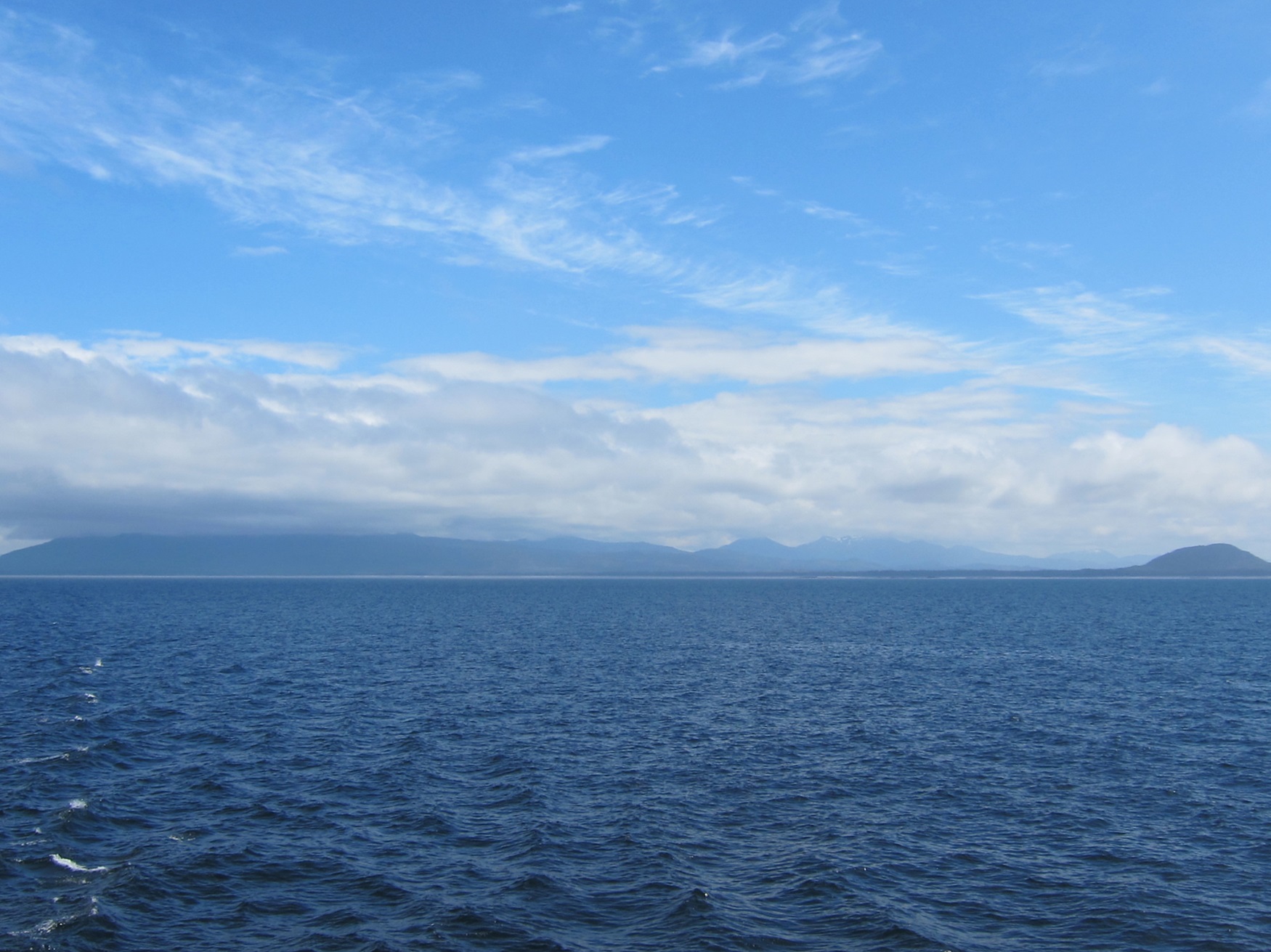
-
"https://thecanadianencyclopedia.ca/images/tce_placeholder.jpg?v=e9dca980c9bdb3aa11e832e7ea94f5d9" // resources/views/front/categories/view.blade.php
https://thecanadianencyclopedia.ca/images/tce_placeholder.jpg?v=e9dca980c9bdb3aa11e832e7ea94f5d9
-
Article
Hells Gate
Hells Gate is a narrow rocky gorge of the Fraser River Canyon south of Boston Bar, British Columbia.
"https://d3d0lqu00lnqvz.cloudfront.net/media/media/3a0bfcc6-c4db-40cb-9d96-e5db248cc7e2.jpg" // resources/views/front/categories/view.blade.php
https://d3d0lqu00lnqvz.cloudfront.net/media/media/3a0bfcc6-c4db-40cb-9d96-e5db248cc7e2.jpg
-
Article
Helmcken Falls
Helmcken Falls is located on the Murtle River at the entrance to British Columbia's Wells Gray Provincial Park, an area noted for its many waterfalls. It is the highest in the park and fifth highest in Canada. Situated in the
"https://d3d0lqu00lnqvz.cloudfront.net/media/media/7ee6d9fa-b453-42f3-8c3b-f2a71dd7943f.jpg" // resources/views/front/categories/view.blade.php
https://d3d0lqu00lnqvz.cloudfront.net/media/media/7ee6d9fa-b453-42f3-8c3b-f2a71dd7943f.jpg
-
Collection
Heritage Minutes
The Heritage Minutes collection is a bilingual series of history-focused public service announcements. Each 60-second short film depicts a significant person, event or story in Canadian history. They are produced by Historica Canada, the not-for-profit organization that also publishes this encyclopedia. First released in 1991, the Heritage Minutes have been shown on television, in cinemas and online. They have become a recognizable part of Canadian culture. The collection currently includes 100 episodes.
"https://d3d0lqu00lnqvz.cloudfront.net/media/media/1bfa3d45-2952-4f79-b7d4-4c6cb6601164.jpg" // resources/views/front/categories/view.blade.php
https://d3d0lqu00lnqvz.cloudfront.net/media/media/1bfa3d45-2952-4f79-b7d4-4c6cb6601164.jpg