
Browse "Cities & Populated Places"
-
Article
Winkler
Winkler, Manitoba, incorporated as a city in 2002, population 10 670 (2011c), 9106 (2006c). The City of Winkler is located in the Pembina Valley region, 115 km southwest of Winnipeg and 22 km north of the US international boundary.
"https://thecanadianencyclopedia.ca/images/tce_placeholder.jpg?v=e9dca980c9bdb3aa11e832e7ea94f5d9" // resources/views/front/categories/view.blade.php
https://thecanadianencyclopedia.ca/images/tce_placeholder.jpg?v=e9dca980c9bdb3aa11e832e7ea94f5d9
-
Article
Winnipeg
Winnipeg, Manitoba, incorporated as a city in 1873, population 749,607 (2021 census), 705,244 (2016 census). The city of Winnipeg is the capital and largest city of Manitoba, and is located at the confluence of the Red River and Assiniboine River 100 km north of the Minnesota border. The name is derived from the Cree name for Lake Winnipeg, 65 km north, win-nipi, meaning "murky water." Winnipeg is an important economic and cultural centre for the Prairies. Lying midway between the Atlantic and Pacific Oceans, it has been called "Bull's Eye of the Dominion," and because of its location between the Canadian Shield and the prairie, "Gateway to the West."
"https://d3d0lqu00lnqvz.cloudfront.net/media/media/13f6cecb-3eb8-4e49-bb41-138036eb158b.jpg" // resources/views/front/categories/view.blade.php
https://d3d0lqu00lnqvz.cloudfront.net/media/media/13f6cecb-3eb8-4e49-bb41-138036eb158b.jpg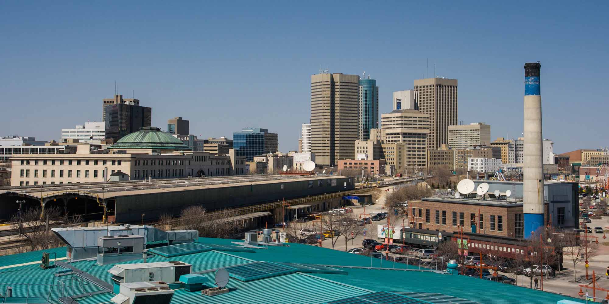
-
Article
Wolfville
Wolfville, NS, incorporated as a town in 1893, population 4269 (2011c), 3772 (2006c). The Town of Wolfville is located on Minas Basin, 75 km northwest of Halifax.
"https://thecanadianencyclopedia.ca/images/tce_placeholder.jpg?v=e9dca980c9bdb3aa11e832e7ea94f5d9" // resources/views/front/categories/view.blade.php
https://thecanadianencyclopedia.ca/images/tce_placeholder.jpg?v=e9dca980c9bdb3aa11e832e7ea94f5d9
-
Article
Woodstock (NB)
Woodstock, NB, incorporated as a town in 1856, population 5254 (2011c), 5113 (2006c). The Town of Woodstock, the shire town of Carleton County, is located 103 km up the Saint John River from Fredericton, at the mouth of the Meduxnekeag River.
"https://thecanadianencyclopedia.ca/images/tce_placeholder.jpg?v=e9dca980c9bdb3aa11e832e7ea94f5d9" // resources/views/front/categories/view.blade.php
https://thecanadianencyclopedia.ca/images/tce_placeholder.jpg?v=e9dca980c9bdb3aa11e832e7ea94f5d9
-
Article
Woodstock (Ontario)
Woodstock, Ontario, incorporated as a city in 1901, population 46,705 (2021 census), 41,098 (2016 census). The city of Woodstock is located on the Thames River, in the heart of southwestern Ontario.
"https://thecanadianencyclopedia.ca/images/tce_placeholder.jpg?v=e9dca980c9bdb3aa11e832e7ea94f5d9" // resources/views/front/categories/view.blade.php
https://thecanadianencyclopedia.ca/images/tce_placeholder.jpg?v=e9dca980c9bdb3aa11e832e7ea94f5d9
-
Article
Wynyard
Wynyard, Saskatchewan, incorporated as a town in 1911, population 1,798 (2016 census), 1,767 (2011 census). The town of Wynyard is located 150 km north of Regina.
"https://thecanadianencyclopedia.ca/images/tce_placeholder.jpg?v=e9dca980c9bdb3aa11e832e7ea94f5d9" // resources/views/front/categories/view.blade.php
https://thecanadianencyclopedia.ca/images/tce_placeholder.jpg?v=e9dca980c9bdb3aa11e832e7ea94f5d9
-
Article
Yarmouth
Yarmouth, NS, incorporated as a town in 1890, population 6761 (2011c), 7162 (2006c). The Town of Yarmouth is located at the entrance to Yarmouth Harbour at the western tip of Nova Scotia and referred to as Eastern Canada's Gateway.
"https://d3d0lqu00lnqvz.cloudfront.net/media/media/f30110e2-f83c-421e-8342-bdfe5e389db2.jpg" // resources/views/front/categories/view.blade.php
https://d3d0lqu00lnqvz.cloudfront.net/media/media/f30110e2-f83c-421e-8342-bdfe5e389db2.jpg
-
Article
Yellowknife
Yellowknife, Northwest Territories, incorporated as a city in 1970, population 20,340 (2021 census), 19,569 (2016 census). The city of Yellowknife is the capital of the Northwest Territories and the territory's only city. It sits on the Canadian Shield, on the north shore of Great Slave Lake, and about 400 km south of the Arctic Circle. Due to its northerly location, Yellowknife is the Canadian city with the most hours of summer sunshine, averaging 1,030 hours per year. The city and Yellowknife Bay were named after the Yellowknives, a Dene band who lived on the islands of Great Slave's East Arm and travelled as far north as the Arctic coast to obtain copper for knives and other implements. They, in turn, acquired their name from the copper-bladed knives they carried.
"https://d3d0lqu00lnqvz.cloudfront.net/media/media/59ab5c6b-7f7b-4307-ae04-bb0ce522fe38.jpg" // resources/views/front/categories/view.blade.php
https://d3d0lqu00lnqvz.cloudfront.net/media/media/59ab5c6b-7f7b-4307-ae04-bb0ce522fe38.jpg
-
Article
Yellowknives Dene
Yellowknives Dene, or T'atsaot'ine, are a group of Athapaskan-speaking Dene associated with the region encompassed by the Coppermine and Yellowknife rivers, the northeast shore of Great Slave Lake, and northeast into the Barren Grounds. Yellowknives are one of the five main groups of the Akaitcho Dene First Nation of the Northwest Territories. In February 2026, the registered population of Yellowknives Dene First Nation was 1,755.
"https://d3d0lqu00lnqvz.cloudfront.net/media/media/1a18a5cd-7270-4876-ad51-e325a73fe883.jpg" // resources/views/front/categories/view.blade.php
https://d3d0lqu00lnqvz.cloudfront.net/media/media/1a18a5cd-7270-4876-ad51-e325a73fe883.jpg
-
Article
Yorkton
Although the York colony eventually faded, large numbers of immigrants from across Europe settled in the area. Of particular significance were the early UKRAINIANS and DOUKHOBORS who formed a large portion of the population.
"https://d3d0lqu00lnqvz.cloudfront.net/media/media/9dde7de9-5182-4dab-a6b3-f141ce3c9272.jpg" // resources/views/front/categories/view.blade.php
https://d3d0lqu00lnqvz.cloudfront.net/media/media/9dde7de9-5182-4dab-a6b3-f141ce3c9272.jpg