
Browse "Cities & Populated Places"
-
Article
Twillingate
Twillingate, NL, incorporated as a town in 1962, population 2269 (2011c), 2448 (2006c). The Town of Twillingate is located on Twillingate Islands, Notre Dame Bay in northeast Newfoundland.
"https://thecanadianencyclopedia.ca/images/tce_placeholder.jpg?v=e9dca980c9bdb3aa11e832e7ea94f5d9" // resources/views/front/categories/view.blade.php
https://thecanadianencyclopedia.ca/images/tce_placeholder.jpg?v=e9dca980c9bdb3aa11e832e7ea94f5d9
-
Article
Tyendinaga Mohawk Territory
The Mohawks of the Bay of Quinte are part of the Kanyen’kehá:ka or Mohawk Nation. Kanyen’kehá:ka means “People of the Land of Flint.” The Mohawk Nation is in turn part of the Rotinonhsyón:ni (Haudenosaunee or Six Nations Confederacy), which translates in English to “People of the Longhouse.” As of February 2026, there were 11,881 members of the Mohawks of the Bay of Quinte living on Turtle Island and beyond. At that time, 2,090 of these members lived on Tyendinaga Mohawk Territory. The Territory is located on the northeastern shore of the Bay of Quinte, just east of Belleville, Ontario.
"https://d3d0lqu00lnqvz.cloudfront.net/media/new_article_images/Tyendinaga/TyendinagaPowwow.jpg" // resources/views/front/categories/view.blade.php
https://d3d0lqu00lnqvz.cloudfront.net/media/new_article_images/Tyendinaga/TyendinagaPowwow.jpg
-
Article
Ucluelet (BC)
Ucluelet, BC, incorporated as a district municipality in 1997, population 1627 (2011c), 1487 (2006c). The District of Ucluelet is located on the west coast of Vancouver Island, 175 km northwest of Victoria, at the entrance to Barkley Sound.
"https://d3d0lqu00lnqvz.cloudfront.net/media/media/4fa0038e-052c-4dd8-acc5-c3bba0cf8e6c.jpg" // resources/views/front/categories/view.blade.php
https://d3d0lqu00lnqvz.cloudfront.net/media/media/4fa0038e-052c-4dd8-acc5-c3bba0cf8e6c.jpg
-
Article
Ulukhaktok
Ulukhaktok, Northwest Territories, incorporated as a hamlet in 1984, population 396 (2016 census), 402 (2011 census). The hamlet of Ulukhaktok is located on the west coast of Victoria Island, on inlets of the Amundsen Gulf, 925 air kilometres north of Yellowknife. The area is the ancestral homeland of the Inuinnait.
"https://d3d0lqu00lnqvz.cloudfront.net/media/media/0668e8fb-1dc0-41b6-b5da-5ac9456eb38a.jpg" // resources/views/front/categories/view.blade.php
https://d3d0lqu00lnqvz.cloudfront.net/media/media/0668e8fb-1dc0-41b6-b5da-5ac9456eb38a.jpg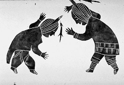
-
Article
Unity
Unity, Sask, incorporated as a town in 1919, population 2389 (2011c), 2147 (2006c). The Town of Unity is located in west-central Saskatchewan 70 km southwest of North Battleford. Settlement in the area commenced in 1904 and the
"https://thecanadianencyclopedia.ca/images/tce_placeholder.jpg?v=e9dca980c9bdb3aa11e832e7ea94f5d9" // resources/views/front/categories/view.blade.php
https://thecanadianencyclopedia.ca/images/tce_placeholder.jpg?v=e9dca980c9bdb3aa11e832e7ea94f5d9
-
Article
Upper Island Cove
Upper Island Cove, NL, incorporated as a town in 1965, population 1594 (2011c), 1667 (2006c). The Town of Upper Island Cove was created when two communities (Upper Island Cove and Spoon Cove) amalgamated. The town is located north of SPANIARD'S BAY on the northwest side of CONCEPTION BAY.
"https://thecanadianencyclopedia.ca/images/tce_placeholder.jpg?v=e9dca980c9bdb3aa11e832e7ea94f5d9" // resources/views/front/categories/view.blade.php
https://thecanadianencyclopedia.ca/images/tce_placeholder.jpg?v=e9dca980c9bdb3aa11e832e7ea94f5d9
-
Article
Upper Liard
Upper Liard, Yukon, settlement, population 125 (2016 census), 132 (2011 census). Upper Liard is located 7 km west of Watson Lake on the Alaska Highway.
"https://thecanadianencyclopedia.ca/images/tce_placeholder.jpg?v=e9dca980c9bdb3aa11e832e7ea94f5d9" // resources/views/front/categories/view.blade.php
https://thecanadianencyclopedia.ca/images/tce_placeholder.jpg?v=e9dca980c9bdb3aa11e832e7ea94f5d9
-
Article
Uranium City
Uranium City, Saskatchewan, northern settlement, population 91 (2021 census), 73 (2016 census). Uranium City is located about 50 km south of the provincial boundary with the Northwest Territories and 75 km east of the Saskatchewan-Alberta border.
"https://d3d0lqu00lnqvz.cloudfront.net/media/new_article_images/UraniumCity/Uranium_City.jpg" // resources/views/front/categories/view.blade.php
https://d3d0lqu00lnqvz.cloudfront.net/media/new_article_images/UraniumCity/Uranium_City.jpg
-
Article
Uummannarjuaq (Blacklead Island)
Uummannarjuaq, which means "like a big sea mammal's heart," had long been an Inuit seasonal campsite. The island attracted whalers because of its strategic location close to the floe edge--the boundary between shore ice and open water where the spring whale hunt took place.
"https://d3d0lqu00lnqvz.cloudfront.net/media/media/a5369db6-95c2-4ab9-8742-29a706a34177.jpg" // resources/views/front/categories/view.blade.php
https://d3d0lqu00lnqvz.cloudfront.net/media/media/a5369db6-95c2-4ab9-8742-29a706a34177.jpg
-
Article
Uxbridge
Uxbridge, Ontario, incorporated as a township in 1974, population 21,176 (2016 census), 20,623 (2011 census). The township of Uxbridge is located 68 km northeast of Toronto on Highway 47. The town of Uxbridge was amalgamated in 1974 with the townships of Scott and Uxbridge to form a new township in the Regional Municipality of Durham.
"https://thecanadianencyclopedia.ca/images/tce_placeholder.jpg?v=e9dca980c9bdb3aa11e832e7ea94f5d9" // resources/views/front/categories/view.blade.php
https://thecanadianencyclopedia.ca/images/tce_placeholder.jpg?v=e9dca980c9bdb3aa11e832e7ea94f5d9
-
Article
Val-Bélair
The name Bélair stems back to the original seigneury granted to Guillaume Bonhomme in 1682 by Governor Joseph-Antoine Le Febvre de La Barre and Intendant Jacques de Meulles. In a 1733 census the seigneury was designated as "the fief commonly referred to as Bélair or Bonhomme.
"https://thecanadianencyclopedia.ca/images/tce_placeholder.jpg?v=e9dca980c9bdb3aa11e832e7ea94f5d9" // resources/views/front/categories/view.blade.php
https://thecanadianencyclopedia.ca/images/tce_placeholder.jpg?v=e9dca980c9bdb3aa11e832e7ea94f5d9
-
Article
Val-des-Monts
Val-des-Monts, Qué, Municipality, pop 7842 (2001c), 7231 (1996c), 5551 (1991c), area 435.57 km2, inc 1975 following the legislative amalgamation of the municipalities of Wakefield-Partie-Est, Portland-Ouest and Perkins, is located about 20 km northeast of HULL on the north bank of the OTTAWA RIVER.
"https://thecanadianencyclopedia.ca/images/tce_placeholder.jpg?v=e9dca980c9bdb3aa11e832e7ea94f5d9" // resources/views/front/categories/view.blade.php
https://thecanadianencyclopedia.ca/images/tce_placeholder.jpg?v=e9dca980c9bdb3aa11e832e7ea94f5d9
-
Article
Val-d'Or
Val-d'Or, Quebec, incorporated as a city in 1968, population 32,752 (2021 census), 32,491 (2016 census). Val-d'Or is located 95 km southeast of Rouyn-Noranda in northwestern Quebec's Abitibi-Témiscamingue region. The town is near the source of the Harricana River, one of the major rivers flowing north to James Bay. Val-d’Or’s name is linked to the gold rush, second in scale only to the Klondike, which took the area by storm in the mid-1930s. (See Gold Rushes in Canada.)
"https://thecanadianencyclopedia.ca/images/tce_placeholder.jpg?v=e9dca980c9bdb3aa11e832e7ea94f5d9" // resources/views/front/categories/view.blade.php
https://thecanadianencyclopedia.ca/images/tce_placeholder.jpg?v=e9dca980c9bdb3aa11e832e7ea94f5d9
-
Article
Valley East
Valley East was formed by the amalgamation of 3 agricultural and rural townships: Hanmer (founded in 1904), Capreol and Blezard (both founded in 1906). Capreol was annexed to Hanmer in 1967 and Hanmer and Blezard amalgamated in 1969 to form the township of Valley East.
"https://thecanadianencyclopedia.ca/images/tce_placeholder.jpg?v=e9dca980c9bdb3aa11e832e7ea94f5d9" // resources/views/front/categories/view.blade.php
https://thecanadianencyclopedia.ca/images/tce_placeholder.jpg?v=e9dca980c9bdb3aa11e832e7ea94f5d9
-
Article
Valleyview
Valleyview, Alta, incorporated as a village in 1954 and as a town in 1957, population 1761 (2011c), 1725 (2006c). The Town of Valleyview is located 105 km east of GRANDE PRAIRIE. The first homesteaders took up land in the area in the late 1910s and the district was called Red Willow.
"https://thecanadianencyclopedia.ca/images/tce_placeholder.jpg?v=e9dca980c9bdb3aa11e832e7ea94f5d9" // resources/views/front/categories/view.blade.php
https://thecanadianencyclopedia.ca/images/tce_placeholder.jpg?v=e9dca980c9bdb3aa11e832e7ea94f5d9