
Browse "Cities & Populated Places"
-
Article
Toronto Feature: Distillery District
This article is from our Toronto Feature series. Features from past programs are not updated.
"https://d3d0lqu00lnqvz.cloudfront.net/media/media/231ec5c6-8e66-4cd7-b84c-831c409a56fa.jpg" // resources/views/front/categories/view.blade.php
https://d3d0lqu00lnqvz.cloudfront.net/media/media/231ec5c6-8e66-4cd7-b84c-831c409a56fa.jpg
-
Article
Toronto Feature: Guildwood Village
This article is from our Toronto Feature series. Features from past programs are not updated.
"https://d3d0lqu00lnqvz.cloudfront.net/media/media/afe6745c-c800-43a2-aaed-a439c109d69b.jpg" // resources/views/front/categories/view.blade.php
https://d3d0lqu00lnqvz.cloudfront.net/media/media/afe6745c-c800-43a2-aaed-a439c109d69b.jpg
-
Article
Toronto Feature: Huron-Wendat Village
This article is from our Toronto Feature series. Features from past programs are not updated.
"https://d3d0lqu00lnqvz.cloudfront.net/media/media/b26f0658-9c91-4722-b371-4bbe28799d26.jpg" // resources/views/front/categories/view.blade.php
https://d3d0lqu00lnqvz.cloudfront.net/media/media/b26f0658-9c91-4722-b371-4bbe28799d26.jpg
-
Article
Toronto Feature: Junction Shul
This article is from our Toronto Feature series. Features from past programs are not updated.
"https://d3d0lqu00lnqvz.cloudfront.net/media/media/eb6c492c-f87b-4684-bc04-04206d289ff1.jpg" // resources/views/front/categories/view.blade.php
https://d3d0lqu00lnqvz.cloudfront.net/media/media/eb6c492c-f87b-4684-bc04-04206d289ff1.jpg
-
Article
Toronto Feature: Little Italy
This article is from our Toronto Feature series. Features from past programs are not updated.
"https://thecanadianencyclopedia.ca/images/tce_placeholder.jpg?v=e9dca980c9bdb3aa11e832e7ea94f5d9" // resources/views/front/categories/view.blade.php
https://thecanadianencyclopedia.ca/images/tce_placeholder.jpg?v=e9dca980c9bdb3aa11e832e7ea94f5d9
-
Article
Toronto Feature: Little Malta
This article is from our Toronto Feature series. Features from past programs are not updated.
"https://d3d0lqu00lnqvz.cloudfront.net/media/media/3a340382-6002-4010-854c-44f2d39d9d8a.jpg" // resources/views/front/categories/view.blade.php
https://d3d0lqu00lnqvz.cloudfront.net/media/media/3a340382-6002-4010-854c-44f2d39d9d8a.jpg
-
Article
Toronto Feature: Teiaiagon Seneca Village
This article is from our Toronto Feature series. Features from past programs are not updated.
"https://d3d0lqu00lnqvz.cloudfront.net/media/media/acf73148-da70-4849-b57e-5d65525fa9c7.jpg" // resources/views/front/categories/view.blade.php
https://d3d0lqu00lnqvz.cloudfront.net/media/media/acf73148-da70-4849-b57e-5d65525fa9c7.jpg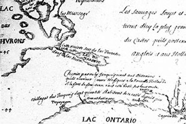
-
Article
Toronto Feature: The Ward
This article is from our Toronto Feature series. Features from past programs are not updated.
"https://d3d0lqu00lnqvz.cloudfront.net/media/media/86faacaa-b2ad-4ac8-990c-6ad4b0aaa1a9.jpg" // resources/views/front/categories/view.blade.php
https://d3d0lqu00lnqvz.cloudfront.net/media/media/86faacaa-b2ad-4ac8-990c-6ad4b0aaa1a9.jpg
-
Article
Tracadie-Sheila
Tracadie-Sheila, NB, incorporated as a town in 1992, population 4933 (2011c), 4479 (2006c). The Town of Tracadie-Sheila is situated on the Gulf of ST LAWRENCE, 83 km southeast of BATHURST.
"https://thecanadianencyclopedia.ca/images/tce_placeholder.jpg?v=e9dca980c9bdb3aa11e832e7ea94f5d9" // resources/views/front/categories/view.blade.php
https://thecanadianencyclopedia.ca/images/tce_placeholder.jpg?v=e9dca980c9bdb3aa11e832e7ea94f5d9
-
Article
Trenton (NS)
Trenton, NS, incorporated as a town in 1911, population 2616 (2011c), 2741 (2006c). The Town of Trenton is located on the East River, immediately adjacent to New Glasgow.
"https://thecanadianencyclopedia.ca/images/tce_placeholder.jpg?v=e9dca980c9bdb3aa11e832e7ea94f5d9" // resources/views/front/categories/view.blade.php
https://thecanadianencyclopedia.ca/images/tce_placeholder.jpg?v=e9dca980c9bdb3aa11e832e7ea94f5d9
-
Article
Trinity
Trinity, NL, incorporated as a town in 1997, population 137 (2011c), 191 (2006c). The Town of Trinity is located on TRINITY BAY in northeast Newfoundland.
"https://d3d0lqu00lnqvz.cloudfront.net/media/media/58774878-3d11-4ee2-9eb0-03b03dad0d66.jpg" // resources/views/front/categories/view.blade.php
https://d3d0lqu00lnqvz.cloudfront.net/media/media/58774878-3d11-4ee2-9eb0-03b03dad0d66.jpg
-
Article
Trois-Rivières
Trois-Rivières, Quebec, incorporated as a city in 1857, population 139,163 (2021 census), 134,413 (2016 census). The city is located at the mouth of the Saint-Maurice River, on the north shore of the St. Lawrence, midway between Quebec City and Montreal and is the regional capital of Quebec's Mauricie region. Its name derives from the 3-armed delta formed by the river's islands at its mouth.
"https://d3d0lqu00lnqvz.cloudfront.net/media/media/f64e6118-f564-4f2e-aee3-8d7194dda785.jpg" // resources/views/front/categories/view.blade.php
https://d3d0lqu00lnqvz.cloudfront.net/media/media/f64e6118-f564-4f2e-aee3-8d7194dda785.jpg
-
Article
Tsiigehtchic
Tsiigehtchic, Northwest Territories, population 187 (2019). Tsiigehtchic is located at the confluence of the Mackenzie and Arctic Red rivers. It is home to the Gwichya Gwich’in First Nation (“people of the flat lands”) who speak an Athapaskan language (see Indigenous Languages in Canada). Formerly known as Arctic Red River, the community’s name was changed to Tsiigehtchic (“at the mouth of iron river”) in 1994. The community is on the Dempster Highway. It is accessible by summer ferry across the Mackenzie River and in winter by ice road. Tsiigehtchic is one of four communities in the Gwich’in Settlement Region. The region is an area created by the Gwich’in Comprehensive Land Claim Agreement (1992). The other three communities in the region are Aklavik, Fort McPherson and Inuvik. (See also Dinjii Zhuh (Gwich'in).)
"https://d3d0lqu00lnqvz.cloudfront.net/media/new_article_images/Tsiigehtchic/River.jpg" // resources/views/front/categories/view.blade.php
https://d3d0lqu00lnqvz.cloudfront.net/media/new_article_images/Tsiigehtchic/River.jpg
-
"https://thecanadianencyclopedia.ca/images/tce_placeholder.jpg?v=e9dca980c9bdb3aa11e832e7ea94f5d9" // resources/views/front/categories/view.blade.php
https://thecanadianencyclopedia.ca/images/tce_placeholder.jpg?v=e9dca980c9bdb3aa11e832e7ea94f5d9
-
Article
Tungsten (NWT)
Tungsten, NWT, was a settlement located in the Selwyn Mountains, near the NWT and Yukon border.
"https://thecanadianencyclopedia.ca/images/tce_placeholder.jpg?v=e9dca980c9bdb3aa11e832e7ea94f5d9" // resources/views/front/categories/view.blade.php
https://thecanadianencyclopedia.ca/images/tce_placeholder.jpg?v=e9dca980c9bdb3aa11e832e7ea94f5d9