
Browse "Cities & Populated Places"
-
Article
St Alban's
St. Alban's, NL, incorporated as a town in 1964, population 1233 (2011c), 1278 (2006c). The Town of St Alban's is located at the mouth of Bay D'Espoir on the south coast of Newfoundland.
"https://d3d0lqu00lnqvz.cloudfront.net/media/media/b429c854-8e79-4688-9843-8158c819faa1.jpg" // resources/views/front/categories/view.blade.php
https://d3d0lqu00lnqvz.cloudfront.net/media/media/b429c854-8e79-4688-9843-8158c819faa1.jpg
-
Article
St Albert
St Albert, Alta, incorporated as a city in 1977, population 61 466 (2011c), 57 764 (2006c). The City of St Albert is located along the northwestern city boundary of EDMONTON.
"https://d3d0lqu00lnqvz.cloudfront.net/media/media/d0a2938b-4548-4d63-8063-2fa2e8a1b54e.jpg" // resources/views/front/categories/view.blade.php
https://d3d0lqu00lnqvz.cloudfront.net/media/media/d0a2938b-4548-4d63-8063-2fa2e8a1b54e.jpg
-
Article
St Andrews (Man)
St Andrews, Manitoba, incorporated as a rural municipality in 1880, population 11 875 (2011c), 11 359 (2006c). The Rural Municipality of St Andrews stretches from a boundary 8 km north of WINNIPEG to Winnipeg Beach and Netley Marsh at the southern tip of Lake Winnipeg.
"https://thecanadianencyclopedia.ca/images/tce_placeholder.jpg?v=e9dca980c9bdb3aa11e832e7ea94f5d9" // resources/views/front/categories/view.blade.php
https://thecanadianencyclopedia.ca/images/tce_placeholder.jpg?v=e9dca980c9bdb3aa11e832e7ea94f5d9
-
Article
St Anthony
St Anthony, NL, incorporated as a town in 1945, population 2418 (2011c), 2476 (2006c). The Town of St Anthony is located near the top of the Northern Peninsula.
"https://thecanadianencyclopedia.ca/images/tce_placeholder.jpg?v=e9dca980c9bdb3aa11e832e7ea94f5d9" // resources/views/front/categories/view.blade.php
https://thecanadianencyclopedia.ca/images/tce_placeholder.jpg?v=e9dca980c9bdb3aa11e832e7ea94f5d9
-
Article
St Boniface
St. Boniface, Manitoba, incorporated as a town in 1883 and a city in 1908, now one of 15 wards in the city of Winnipeg, population 46,035 (2016 census). St. Boniface is located on the banks of the Red and Seine rivers in eastern Winnipeg. One councillor represents St. Boniface on Winnipeg City Council. As one of the larger French communities outside Quebec, it has often been at the centre of struggles to preserve French language and identity within Manitoba.
"https://d3d0lqu00lnqvz.cloudfront.net/media/media/ef9365db-3cb4-4ed6-aa76-73e4674169b4.jpg" // resources/views/front/categories/view.blade.php
https://d3d0lqu00lnqvz.cloudfront.net/media/media/ef9365db-3cb4-4ed6-aa76-73e4674169b4.jpg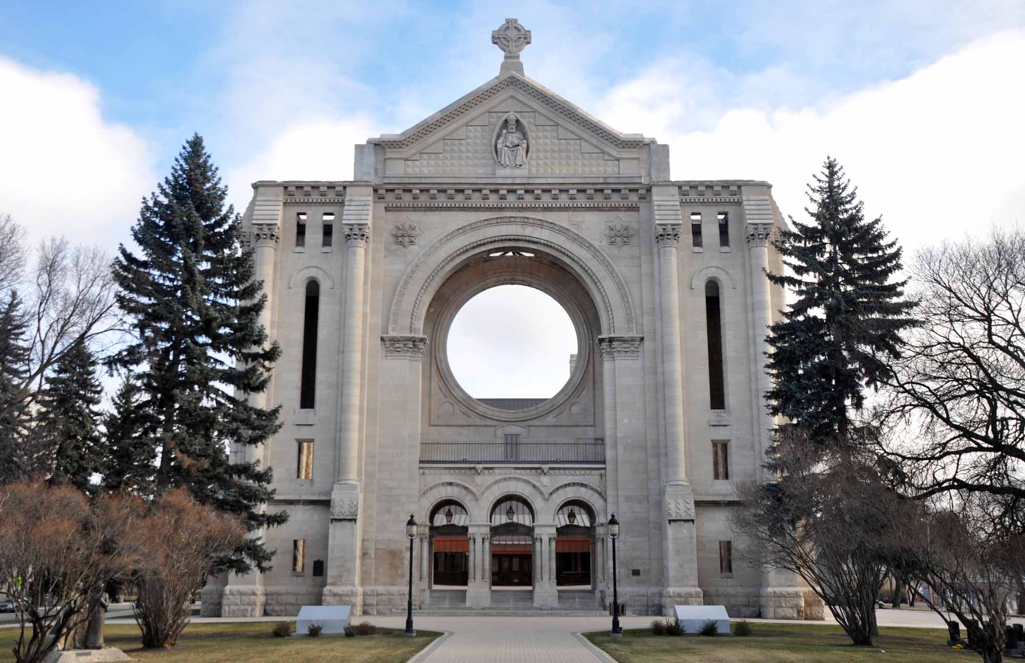
-
Article
St. Catharines
St. Catharines, ON, incorporated as a city in 1876, population 136,803 (2021 census), 133,113 (2016 census). The City of St. Catharines is the principal city of the Niagara Region. It lies south of Toronto across Lake Ontario (111 km by the Queen Elizabeth Way), 19 km inland from the international boundary with the United States, along the Niagara River. The city is named after Catharine Hamilton, wife of Robert Hamilton, an influential merchant of Queenston and a landowner with mills on Twelve Mile Creek; the growing community, then known as The Twelve or Shipman's Corners, was renamed in her honour after her death in 1796. After 1876, as the urban area of St. Catharines expanded, it was permitted to annex parts of the surrounding Grantham Township, culminating in 1961 in the complete amalgamation of the township as well as the adjacent towns of Merritton and Port Dalhousie. In 1970, the rural township of Louth to the west was split between St. Catharines and the new town of Lincoln.
"https://d3d0lqu00lnqvz.cloudfront.net/media/media/0b59b887-a76a-4eea-9406-10f64badd85e.jpg" // resources/views/front/categories/view.blade.php
https://d3d0lqu00lnqvz.cloudfront.net/media/media/0b59b887-a76a-4eea-9406-10f64badd85e.jpg
-
Article
St George's
St George's, NL, incorporated as a town in 1965, population 1207 (2011c), 1246 (2006c). The Town of St George's is located on the southeast side of St George's Bay, on the west coast of Newfoundland.
"https://thecanadianencyclopedia.ca/images/tce_placeholder.jpg?v=e9dca980c9bdb3aa11e832e7ea94f5d9" // resources/views/front/categories/view.blade.php
https://thecanadianencyclopedia.ca/images/tce_placeholder.jpg?v=e9dca980c9bdb3aa11e832e7ea94f5d9
-
Article
St Hubert Mission
St Hubert MissionSt Hubert Mission, located some 16 km SW of Whitewood, Sask, originated from the settlement of a group of titled French and Belgian nobility that apparently sought to escape from adverse changes undermining their way of life in Europe and to transplant the Old World traditions of French noblesse oblige. In the mid-1880s the representative of a wealthy Frenchman bought land in the area and commenced farming operations. His home, called La Rolanderie,...
"https://thecanadianencyclopedia.ca/images/tce_placeholder.jpg?v=e9dca980c9bdb3aa11e832e7ea94f5d9" // resources/views/front/categories/view.blade.php
https://thecanadianencyclopedia.ca/images/tce_placeholder.jpg?v=e9dca980c9bdb3aa11e832e7ea94f5d9
-
Article
St. Jacobs
St. Jacobs, ON, established as a Police Village in 1904 and dissolved as such in 1972 under the Regional Municipality of Waterloo Act (1972), population 1,891 (2011c), 1,597 (2006c).
"https://d3d0lqu00lnqvz.cloudfront.net/media/media/019c8ee4-7bf6-4277-84a6-04025bd7a60e.jpg" // resources/views/front/categories/view.blade.php
https://d3d0lqu00lnqvz.cloudfront.net/media/media/019c8ee4-7bf6-4277-84a6-04025bd7a60e.jpg
-
Article
St. John's
St. John's, NL, incorporated as a city in 1921, population 110,525 (2021 census), 108,860 (2016 census). The capital and largest city of Newfoundland and Labrador, the city of St. John's is located on the eastern side of the Avalon Peninsula of southeast Newfoundland. Its landlocked harbour is approached through a long, narrow channel and is protected by the high hills on which the city is built. The origin of the name St. John's is not known, but its use appears on a Portuguese map by Pedro Reinel (1516–20) as "Rio de San Johem" and later, in a 1527 letter by the English seaman John Rut, as the "Haven of St. John's." According to popular folklore, however, the city takes its name from the feast of Saint John the Baptist and the arrival of Italian explorer Giovanni Caboto (John Cabot) on the shores of Newfoundland on 24 June 1497.
"https://d3d0lqu00lnqvz.cloudfront.net/media/media/fa98a7ea-65f5-47f6-9d63-252242142821.jpg" // resources/views/front/categories/view.blade.php
https://d3d0lqu00lnqvz.cloudfront.net/media/media/fa98a7ea-65f5-47f6-9d63-252242142821.jpg
-
Article
St Lawrence
St Lawrence, NL, incorporated as a town in 1949, population 1244 (2011c), 1349 (2006c). The Town of St Lawrence is located in the southeast corner of Newfoundland on the Burin Peninsula.
"https://d3d0lqu00lnqvz.cloudfront.net/media/media/b7a47460-85e0-4234-bcc2-659dcd61fad9.jpg" // resources/views/front/categories/view.blade.php
https://d3d0lqu00lnqvz.cloudfront.net/media/media/b7a47460-85e0-4234-bcc2-659dcd61fad9.jpg
-
Article
St. Margarets Bay
St. Margarets Bay, 70 km2, is a small inlet of the Atlantic Ocean on the SE coast of Nova Scotia, 40 km W of HALIFAX. It is a favourite summer resort area, noted especially for its relatively warm surface water, sandy beaches and ideal sailing conditions for small craft.
"https://thecanadianencyclopedia.ca/images/tce_placeholder.jpg?v=e9dca980c9bdb3aa11e832e7ea94f5d9" // resources/views/front/categories/view.blade.php
https://thecanadianencyclopedia.ca/images/tce_placeholder.jpg?v=e9dca980c9bdb3aa11e832e7ea94f5d9
-
Article
St Marys
The CANADA COMPANY had the area surveyed in 1839. The first settlers were attracted to the community in the 1840s because its location on the banks of the 2 watercourses meant water power to run various mills.
"https://thecanadianencyclopedia.ca/images/tce_placeholder.jpg?v=e9dca980c9bdb3aa11e832e7ea94f5d9" // resources/views/front/categories/view.blade.php
https://thecanadianencyclopedia.ca/images/tce_placeholder.jpg?v=e9dca980c9bdb3aa11e832e7ea94f5d9
-
Article
St. Paul
St. Paul, Alberta, incorporated as a town in 1936, population 5,827 (2016 census), 5,405 (2011 census). The town of St. Paul, county seat for the county of St. Paul, is located on the north shore of Upper Thérien Lake, about 200 km northeast of Edmonton.
"https://d3d0lqu00lnqvz.cloudfront.net/media/media/d98dfd00-9c91-4c5d-bdbe-d68a2a98ce2e.jpg" // resources/views/front/categories/view.blade.php
https://d3d0lqu00lnqvz.cloudfront.net/media/media/d98dfd00-9c91-4c5d-bdbe-d68a2a98ce2e.jpg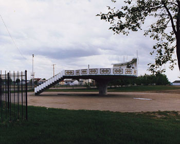
-
Article
St Peter's
St Peter's, NS, incorporated as a village in, inc 1940. St Peter's is situated between St Peter's Inlet and St Peter's Bay on the south shore of Cape Breton Island.
"https://thecanadianencyclopedia.ca/images/tce_placeholder.jpg?v=e9dca980c9bdb3aa11e832e7ea94f5d9" // resources/views/front/categories/view.blade.php
https://thecanadianencyclopedia.ca/images/tce_placeholder.jpg?v=e9dca980c9bdb3aa11e832e7ea94f5d9