
Browse "Cities & Populated Places"
-
Article
Shediac
Shediac, NB, incorporated as a town in 1903, population 6053 (2011c), 5497 (2006c). The Town of Shediac is located on Northumberland Strait, 20 km east of MONCTON.
"https://d3d0lqu00lnqvz.cloudfront.net/media/media/79b00de0-c5fb-45bb-845c-10eedba8ac81.jpg" // resources/views/front/categories/view.blade.php
https://d3d0lqu00lnqvz.cloudfront.net/media/media/79b00de0-c5fb-45bb-845c-10eedba8ac81.jpg
-
Article
Shelburne
Shelburne, NS, incorporated as a town in 1907, population 1686 (2011c), 1879 (2006c). The Town of Shelburne, the seat of Shelburne County, is located on Shelburne Harbour 208 km southwest of Halifax.
"https://d3d0lqu00lnqvz.cloudfront.net/media/media/c753ddd6-20d5-44c3-9c7e-80a07b3f6bf1.jpg" // resources/views/front/categories/view.blade.php
https://d3d0lqu00lnqvz.cloudfront.net/media/media/c753ddd6-20d5-44c3-9c7e-80a07b3f6bf1.jpg
-
Article
Shellbrook
Shellbrook is located near the northern edge of agricultural settlement in Saskatchewan. Its first homesteaders did not arrive until the late 19th century. Much of the land was covered by jack pine which had to be cleared before crops could be planted.
"https://d3d0lqu00lnqvz.cloudfront.net/media/media/d89a508e-6a18-4e5d-8dd1-b2e744a7af23.jpg" // resources/views/front/categories/view.blade.php
https://d3d0lqu00lnqvz.cloudfront.net/media/media/d89a508e-6a18-4e5d-8dd1-b2e744a7af23.jpg
-
Article
Sherbrooke Village
Sherbrooke Village in Sherbrooke, NS, is unusual in that it is not a collection of historic buildings moved into a reconstructed townsite, but rather the older portion of the actual village of Sherbrooke.
"https://thecanadianencyclopedia.ca/images/tce_placeholder.jpg?v=e9dca980c9bdb3aa11e832e7ea94f5d9" // resources/views/front/categories/view.blade.php
https://thecanadianencyclopedia.ca/images/tce_placeholder.jpg?v=e9dca980c9bdb3aa11e832e7ea94f5d9
-
Article
Shippagan
Shippagan, NB, incorporated as a town in 1958, population 2603 (2011c), 2754 (2006c). The Town of Shippagan is located at the extreme northeastern point of mainland New Brunswick.
"https://thecanadianencyclopedia.ca/images/tce_placeholder.jpg?v=e9dca980c9bdb3aa11e832e7ea94f5d9" // resources/views/front/categories/view.blade.php
https://thecanadianencyclopedia.ca/images/tce_placeholder.jpg?v=e9dca980c9bdb3aa11e832e7ea94f5d9
-
Article
Sicamous
Sicamous, British Columbia, incorporated as a district municipality in 1989, population 2,429 (2016 census), 2,441 (2011 census). The District of Sicamous is located at the eastern end of Shuswap Lake in south-central British Columbia, 140 km east of Kamloops. It lies to the west of the Monashee Mountains on a narrow strip of land between Shuswap and Mara lakes. Its name derives from a Secwepemc First Nation word meaning “narrow” or “squeezed in the middle.” (See also Interior Salish.)
"https://thecanadianencyclopedia.ca/images/tce_placeholder.jpg?v=e9dca980c9bdb3aa11e832e7ea94f5d9" // resources/views/front/categories/view.blade.php
https://thecanadianencyclopedia.ca/images/tce_placeholder.jpg?v=e9dca980c9bdb3aa11e832e7ea94f5d9
-
Article
Sidney
Sidney, BC, incorporated as a town in 1967, population 11 178 (2011c), 11 315 (2006c). The Town of Sidney is located on the east side of the SAANICH PENINSULA on Vancouver Island, 30 km north of VICTORIA, facing Haro Strait.
"https://thecanadianencyclopedia.ca/images/tce_placeholder.jpg?v=e9dca980c9bdb3aa11e832e7ea94f5d9" // resources/views/front/categories/view.blade.php
https://thecanadianencyclopedia.ca/images/tce_placeholder.jpg?v=e9dca980c9bdb3aa11e832e7ea94f5d9
-
Article
Sillery
Sillery was the first reserve created by Europeans for Aboriginal peoples in what is now Canada. It was established in 1637 near Québec City. It was funded by a French nobleman, Noël Brûlart de Sillery, in response to an advertisement placed by Father Paul Le Jeune in the Jesuit Relations.
"https://d3d0lqu00lnqvz.cloudfront.net/media/media/91a88fee-54b1-44f5-86a7-a19175816c6e.jpg" // resources/views/front/categories/view.blade.php
https://d3d0lqu00lnqvz.cloudfront.net/media/media/91a88fee-54b1-44f5-86a7-a19175816c6e.jpg
-
Article
Sillery (Qué)
Sillery has a grand history dating back to the 17th century. It was the site of Canada's first Indian reserve and Jesuit mission, Sillery, on the edge of the St Lawrence. The reserve was funded by Noël Brulart de Sillery (1577-1640), for whom the town was named.
"https://d3d0lqu00lnqvz.cloudfront.net/media/media/91a88fee-54b1-44f5-86a7-a19175816c6e.jpg" // resources/views/front/categories/view.blade.php
https://d3d0lqu00lnqvz.cloudfront.net/media/media/91a88fee-54b1-44f5-86a7-a19175816c6e.jpg
-
Article
Simcoe
The town of Simcoe, including the nearby hamlet of Hillcrest, was one of 6 area municipalities formed as part of the Regional Municipality of Haldimand-Norfolk in 1974.
"https://thecanadianencyclopedia.ca/images/tce_placeholder.jpg?v=e9dca980c9bdb3aa11e832e7ea94f5d9" // resources/views/front/categories/view.blade.php
https://thecanadianencyclopedia.ca/images/tce_placeholder.jpg?v=e9dca980c9bdb3aa11e832e7ea94f5d9
-
Article
Sioux Narrows-Nestor Falls
Some 500 Ojibwa currently live on the nearby Whitefish Bay Reserve. European settlement dates from the late 1920s, although previously there were numerous lumber camps in the area.
"https://thecanadianencyclopedia.ca/images/tce_placeholder.jpg?v=e9dca980c9bdb3aa11e832e7ea94f5d9" // resources/views/front/categories/view.blade.php
https://thecanadianencyclopedia.ca/images/tce_placeholder.jpg?v=e9dca980c9bdb3aa11e832e7ea94f5d9
-
Article
Slave Lake
Slave Lake, Alberta, incorporated as a town in 1965, population 6,651 (2016 census), 6,782 (2011 census). The town of Slave Lake is about two kilometres from the southeastern shore of Lesser Slave Lake.
"https://d3d0lqu00lnqvz.cloudfront.net/media/media/04d79109-7d09-494b-943b-1d5a62085ec2.jpg" // resources/views/front/categories/view.blade.php
https://d3d0lqu00lnqvz.cloudfront.net/media/media/04d79109-7d09-494b-943b-1d5a62085ec2.jpg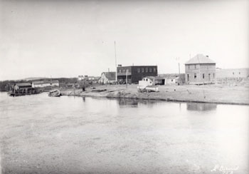
-
Article
Slocan
Slocan, British Columbia, incorporated as a village in 1958, population 272 (2016 census), 296 (2011 census). The village of Slocan is located 70 km by road northwest of Nelson, at the south end of Slocan Lake. Slocan is an Okanagan word meaning “pierce or strike on the head,” referring to the salmon-fishing practice of the Okanagan (see Interior Salish). The community was also known as Slocan City when it was an incorporated city (1901-1958).
"https://d3d0lqu00lnqvz.cloudfront.net/media/media/ade75a0e-66ab-432e-af8e-3566a6dad341.jpg" // resources/views/front/categories/view.blade.php
https://d3d0lqu00lnqvz.cloudfront.net/media/media/ade75a0e-66ab-432e-af8e-3566a6dad341.jpg
-
Article
Smithers
Smithers, British Columbia, incorporated as a town in 1967, population 5,401 (2016 census), 5,404 (2011 census). The town of Smithers is located on the Bulkley River in central BC, on Highway 16. The town is 334 km west of Prince George and 371 km east of Prince Rupert.
"https://thecanadianencyclopedia.ca/images/tce_placeholder.jpg?v=e9dca980c9bdb3aa11e832e7ea94f5d9" // resources/views/front/categories/view.blade.php
https://thecanadianencyclopedia.ca/images/tce_placeholder.jpg?v=e9dca980c9bdb3aa11e832e7ea94f5d9
-
Article
Smiths Falls
Smiths Falls, ON, incorporated as a town in 1882, population 9,254 (2021 census), 8,780 (2016 census). The Town of Smiths Falls is located on the Rideau River, 60 km southwest of Ottawa. The town is an important lockport on the waterway.
"https://thecanadianencyclopedia.ca/images/tce_placeholder.jpg?v=e9dca980c9bdb3aa11e832e7ea94f5d9" // resources/views/front/categories/view.blade.php
https://thecanadianencyclopedia.ca/images/tce_placeholder.jpg?v=e9dca980c9bdb3aa11e832e7ea94f5d9