
Browse "Cities & Populated Places"
-
Article
Port Hawkesbury
Some farming and a local forest industry supported the livelihood of the dominant Scottish population. As an early 19th-century ferry terminus and later a railway centre, the town suffered the loss of these activities from the building of the Canso Causeway in the mid-1950s at nearby Port Hastings.
"https://thecanadianencyclopedia.ca/images/tce_placeholder.jpg?v=e9dca980c9bdb3aa11e832e7ea94f5d9" // resources/views/front/categories/view.blade.php
https://thecanadianencyclopedia.ca/images/tce_placeholder.jpg?v=e9dca980c9bdb3aa11e832e7ea94f5d9
-
Article
Port Hope
Long a manufacturing and regional commercial centre, Port Hope's main street is one of the best preserved from late 19th-century Ontario. It is now a centre for uranium refining and the manufacture of machinery, tools, plastics and rubber.
"https://thecanadianencyclopedia.ca/images/tce_placeholder.jpg?v=e9dca980c9bdb3aa11e832e7ea94f5d9" // resources/views/front/categories/view.blade.php
https://thecanadianencyclopedia.ca/images/tce_placeholder.jpg?v=e9dca980c9bdb3aa11e832e7ea94f5d9
-
Article
Port McNeill
Port McNeill, BC, incorporated as a town in 1984, population 2505 (2011c), 2623 (2006c). The Town of Port McNeill is located on the northeast coast of VANCOUVER ISLAND on Broughton Strait, 200 km northwest of CAMPBELL RIVER.
"https://d3d0lqu00lnqvz.cloudfront.net/media/media/af04bfbb-be18-40ef-869d-accbd98f0e3a.jpg" // resources/views/front/categories/view.blade.php
https://d3d0lqu00lnqvz.cloudfront.net/media/media/af04bfbb-be18-40ef-869d-accbd98f0e3a.jpg
-
Article
Port Moody
Port Moody, British Columbia, incorporated as a city in 1913, population 33,535 (2021 census), 33,551 (2016 census). The City of Port Moody lies at the head of Burrard Inlet, 20 km east of Vancouver. It is a member of the Metro Vancouver Regional District and part of the Tri-Cities with Coquitlam and Port Coquitlam.
"https://thecanadianencyclopedia.ca/images/tce_placeholder.jpg?v=e9dca980c9bdb3aa11e832e7ea94f5d9" // resources/views/front/categories/view.blade.php
https://thecanadianencyclopedia.ca/images/tce_placeholder.jpg?v=e9dca980c9bdb3aa11e832e7ea94f5d9
-
Article
Portage la Prairie
Portage la Prairie, MB, incorporated as a city in 1907, population 13,270 (2021 census), 13,304 (2016 census). The city of Portage la Prairie, located 70 km west of Winnipeg, is an important regional service centre for the flat but highly fertile soils of the surrounding Portage Plains.
"https://d3d0lqu00lnqvz.cloudfront.net/media/media/7ab1a35a-234d-430c-8104-7c6abb2bd760.jpg" // resources/views/front/categories/view.blade.php
https://d3d0lqu00lnqvz.cloudfront.net/media/media/7ab1a35a-234d-430c-8104-7c6abb2bd760.jpg
-
Article
Portugal Cove-St Philip's
Portugal Cove-St Philip's, NL, incorporated as a town in 1992, population 7366 (2011c), 6575 (2006c). The Town of Portugal Cove-St Philip's is the result of the amalgamation of three former towns, Portugal Cove, St Philip's and Hogan's Pond, and the lands surrounding the communities.
"https://d3d0lqu00lnqvz.cloudfront.net/media/media/34e9289b-f9b0-47de-b85f-c55b822d3f93.jpg" // resources/views/front/categories/view.blade.php
https://d3d0lqu00lnqvz.cloudfront.net/media/media/34e9289b-f9b0-47de-b85f-c55b822d3f93.jpg
-
Article
Pouce Coupe
Pouce Coupe, British Columbia, incorporated as a village in 1932, population 792 (2016 census), 738 (2011 census). The village of Pouce Coupe is located 6 km southeast of Dawson Creek on the highway and freight railway between there and Grande Prairie, Alberta. Its name likely comes from that of a Dane-zaa chief, Pooscapee, which early voyageurs rendered into the French name Pouce Coupé (Cut Thumb).
"https://thecanadianencyclopedia.ca/images/tce_placeholder.jpg?v=e9dca980c9bdb3aa11e832e7ea94f5d9" // resources/views/front/categories/view.blade.php
https://thecanadianencyclopedia.ca/images/tce_placeholder.jpg?v=e9dca980c9bdb3aa11e832e7ea94f5d9
-
Article
Pouch Cove
Pouch Cove, NL, incorporated as a town in 1970, population 1866 (2011c), 1756 (2006c). The Town of Pouch Cove is located about 25 km north of ST JOHN'S near Cape St Francis.
"https://thecanadianencyclopedia.ca/images/tce_placeholder.jpg?v=e9dca980c9bdb3aa11e832e7ea94f5d9" // resources/views/front/categories/view.blade.php
https://thecanadianencyclopedia.ca/images/tce_placeholder.jpg?v=e9dca980c9bdb3aa11e832e7ea94f5d9
-
Article
Powell River
Powell River, BC, incorporated as a city in 2005, population 13,943 (2021 census), 13,157 (2016 census). The City of Powell River is located on the east side of the Strait of Georgia, 133 km northwest of Vancouver. It is bounded on the east by the Smith Mountain Range, Powell Lake and Haslam Lake. The city enjoys a mild climate year-round, moderated by the warm current of the strait. It takes its name from the river draining Powell Lake, which was named for Israel Wood Powell, British Columbia’s superintendent of Indian affairs in the 1880s.
"https://thecanadianencyclopedia.ca/images/tce_placeholder.jpg?v=e9dca980c9bdb3aa11e832e7ea94f5d9" // resources/views/front/categories/view.blade.php
https://thecanadianencyclopedia.ca/images/tce_placeholder.jpg?v=e9dca980c9bdb3aa11e832e7ea94f5d9
-
Article
History of Settlement in the Canadian Prairies
The Canadian Prairies were peopled in six great waves of migration, spanning from prehistory to the present. The migration from Asia, about 13,300 years ago, produced an Indigenous population of 20,000 to 50,000 by about 1640. Between 1640 and 1840, several thousand European and Canadian fur traders arrived, followed by several hundred British immigrants. They created dozens of small outposts and a settlement in the Red River Colony, where the Métis became the largest part of the population. The third wave, from the 1840s to the 1890s, consisted mainly but not solely of Canadians of British heritage. The fourth and by far the largest wave was drawn from many nations, mostly European. It occurred from 1897 to 1929, with a pause (1914–22) during and after the First World War. The fifth wave, drawn from other Canadian provinces and from Europe and elsewhere, commenced in the late 1940s. It lasted through the 1960s. The sixth wave, beginning in the 1970s, drew especially upon peoples of the southern hemisphere. It has continued, with fluctuations, to the present. Throughout the last century, the region has also steadily lost residents, as a result of migration to other parts of Canada, to the United States, and elsewhere.
"https://d3d0lqu00lnqvz.cloudfront.net/media/media/e1c671ab-3dcf-459c-b108-0bc6e4a86b99.jpg" // resources/views/front/categories/view.blade.php
https://d3d0lqu00lnqvz.cloudfront.net/media/media/e1c671ab-3dcf-459c-b108-0bc6e4a86b99.jpg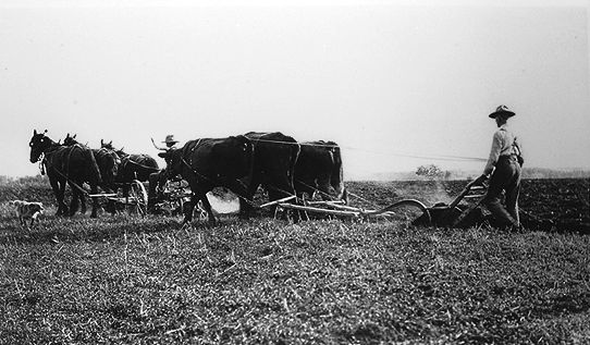
-
Article
Première Nation des Pekuakamiulnuatsh
Première Nation des Pekuakamiulnuatsh is located in Quebec about 6 km north of Roberval on the western shore of Lac Saint-Jean. Prior to being declared a reserve as part of the Indian Act, the First Nation called their land Mashteuiatsh, which means “where there is a point.” Mashteuiatsh was a common meeting place due to its location along the banks of the Pekuakami. The primary languages of the First Nation are Nehlueun and French. Première...
"https://thecanadianencyclopedia.ca/images/tce_placeholder.jpg?v=e9dca980c9bdb3aa11e832e7ea94f5d9" // resources/views/front/categories/view.blade.php
https://thecanadianencyclopedia.ca/images/tce_placeholder.jpg?v=e9dca980c9bdb3aa11e832e7ea94f5d9
-
Article
Prince Albert
Prince Albert, SK, incorporated as a city in 1904, population 37,756 (2021 census), 35,926 (2016 census). The City of Prince Albert is located on the south shore of the North Saskatchewan River near the geographical centre of the province. As Saskatchewan's "Gateway to the North," open prairie lies to the south of the city and lakes and forests to the north. Prince Albert is Saskatchewan's third largest city.
"https://d3d0lqu00lnqvz.cloudfront.net/media/media/7a806eea-b539-4379-a058-0e45dabd0fe2.jpg" // resources/views/front/categories/view.blade.php
https://d3d0lqu00lnqvz.cloudfront.net/media/media/7a806eea-b539-4379-a058-0e45dabd0fe2.jpg
-
Article
Prince George
Prince George, British Columbia, incorporated as a city in 1915, population 76,708 (2021 census), 74,003 (2016 census). Prince George is the largest city in the northern part of the province. It is situated in the geographical centre of British Columbia at the junction of the Nechako and Fraser rivers. Prince George was founded on the traditional territory of the Lheidli T'enneh, a sub-group of the Dakelh or Carrier Dene. The Dakelh aided Alexander Mackenzie on his journey to the Pacific coast in 1793.
"https://d3d0lqu00lnqvz.cloudfront.net/media/media/5cada4a2-0076-4515-b8d0-dfad91ba5c9a.jpg" // resources/views/front/categories/view.blade.php
https://d3d0lqu00lnqvz.cloudfront.net/media/media/5cada4a2-0076-4515-b8d0-dfad91ba5c9a.jpg
-
Article
Prince Rupert
Prince Rupert, BC, incorporated as a city in 1910, population 12,300 (2021 census), 12,220 (2016 census). The City of Prince Rupert is located on Kaien Island, at the mouth of the Skeena River in the Coast Mountains of British Columbia. It is Canada's wettest city, with an average of 2,619 mm of precipitation falling each year. Prince Rupert marks western end of the Yellowhead Trans-Canada Highway and, as Canada's deepest ice-free seaport, a link between the lower United States, Vancouver and Alaska (see also Iconic Highways in Canada). For these reasons it is the industrial, commercial and institutional centre for BC's Northwest Coast.
"https://d3d0lqu00lnqvz.cloudfront.net/media/media/adb7f8d5-a8d7-465c-8567-2d8d0de2e468.jpg" // resources/views/front/categories/view.blade.php
https://d3d0lqu00lnqvz.cloudfront.net/media/media/adb7f8d5-a8d7-465c-8567-2d8d0de2e468.jpg
-
Article
Princeton
Princeton, BC, incorporated as a town in 1978, population 2724 (2011c), 2780 (2006c). The Town of Princeton is located at the junction of the Tulameen and Similkameen rivers, 114 km west of PENTICTON.
"https://thecanadianencyclopedia.ca/images/tce_placeholder.jpg?v=e9dca980c9bdb3aa11e832e7ea94f5d9" // resources/views/front/categories/view.blade.php
https://thecanadianencyclopedia.ca/images/tce_placeholder.jpg?v=e9dca980c9bdb3aa11e832e7ea94f5d9