
Browse "Cities & Populated Places"
-
Article
North Saanich
North Saanich, BC, incorporated as a district municipality in 1965, population 11 089 (2011c), 10 823 (2006c). The District of North Saanich is one of three district municipalities on the Saanich Peninsula about 27 km north of Victoria.
"https://d3d0lqu00lnqvz.cloudfront.net/media/media/dee732ba-3897-4661-8537-d19601c1bfee.jpg" // resources/views/front/categories/view.blade.php
https://d3d0lqu00lnqvz.cloudfront.net/media/media/dee732ba-3897-4661-8537-d19601c1bfee.jpg
-
Article
North Vancouver
North Vancouver, British Columbia, incorporated as a district in 1891, population 85,935 (2016 census), 84,412 (2011 census); also, a separate entity incorporated as a city in 1907, population 52,898 (2016 census), 48,196 (2011 census). The district of North Vancouver and the city of North Vancouver are located in southwestern British Columbia, adjacent to the city of Vancouver. Situated on the north shore of Burrard Inlet, North Vancouver extends from the Capilano River on the west to beyond Deep Cove on the east. The district surrounds the city, which is centered on Lonsdale Avenue, except at the waterfront. Elevations in North Vancouver range from sea level to 1,400 metres. The North Shore mountains — such as Grouse and Seymour — form a scenic backdrop.
"https://d3d0lqu00lnqvz.cloudfront.net/media/new_article_images/NorthVancouver/North Vancouver_2016.jpg" // resources/views/front/categories/view.blade.php
https://d3d0lqu00lnqvz.cloudfront.net/media/new_article_images/NorthVancouver/North Vancouver_2016.jpg
-
Article
North-West Territories (1870–1905)
The North-West Territories was the first Canadian territory. It was Established on 15 July 1870. As a territory, the region became part of Canada. But it lacked the population, economic and infrastructure resources to attain provincial status. It thus fell under the jurisdiction of the federal government. It covered a vast area, stretching west from a disputed boundary with Labrador, across the northern portions of present-day Quebec and Ontario, through the Prairies to British Columbia, and north from the 49th parallel to the Arctic Ocean. The territory was subject to numerous boundary changes before 1905. At that time, the provinces of Saskatchewan and Alberta were carved out of the southwest portion of the region. In 1906, the remaining territory was renamed the Northwest Territories.
"https://d3d0lqu00lnqvz.cloudfront.net/media/media/1ca2e02a-e2e8-4709-acee-5581d6051d5c.jpg" // resources/views/front/categories/view.blade.php
https://d3d0lqu00lnqvz.cloudfront.net/media/media/1ca2e02a-e2e8-4709-acee-5581d6051d5c.jpg
-
Article
North York
North York, Ontario, Urban Community within the city of Toronto. North York was a city (incorporated from 1979 to 1998) until it was amalgamated into the new megacity of TORONTO in 1998.
"https://d3d0lqu00lnqvz.cloudfront.net/media/media/c23a342f-ed21-417e-896b-1565a1f1be1b.jpg" // resources/views/front/categories/view.blade.php
https://d3d0lqu00lnqvz.cloudfront.net/media/media/c23a342f-ed21-417e-896b-1565a1f1be1b.jpg
-
Article
Notre Dame de Lourdes
Notre Dame de Lourdes, Manitoba, incorporated as a village in 1963, population 683 (2011c), 589 (2006c). The Village of Notre Dame de Lourdes is situated on the northeast slope of the Pembina Hills, 130 km southwest of WINNIPEG.
"https://thecanadianencyclopedia.ca/images/tce_placeholder.jpg?v=e9dca980c9bdb3aa11e832e7ea94f5d9" // resources/views/front/categories/view.blade.php
https://thecanadianencyclopedia.ca/images/tce_placeholder.jpg?v=e9dca980c9bdb3aa11e832e7ea94f5d9
-
Article
Nova Scotia and Confederation
Nova Scotia was one of the four founding provinces of Canada. It joined New Brunswick, Ontario and Quebec in Confederation on 1 July 1867. However, this was mainly because Confederation delivered the Intercolonial Railway to the Maritimes, and because of the efforts of Sir Charles Tupper. His government passed approval for Confederation in the colonial legislature despite popular opposition. (See Confederation’s Opponents.) Confederation was met with mass protests in the colony. Joseph Howe led a two-year effort to repeal the union. (See Repeal Movement.) But Howe finally decided he could do more to help his province by working inside the federal government. He joined the federal Cabinet in 1869.
"https://d3d0lqu00lnqvz.cloudfront.net/media/media/7b457631-bb6e-40ee-bf61-fab12a06fb6d.jpg" // resources/views/front/categories/view.blade.php
https://d3d0lqu00lnqvz.cloudfront.net/media/media/7b457631-bb6e-40ee-bf61-fab12a06fb6d.jpg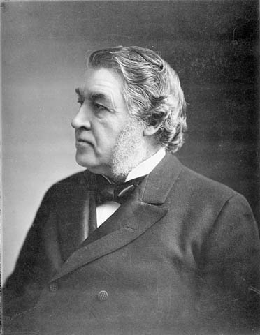
-
Article
Oak Bay
Oak Bay, incorporated as a district municipality in 1906, population 18 015 (2011c), 17 908 (2006c). The District of Oak Bay is located on the southeast corner of VANCOUVER ISLAND, adjoining the city of VICTORIA. It is surrounded by JUAN DE FUCA STRAIT on the south and Haro Strait on the east.
"https://thecanadianencyclopedia.ca/images/tce_placeholder.jpg?v=e9dca980c9bdb3aa11e832e7ea94f5d9" // resources/views/front/categories/view.blade.php
https://thecanadianencyclopedia.ca/images/tce_placeholder.jpg?v=e9dca980c9bdb3aa11e832e7ea94f5d9
-
Article
Oakville
Oakville, Ontario, incorporated as a town in 1857, population 213,759 (2021 census), 193,832 (2016 census). Located in Halton Region, Oakville is west of Mississauga, south of Halton Hills and east of Burlington. The Township of Trafalgar, the Village of Bronte and the Town of Oakville merged in 1962, creating present-day Oakville. Throughout history, the Oakville area has been home to different Indigenous groups, namely the Neutral, Huron-Wendat, Haudenosaunee and Anishinaabeg, including the Mississauga. The land is covered by Treaty 14, also known as the Head of the Lake Purchase (see also Upper Canada Land Surrenders).
"https://d3d0lqu00lnqvz.cloudfront.net/media/new_article_images/Oakville/OakvilleHarbour.jpg" // resources/views/front/categories/view.blade.php
https://d3d0lqu00lnqvz.cloudfront.net/media/new_article_images/Oakville/OakvilleHarbour.jpg
-
Article
Okotoks
Okotoks, Alberta, incorporated as a town in 1904, population 30,214 (2021 census), 28,833 (2016 census). The town of Okotoks is located 20 km south of Calgary.
"https://d3d0lqu00lnqvz.cloudfront.net/media/media/3b6d7b08-6a6e-43bd-adc4-3966fa1a210c.jpg" // resources/views/front/categories/view.blade.php
https://d3d0lqu00lnqvz.cloudfront.net/media/media/3b6d7b08-6a6e-43bd-adc4-3966fa1a210c.jpg
-
Article
Olds
Olds, Alta, incorporated as a town in 1905, population 8235 (2011c), 7253 (2006c). The Town of Olds is situated in a transition zone between prairie grassland and partially wooded parkland 89 km north of Calgary.
"https://thecanadianencyclopedia.ca/images/tce_placeholder.jpg?v=e9dca980c9bdb3aa11e832e7ea94f5d9" // resources/views/front/categories/view.blade.php
https://thecanadianencyclopedia.ca/images/tce_placeholder.jpg?v=e9dca980c9bdb3aa11e832e7ea94f5d9
-
Article
O'Leary
O'Leary, PEI, incorporated as a village in 1951 and as a community in 1983, population 812 (2011c), 861 (2006c).The Community of O'Leary is situated in Prince County 59 km northwest of SUMMERSIDE. It came into being after 1874,
"https://thecanadianencyclopedia.ca/images/tce_placeholder.jpg?v=e9dca980c9bdb3aa11e832e7ea94f5d9" // resources/views/front/categories/view.blade.php
https://thecanadianencyclopedia.ca/images/tce_placeholder.jpg?v=e9dca980c9bdb3aa11e832e7ea94f5d9
-
Article
Oliver
Oliver, BC, incorporated as a village in 1945 and as a town in 1991, population 4824 (2011c), 4395 (2006c). The Town of Oliver is located in the OKANAGAN VALLEY, 27 km south of Penticton.
"https://thecanadianencyclopedia.ca/images/tce_placeholder.jpg?v=e9dca980c9bdb3aa11e832e7ea94f5d9" // resources/views/front/categories/view.blade.php
https://thecanadianencyclopedia.ca/images/tce_placeholder.jpg?v=e9dca980c9bdb3aa11e832e7ea94f5d9
-
Article
Orangeville
Orangeville, Ontario, incorporated as a town in 1864, population 30,167 (2021 census), 28,900 (2016 census), is a town just north of the western end of the Greater Toronto Area. Located at the southern border of Dufferin County, it is surrounded by the townships of Amaranth and East Garafraxa, and the towns of Caledon and Mono. Throughout history, the Caledon area has been home to different Indigenous groups, namely the Wendat (Huron), Tionontati (Petun), Haudenosaunee and Anishinaabeg, including the Mississaugas of the Credit First Nation. The land is part of Treaty 18 (Lake Simcoe-Nottawasaga Treaty) and Treaty 19 (Ajetance Purchase).
"https://d3d0lqu00lnqvz.cloudfront.net/Orangeville/DowntownOrangeville.jpg" // resources/views/front/categories/view.blade.php
https://d3d0lqu00lnqvz.cloudfront.net/Orangeville/DowntownOrangeville.jpg
-
Article
Orillia
Orillia, Ontario, incorporated as a village in 1867, as a town in 1875 and as a city in 1969, population 33,411 (2021 census), 31,166 (2016 census). The city of Orillia is located on the shores of Lakes Simcoe and Couchiching in central Ontario. The name likely derives from the Spanish word for the bank of a river or shore of a lake, orilla. The name was given by Sir Peregrine Maitland, lieutenant-governor of Upper Canada (1818-28), who had served in Spain.
"https://thecanadianencyclopedia.ca/images/tce_placeholder.jpg?v=e9dca980c9bdb3aa11e832e7ea94f5d9" // resources/views/front/categories/view.blade.php
https://thecanadianencyclopedia.ca/images/tce_placeholder.jpg?v=e9dca980c9bdb3aa11e832e7ea94f5d9
-
Article
Orkney
Since 1926 the Rural Municipality of Orkney has had a joint administration with the neighbouring rural municipality of Wallace. There are 2 communities in the rural municipality, Orcadia, a stop on the Canadian Pacific Railway line and White Spruce.
"https://d3d0lqu00lnqvz.cloudfront.net/media/media/70457afb-6f7d-4316-b6b4-db43541c3e08.jpg" // resources/views/front/categories/view.blade.php
https://d3d0lqu00lnqvz.cloudfront.net/media/media/70457afb-6f7d-4316-b6b4-db43541c3e08.jpg