Share on Facebook
 Share on X
 Share by Email
 Share on Google Classroom
The Canadian Clay Belt is a half-moon-shaped area of heavy clay soil in northeastern Canada. Situated within the Canadian Shield, it spans the Ontario-Quebec border. The belt region’s 180,000 km2 of clayey soil is a legacy of ancient postglacial lakes. Its history is a complex narrative of geological formation, colonization schemes, economic fluctuation and ongoing research on land management.
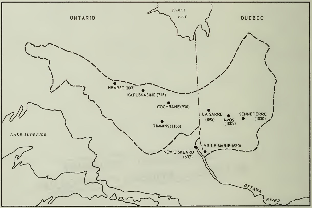
Description
The Canadian Clay Belt is a physiographic sub-region within the Canadian Shield in northeastern Canada, distinguished by its vast clay plains. This landform, roughly half-moon shaped, stretches primarily east–west between the provinces of Quebec and Ontario. Its centre lies along the 49th parallel north of the equator. The belt region varies in width from roughly 25 to 150 km. It has an area of around 180,000 km2. Most of the region is located in Cochrane District, Northern Ontario, while the smaller eastern section is in Abitibi-Témiscamingue, Quebec.
Also called the Great Clay Belt or its mononym, Claybelt, it is named after its clayey composition. But it is not the only soil type present. It also contains silt and bog-like mulch.
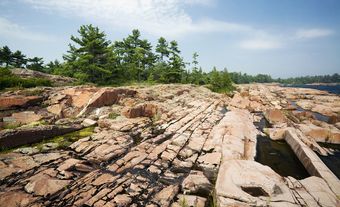
The belt’s topography is generally flat to gently rolling, a result of its formation from a glacial lakebed. Boreal forests are extensive in the Clay Belt compared to the sparser vegetation of the rocky Canadian Shield. The dominant species are conifers, especially black and white spruce. Broadleaf species such as poplar are also widely distributed. Other deciduous trees are found interspersed. Because of poor drainage, the Clay Belt supports extensive muskeg.
It has a humid continental climate, closely bordering on subarctic conditions. Winters are long, cold and snowy; while summers are short but can be quite warm.
Natural History
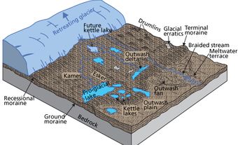
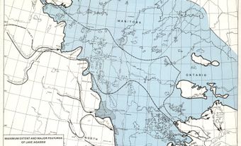
The Canadian Clay Belt formed as a direct result of the last Ice Age. Long periods of erosion, from the Pleistocene epoch (see Geological History of Canada), modified the surface topography of the Canadian Shield. From a mountainous area, rock ridges were levelled and scoured. Pre-existing drainage patterns were disrupted. This resulted in a vast number of river systems, shallow ponds or depressions and freshwater lakes. The retreat of the ice was not uniform; occasional re-advances created moraines that acted as dams, influencing the water’s extent and depth. Such large prehistoric bodies of water include Lake Barlow-Ojibway, which covered much of northern Ontario nearly 10,000 years ago. Eventually, the remnants of the lakebed formed layers of water-laid clay that distinguish the soil structure of the belt from the surrounding Canadian Shield.
Human Settlement
Human activity in the area that would be known as the Canadian Clay Belt can be traced back to the retreat of the last ice age, approximately 6,000 BCE. Contact between First Nations groups and Europeans in this region began in the 17th century as a result of developments in the fur trade. Rupert's Land, in which the Clay Belt lies, was claimed by the Hudson's Bay Company as a commercial domain. In 1869, it was acquired by Canada.
The first reported survey of the area in which the Clay Belt lies was carried out in 1887 by Dr. Robert Bell of the Geological Survey of Canada, along with his assistant Alfred Barlow. In 1899, Barlow wrote a report promoting the Clay Belt for agricultural settlement, citing its fertile soil, relatively flat terrain, high water table, and its close proximity to established and expanding logging and mining infrastructure.
Settlement happened on a significant scale in the late 19th and early 20th century. At the time, the provincial governments propagated the belt region’s agricultural potential, opening up townships for under colonization programs (see Frontier Thesis).
Quebec
Until the mid-19th century, only fur traders and missionaries travelled in the area. The first homesteaders then started settling on fertile land along Lake Timiskaming. In the 1880s, colonization societies and the Catholic Church encouraged French-Canadian settlers to establish farms along the clay belt in Quebec. The construction of the National Transcontinental Railway (later part of the Canadian National Railway) between 1910 and 1913 accelerated the creation of townships, affecting settlers' relationships with the land and often leading to the displacement of Indigenous peoples. By the mid-1930s, the provincial government's Vautrin settlement plan provided land grants and support for building materials, leading to the establishment of permanent communities. After the First World War, expansion continued in the Abitibi District through the opening of a series of planned parishes, mostly north of the railway line.
Ontario
From 1905 to 1906, the Crown negotiated between the Ojibwe and Cree nations, and the region primarily fell under Treaty 9. Its development was closely tied to the expansion of the Temiskaming and Northern Ontario Railway (later the Ontario Northland Railway). In 1903, the discovery of silver at Cobalt spurred railway construction and attracted thousands of prospectors and workers. The government-owned railway company carried out campaigns to encourage homesteaders with free land grants under agrarian capitalism. Many Quebec farmers arrived in Ontario. By the 1920s, there were pockets of agricultural development throughout the region. Farming in the Clay Belt, however, proved to be difficult. The poor drainage of the clay soils required extensive and expensive tile-draining systems. Many farms were ultimately abandoned after the timber on them had been cut. The population became increasingly dependent on the region's resource-based industries: mining (gold, copper, zinc) and forestry (pulp and paper, lumber; see Economic History of Central Canada).
Growth and Pushback
While pioneer agriculture still exists in the Canadian Clay Belt, uneven development on both sides of Quebec and Ontario is fraught with the provincial governments’ different approaches to farming.
From the outset, the federal and provincial administrations established agricultural research stations, such as the one in Kapuskasing, Ontario, to develop techniques and crop varieties suited to the northern climate. However, the region’s theoretical potential and the reality of northern agriculture have been a subject of ongoing research and debate. Rising food prices sparked renewed interest, leading to studies and promotional efforts suggesting the Clay Belt could become the country’s "next breadbasket" in the context of climate change. These proposals were consistently met with skepticism from scientists and economists who pointed to the persistent economic, social and environmental challenges.
There is a growing recognition of the environmental sensitivity of the boreal forest within the Clay Belt and the importance of minimizing carbon emissions. Since 1997, the Université du Québec en Abitibi-Témiscamingue has been at the forefront of research related to the region. In 2022, Nature Conservancy of Canada established the Boreal Wildlands protected property, citing numerous at-risk species that inhabit it. With a 1,450-km2 section of the Clay Belt, the project is considered the largest private land conservation agreement in Canada.